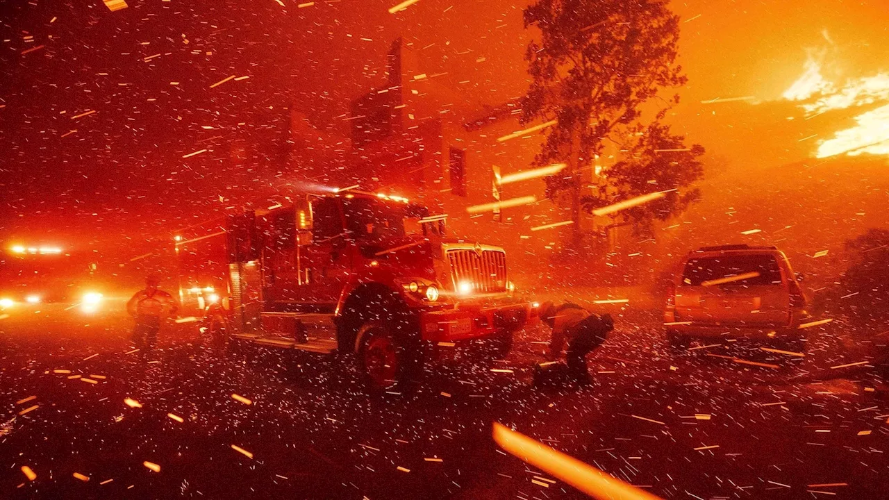
Areas recently burned by wildfires in Los Angeles County face increased risks of flooding and landslides as Southern California prepares for its first major rainfall of the winter. The National Weather Service warns of a 10% to 20% chance of significant flash flooding and debris flows, particularly in areas affected by recent fires. Residents are advised to take precautions and avoid recently burned areas during the period of highest risk.
Areas recently scorched by wildfires in Los Angeles County are facing a heightened risk of flooding and landslides as Southern California braces for its first substantial rainfall of the winter. The National Weather Service office in Oxnard has issued a stark warning on social media, stating that the threat is dire enough to warrant preparations for the worst-case scenario.
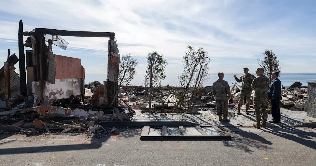
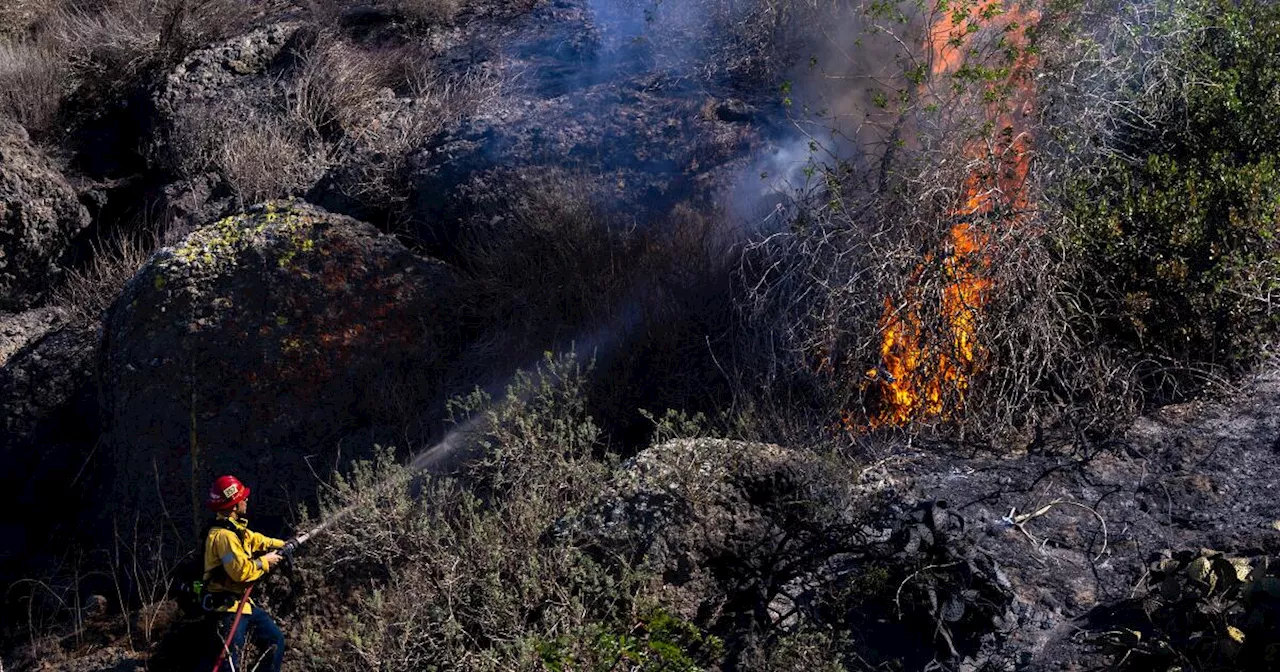
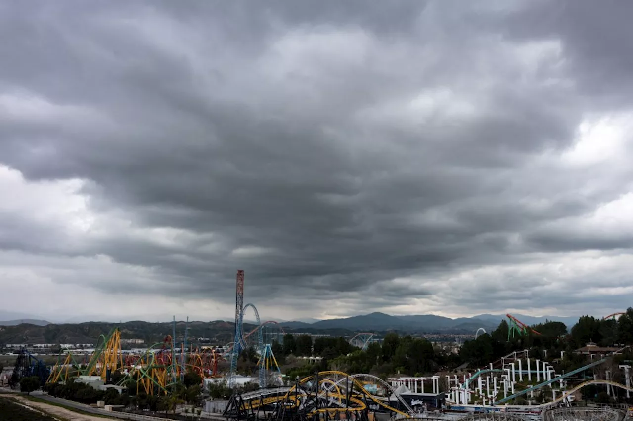
Forecasters project a 10% to 20% chance of significant flash flooding and debris flows capable of inflicting damage on roads and homes in the most vulnerable burn zones. These zones encompass the areas affected by the Palisades and Franklin fires around Pacific Palisades and Malibu, the Eaton fire around Altadena and Pasadena, the Hughes fire near Lake Castaic, and the Bridge fire within the Angeles National Forest north of Glendora. The Bridge fire, which ravaged over 56,000 acres across Los Angeles and San Bernardino counties in the fall, destroyed 81 structures and injured eight firefighters. According to a U.S. Geological Survey assessment, these burn scars present the highest potential for substantial debris flows, according to Ryan Kittell, a meteorologist with the weather service. He explained that these areas are characterized by their recent fires, proximity to communities and vulnerable infrastructure, and terrain orientation that favors higher rainfall intensities and totals. The probability of flooding and debris flow in these recently burned areas, announced Friday afternoon, represents a surge from the 5% to 10% chance predicted the day before. While damaging debris flows are not the most likely outcome, the weather service emphasizes that there exists a considerable degree of uncertainty surrounding this storm. The risk of flooding and landslides stems from the fact that the intense heat of the wildfires inhibits water absorption through the topsoil. The soil becomes water-repellent, causing water to flow over the surface downhill, picking up rocks and debris. This can result in 'mudflows,' where water rushes down hillsides with primarily mud, generally less than 15 feet deep, or more destructive and potentially lethal 'debris flows,' where rushing water carries rocks, branches, and sometimes massive boulders. Mudflows and debris flows are classified as landslides. 'The most likely outcome is that there won't be significant debris flows, but there's a high enough chance to definitely amplify the message that it's there, it's on the table, that the threat is increasing,' Kittell stated. 'It's still a threat that people should at least plan for and take into consideration.' 'The most likely outcome is that there might be some shallow debris flows that are kind of minor impacts,' Kittell added. The weather service has issued a flood watch for the 24-hour period with the highest risk, spanning from Sunday at 4 p.m. through Monday at 4 p.m. Sunday night is identified as the period of particularly heightened concern by meteorologist Ryan Kittell. A flood watch is issued when weather conditions are conducive to flooding. 'It does not mean flooding will occur, but it is possible,' the weather service clarifies. Among the weather service's recommendations: Avoid recently burned areas during this period. Utilize sandbags to safeguard property. And residents who choose to remain should 'stock up on supplies in case road access is blocked.' The planned flood watch does not encompass the Mountain fire burn scar in Ventura County. The chance of rainfall commences to rise Saturday afternoon in Los Angeles and Ventura counties, with the period of peak rainfall intensity anticipated between Sunday afternoon and Monday noon for Los Angeles and Ventura counties. Rain is expected to be light and intermittent throughout the weekend and into Monday. 'It's a slow-moving storm, so it's going to be stubborn. It's going to hang around,' said Alex Tardy, a meteorologist with the National Weather Service office in San Diego. 'It's going to send waves of moisture through Monday. So I think that's really going to add up to significant rain and snow.' Forecasters have revised their rainfall projections upward. The adjusted forecast is a consequence of the low-pressure system, originating from Canada, appearing to shift slightly westward, closer to the coast of Southern California than initially predicted. This westward movement would intensify the storm's moisture content, leading to 'increased concerns for debris flows over some of the burned scars,' Kittell explained. The mountains of Los Angeles and Ventura counties could receive 1 to 2 inches of rain, while areas at lower elevations could see between half an inch and 1 inch. Between Saturday and Monday, Thousand Oaks and Oxnard could experience three-fifths of an inch of rain; Redondo Beach, Santa Clarita, and Fillmore, seven-tenths of an inch; Long Beach, four-fifths of an inch; and downtown Los Angeles and Covina, nine-tenths of an inch.
WILDFIRES FLOODING LANDSLIDES SOUTHERN CALIFORNIA RAIN NATIONAL WEATHER SERVICE LOS ANGELES COUNTY
United States Latest News, United States Headlines
Similar News:You can also read news stories similar to this one that we have collected from other news sources.
 Southern California Braces for Potential Dry Spell After First Rains of WinterSouthern California faces a potential return to dry conditions after a much-needed respite from relentless fire weather brought by the first significant rainfall of the winter. While the weekend's rains are expected to provide temporary relief, concerns remain about the long-term drought and the potential for wildfire risk if dry patterns return.
Read more »
 Southern California Braces for First Winter Rains, But Dry Spell LoomsSouthern California is set for its first significant rainfall of the winter, offering much-needed relief from the region's persistent fire threat. However, concerns remain about the potential for a return to dry conditions and heightened wildfire risk.
Read more »
 Southern California Braces for First Rainfall in Months, With Potential HazardsSouthern California is set to receive its first significant rainfall in months this weekend, bringing relief to firefighters battling wildfires but also posing potential hazards. Meteorologists predict up to 1.5 inches of rain, with the heaviest downpour expected on Sunday night and into Monday.
Read more »
 Southern California Braces for High Surf and WildfiresSouthern California is facing a double threat of high surf and wildfires. High surf advisories are in place for Southern California beaches, with waves reaching up to 20 feet in some areas. Meanwhile, a fast-burning fire fueled by strong Santa Ana winds has destroyed homes and forced evacuations.
Read more »
 Southern California Braces for Critical Fire Danger Amid High Winds and Dry ConditionsStrong Santa Ana winds and low humidity are expected to create dangerous fire conditions in Southern California, threatening areas impacted by recent wildfires.
Read more »
 Southern California Braces for 'Life-Threatening' January WindstormA rare red flag warning has been issued for Southern California as a powerful windstorm threatens to ignite wildfires due to the region's prolonged drought.
Read more »