
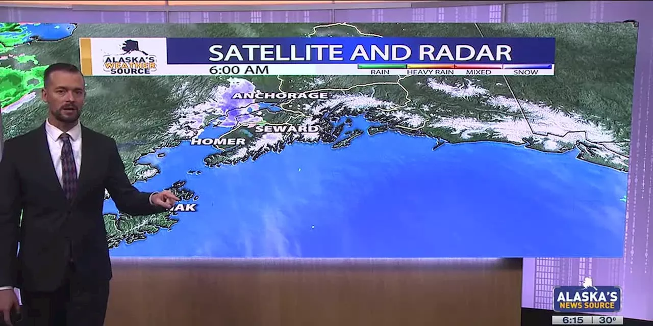
The heaviest rain will fall near Kodiak, where over 5 inches is possible by week's end.
Heaviest rain will fall near Kodiak, where 5-plus inches possible by week’s endANCHORAGE, Alaska - The sunny weather for much ofAn area of low pressure situated southwest of Kodiak will be the big driver in our weather pattern over the next few days. Strong southeasterly flow on the eastern side of the low is slamming into Kodiak, where up to 5-plus inches of rain looks likely by week’s end.
Coastal areas of the Kenai and Western Prince William Sound will also see moderate rain, although the accumulation will be nearly half of what Kodiak will see. From Whittier, southwest to Homer, expect anywhere from 1 to 3 inches of rainfall over the next few days, with some areas of wintry mix possible for Whittier. While rain looks to primarily favor coastal regions, inland areas of Southcentral could see some spotty afternoon showers.
. Some of the heaviest accumulation will occur near Unalaska, where up to 9 inches of snowfall looks likely. Be prepared for areas of blowing snow as well, as gusts through the Aleutians will range anywhere from 30 to 55 mph. Further north into Southwest, lighter snowfall totals can be expected. While that will be the case, it will still be a wintry mess for some.
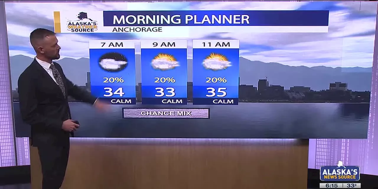
will return to drier weather. While some coastal activity can be anticipated, inland locations will see a mix of sun and clouds. It’s looking very likely Anchorage could see our first 50-degree day of the year arrive either Friday or Saturday.
United States Latest News, United States Headlines
Similar News:You can also read news stories similar to this one that we have collected from other news sources.
 Rain and snow return to Southcentral Alaska with above-average temperaturesSome light snow can be expected Friday morning, before warmer weather transitions to rain.
Read more »
 Easter outlook: Wet weather to make a return to Southern AlaskaBreezy winds and rain showers look to arrive in Southcentral through the day Friday.
Read more »
 First Alert: Active weather is back this weekRain is possible this evening through tomorrow; heavy rain and storms then arrive Wed.
Read more »
 Gusty winds and snow sweep through SouthcentralStormy weather in Western Alaska will contribute to gusty winds and snow across Southcentral through Thursday.
Read more »
 Snowfall Expected in Southcentral AlaskaLight snow is beginning to spread across Southcentral Alaska this morning as a frontal system is pushing into the region. With the current snow this morning, we could see 1 to 3 inches of accumulation into the afternoon hours. Heavier activity can be expected across parts of the Susitna Valley, where up to 4+ inches of accumulation could occur through the afternoon. Any lingering precipitation through the afternoon hours will also lead to the possibility for some rain embedded within some of the snow. You’ll certainly want to take it easy on the roads, as any snow that falls and accumulates will lead to slushy and slick roads. We should see a decent lull in the precipitation through the day, before another band of heavier snow arrives this evening.
Read more »
 Micro Dairy in Kodiak Thrives by Selling Variety of ProductsKelli Foreman runs the states only Grade “A” Certified goat dairy. She sells a variety of products, including lotion and soap. Dairy farming is not an easy business, but the micro dairy at Heritage Farm and Ranch in Kodiak makes it work by selling a variety of products and focusing on being more efficient.
Read more »