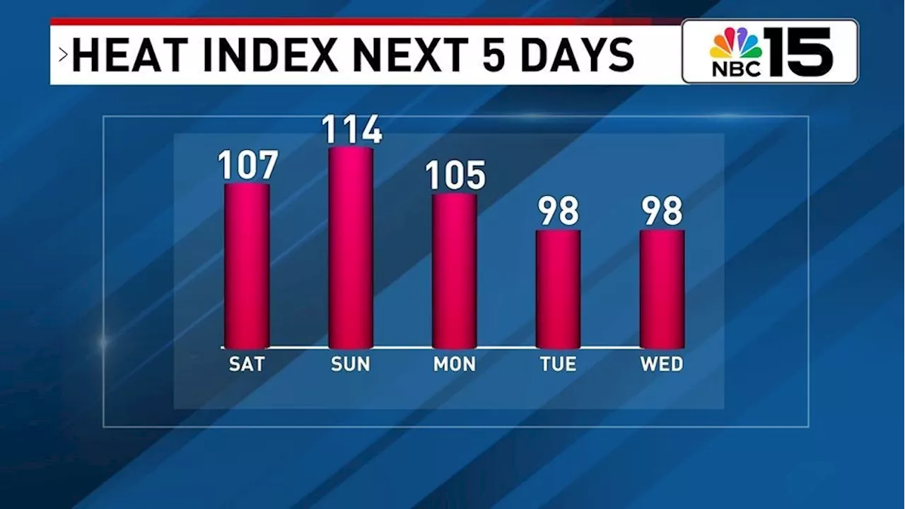
Another day, another heat advisory. For Saturday, our western counties will be included in a heat advisory from 10AM-7PM as values could reach as high as 109. C
ounties included are Mobile, Baldwin, Monroe, Clarke, and Washington in Alabama , plus our Mississippi Counties.
Daytime highs for Saturday will range in the mid to upper 90s for those along and north of I-10, while coastal areas see low to mid 90s. Skies will be mostly sunny to partly cloudy with a chance of scattered showers and thunderstorms, mainly in the afternoon. The chance wet weather finds you will be 40%.
Scattered showers and storms will be possible again on Sunday as a front approaches from the north. A few strong to severe storms can't be ruled out with strong winds and hail being the main concerns. Outside of any wet weather, highs will range mainly in the mid to upper 90s with heat index values near or even above 110.
The front on Sunday into Monday could bring us relief from the high humidity into early next week. While daytime highs likely won't see any drastic changes, we could see heat index values closer to 95-100 vs. the 105-110 like we've gotten used to. The drier air will also mean any wet weather chance will be 20% or less through the first half of next week. Stay tuned!
THE TROPICS: Ernesto is expected to move past Bermuda by the second half of Saturday. It will continue to move north and as it moves into the north Atlantic it will weaken and will lose its tropical characteristics. By the middle of next week, whatever is left of Ernesto could approach Ireland!The rip current risk will be low/moderate this weekend into early next week. Always check the flags before entering into Gulf waters.
Scattered Storms Highs Humidity Heat Index Alabama Mississippi Ernesto
United States Latest News, United States Headlines
Similar News:You can also read news stories similar to this one that we have collected from other news sources.
 ‘Saturday Night’ Trailer Reveals the Origin of ‘Saturday Night Live’The film is about the very first broadcast of one of the most important TV shows in history.
Read more »
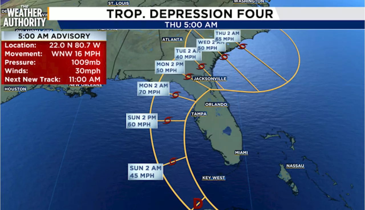 Tropical Depression 4 expected to become Tropical Storm Debby Saturday afternoonAs of the 5 a.m. National Hurricane Center update, Tropical Depression 4 is still hanging out over Cuba and is expected to reemerge into the eastern Gulf of Mexico west of Key West later this afternoon and likely become Tropical Storm Debby before continuing northeastward towards the western coast of Florida by Sunday evening.
Read more »
 A record tied on Saturday, more heat ahead the next few daysStacey is a certified meteorologist with Seals of Approval from the American Meteorological Society and the National Weather Association.
Read more »
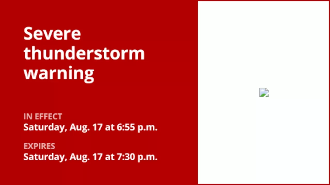 Thunderstorms with quarter-sized hail and damaging winds in McKean and Warren counties SaturdayOn Saturday at 6:55 p.m. the National Weather Service issued a severe thunderstorm warning valid until 7:30 p.m. for McKean and Warren counties.
Read more »
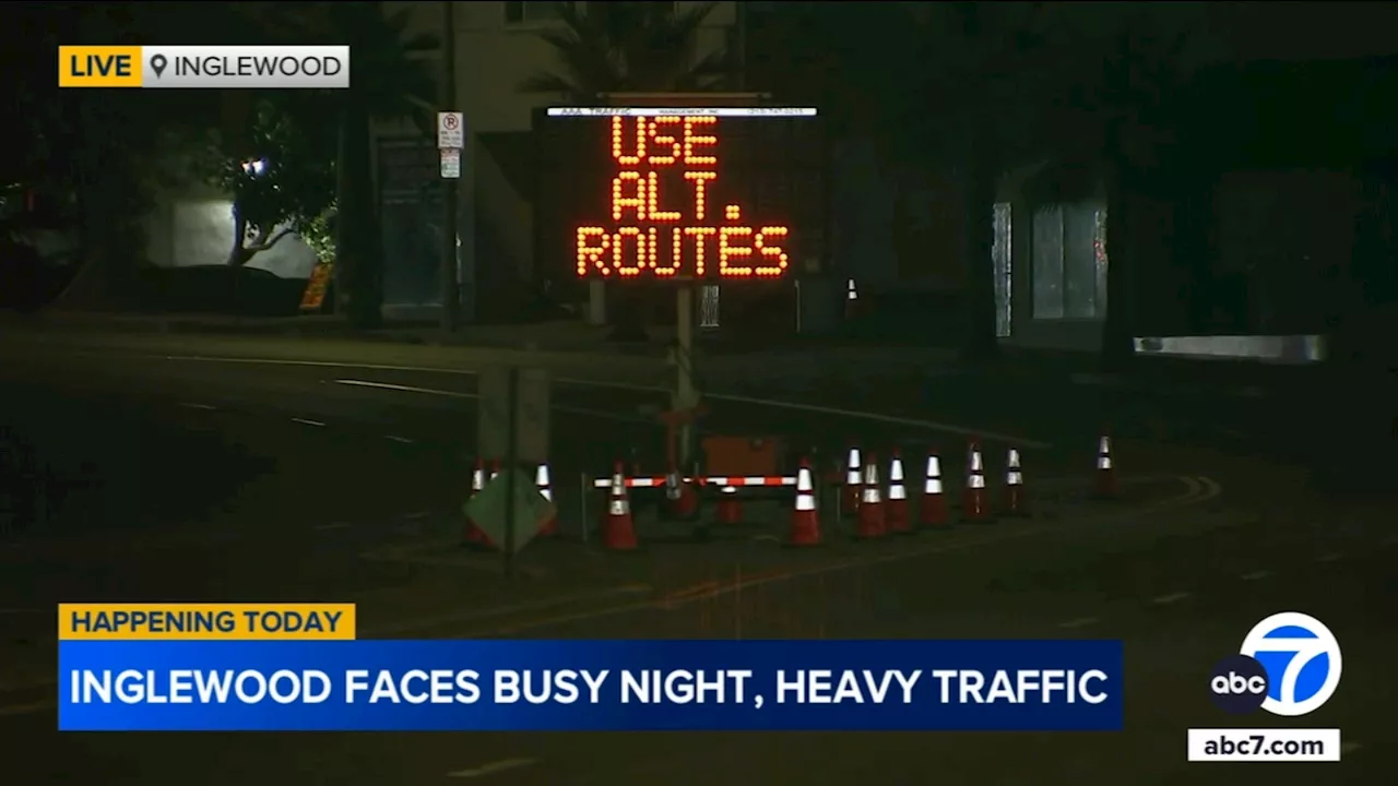 Inglewood bracing for crush of traffic Saturday amid Chargers-Rams game, live showsHeavy traffic is expected in Inglewood on a night when an NFL football game and two high-profile concerts are being held at the city's venues.
Read more »
 Flash flood warning for Crawford County until Saturday nightOn Saturday at 6:05 p.m. the National Weather Service issued a flash flood warning in effect until 11 p.m. for Crawford County.
Read more »