Heavy snow, ice, and rain batter the nation, prompting travel delays, school closures, and flood warnings. From the East Coast to the West, multiple storms wreak havoc, while a dangerous cold snap grips the Midwest and Plains.
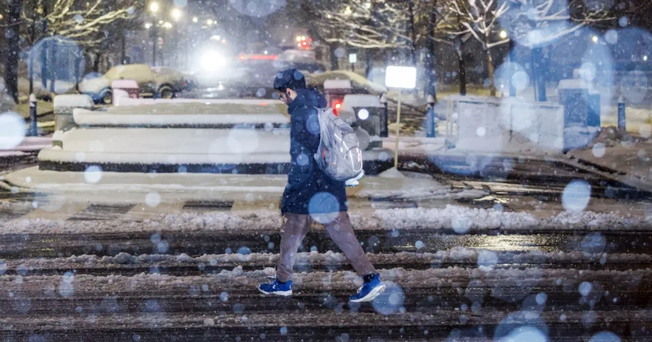
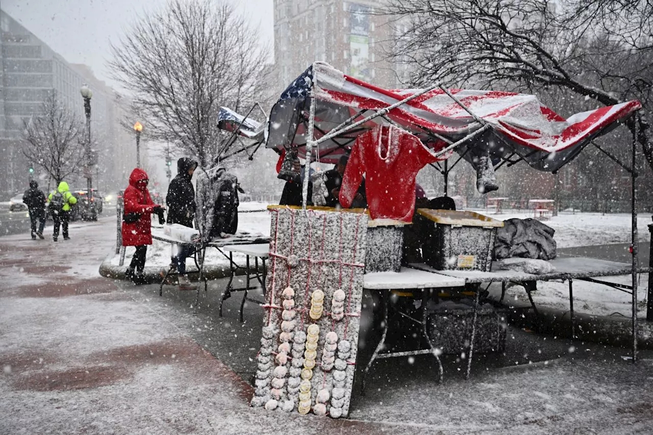
More than 100 million people are waking to winter weather alerts and warnings Wednesday morning, as storm systems cause severe conditions, biting cold and travel chaos from coast to coast. The National Weather Service warnings stretch from Colorado to Maine and multiple storms systems have dumped as much as 9 inches of snow in West Virginia and disrupted planned confirmation hearings in Washington D.C.
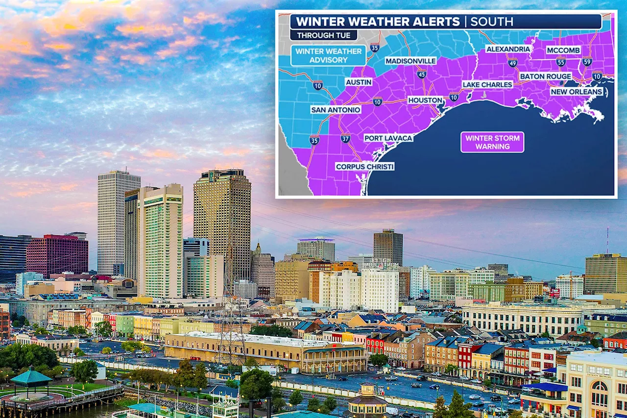
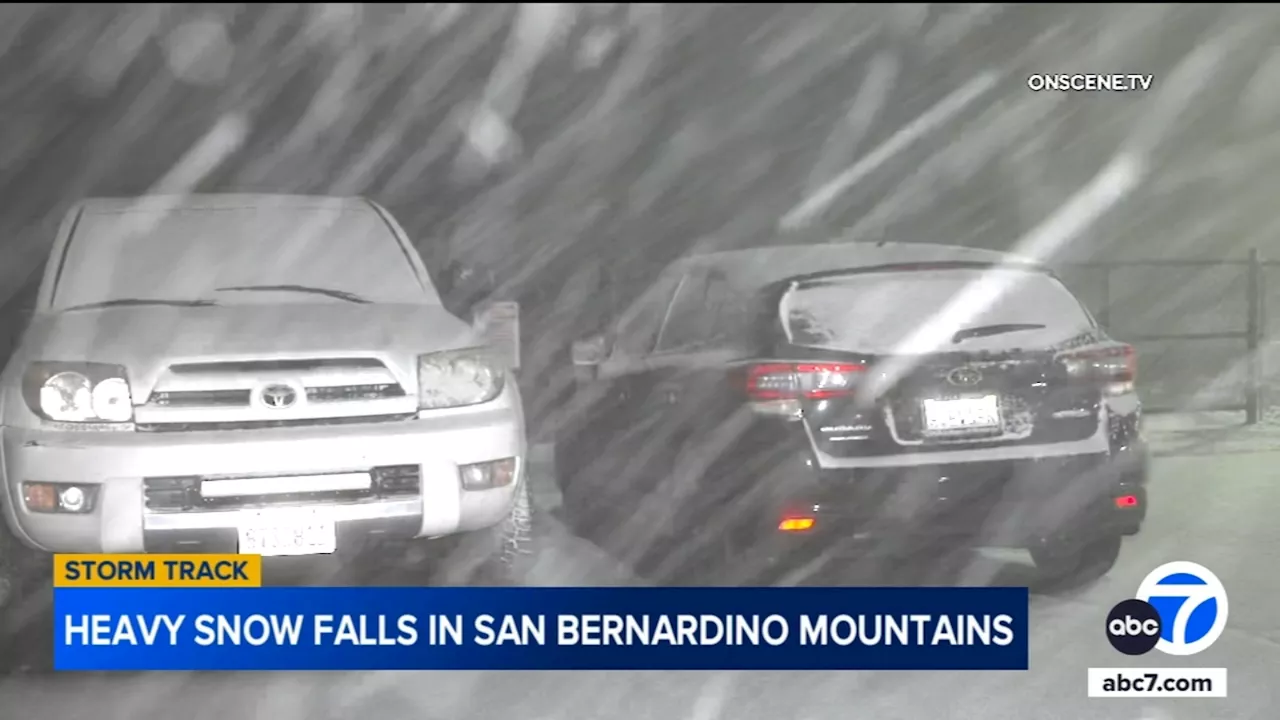
Back-to-back winter storms threaten to continue the icy conditions and snowfall over these regions in the next two days and a third storm is expected by the weekend. As much as 6 inches of snow could fall in Maryland, while New York City could get between 1 and 2 inches. Heavy rain is drenching the South, from east Texas to southern Kentucky, raising the threat of localized flooding with 15 million people under flood alerts. Another 10 million people are at risk of possible tornadoes from Birmingham, Alabama, down to Baton Rouge, Louisiana. The storms to the south Wednesday will likely create air travel delays in Atlanta, NBC's Al Roker said. There have already been nearly 200 flight delays and over 70 cancellations, mostly impacting the East Coast, since 4 a.m. this morning, according to FlightAware’s Misery Map. The second storm system is already forming over eastern Colorado and the Plains and looks set to bring heavy snow to the Midwest and Upper Midwest. This will spread snow from the Central Plains into the Great Lakes on Wednesday — hitting Chicago around lunchtime — and into New England overnight, where it'll create ice and rain. Snow falling at a rate of an inch an hour or more could create a hazardous evening commute, significant air travel delays, and school closures on Wednesday for big urban areas including Milwaukee, Chicago, Grand Rapids and Detroit. Chicago is forecast to see 4 to 7 inches of snow through Thursday night, Detroit is forecast to get 4 to 6 inches, and Kansas City 3 to 6 inches. The NWS office in Kansas City urged motorists to allow extra time and 'use extreme caution' during Wednesday morning's commute, as heavy snow continues to fall. The Missouri Department of Transportation told drivers to avoid traveling at all where possible. Meanwhile, California is braced for an atmospheric river event that could bring the state’s biggest winter storm of the season, with heavy rain threatening possible flooding and burn scars from recent wildfires heightening the risk of mudslides and subsidence. And the cold snap is expected to last through the working week and reach further into the lower 48. The blast of Arctic air that has seen parts of North Dakota reach minus 55 degrees Fahrenheit this week, when the wind chill factor is added in, will move southward to the Ohio Valley and Central Appalachians by Friday, with temperatures 25 to 35 degrees below seasonal averages. An extreme cold warning is still in place in the Northern Rockies and Northern Plains. What the NWS called a 'damaging freezing rain, ice event' will continue through Wednesday from northwest North Carolina to Western Virginia, with 0.25 inches of ice expected, which could lead to dangerous road conditions. The Southern Plains, Lower Mississippi Valley and Southeast will see heavy rain and possible thunderstorms and the risk of tornadoes on Wednesday as moisture moves north from the Gulf, the NWS warned. Local amounts of up to six inches of rain in the Mississippi River valley is forecast through tomorrow night, Roker said. Burn scar debris fears in California In California, heavy rain is expected Wednesday night and could intensify into Thursday. The NWS said there was a moderate risk of severe rainfall over parts of Southern California on Thursday, amid fears that rainfall could reach 1 inch per hour, with heavy snow falling in mountain ranges. 'Numerous flash flooding events are possible,' the service said. Gov. Gavin Newsom ordered a state-government wide response in advance of the coming storm — including the use of protective materials to contain burn scar debris from the Palisades and Eaton Fires entering creeks and rivers. 'The incoming storm could bring an increased risk of power outages, flooding in small streams and low-lying areas, and debris, rocks and mudslides on roadways,' the state said in an update Tuesday night. Concrete barriers known as K-rails, 319,000 sandbags and 5,600 co-called 'super sacks' have been placed across Southern California to make protective walls stretching nearly 120 miles in total, and there has already been work to remove some debris in the last month, the state government said. Some 242 fire engines are already deployed, as well as 400 personnel in eight counties, five helicopters and 70 soldiers. The state has also employed 14 geologists to study and map the burn scars to better understand possible debris flow. The Pacific Northwest is not spared the winter onslaught and will experience coastal rain and higher-elevation snow on Thursday, as snow affects much of the Western states
WINTER STORM SNOW ICE STORM FLOOD WARNING TRAVEL DELAYS SCHOOL CLOSURES COLD SNAP CALIFORNIA ATLANTA CHICAGO NEW YORK CITY
United States Latest News, United States Headlines
Similar News:You can also read news stories similar to this one that we have collected from other news sources.
 Historic Winter Storm to Bring Rare Snow and Ice to Gulf Coast, Impacting MillionsA rare winter storm is expected to bring heavy snowfall and ice to the Gulf Coast, potentially impacting up to 55 million people. States like Louisiana and Florida have declared states of emergency, advising residents to prepare for the unusual weather and stay off the roads. The storm could drop up to 6 inches of snow in some areas, with the Gulf Coast facing its first major snowfall event in years.
Read more »
 Millions Face Extreme Cold, Rare Winter Storm Hits Gulf CoastMillions of Americans are bracing for extreme cold and winter storms through Tuesday, with weather warnings in effect across over 30 states. The Midwest and Northeast are expected to be hit hardest by frigid temperatures, while a rare winter storm, Enzo, is bringing significant snow, ice, and freezing rain to the Gulf Coast states.
Read more »
 San Bernardino Mountains Braced for Heavy Snow, Winter Storm Warning in EffectA winter storm slammed the San Bernardino Mountains with heavy snow on Sunday, prompting a winter storm warning for the region. The warning remains in effect until Monday afternoon, with significant snowfall expected. Driving conditions are hazardous and the CHP urges residents to avoid travel if possible.
Read more »
 Winter Storm Strands Drivers in Atlanta, Triggers First-Ever Blizzard Warning for Gulf CoastA winter storm brought dangerous icy conditions to Atlanta, Georgia, stranding over 100 drivers in their cars. The storm also brought blizzard and near-blizzard conditions to the Gulf Coast, resulting in the first-ever Blizzard Warning for Louisiana and southeastern Texas. The storm caused major disruptions in both locations, with roads becoming impassable and businesses forced to close.
Read more »
 Historic Winter Storm Causes Road Havoc on Gulf CoastA severe winter storm has led to hazardous road conditions and numerous accidents along the Gulf Coast. Authorities in Mobile and Baldwin County report a significant increase in calls related to motor vehicle accidents, motorist assists, and road closures. Officials urge drivers to exercise caution and avoid unnecessary travel.
Read more »
 Dangerous ‘rare winter storm' hits Gulf Coast as it braces for historic snowfallTemperatures could dip to record lows along the Gulf Coast and into the Tennessee Valley, the National Weather Service warned.
Read more »