
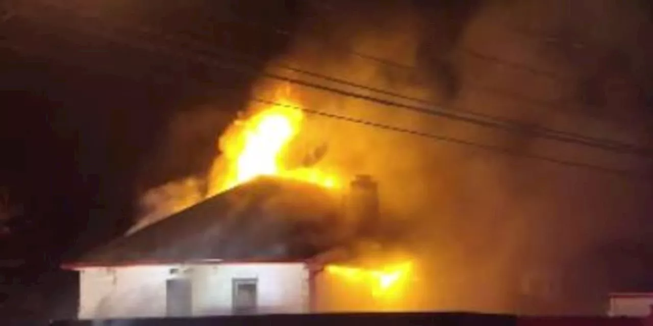
Painesville Fire Department battles a large fire on Mentor Avenue, facing challenges from frozen hydrants and intense cold.
The Painesville Fire Department battled a significant blaze on Mentor Avenue in Painesville, Ohio on Wednesday afternoon. Fire Chief Tom Hummel reported that thankfully, there were no injuries and most pets residing in the affected home were safely accounted for. The fire presented numerous challenges for the firefighters, requiring them to utilize four different hydrants to access the necessary water supply.
The intense cold weather further complicated the situation, with some fire hydrants being frozen shut, as confirmed by the Chardon Fire Department in a Facebook post. The fire originated on the ground floor porch and quickly spread upwards along the exterior wall of the building. The structure, divided into apartments, housed approximately 11 individuals. As the Painesville Fire Department worked diligently to extinguish the flames, they faced logistical difficulties due to the limited water access caused by the hydrant issues and the freezing temperatures. Chief Hummel emphasized the critical role of hydrant accessibility during firefighting operations, explaining that the initial fire engine carries a thousand gallons of water, which can be depleted within a few minutes. Without a readily accessible hydrant, the department's water supply is significantly restricted. The Painesville Fire Department, along with assistance from the Chardon Fire Department, successfully contained the fire, preventing further damage and ensuring the safety of the residents
FIRE OHIO PAINSEVILLE MENTOR AVENUE FROZEN HYDRANTS WEATHER EMERGENCY RESPONSE
United States Latest News, United States Headlines
Similar News:You can also read news stories similar to this one that we have collected from other news sources.
 Cal Fire's Fire Hazard Severity Zone Map Shows California Fire RiskCal Fire's new Fire Hazard Severity Zone map allows Californians to search for an address and see the location's probability of being affected by fire. The map assesses fire hazard, rather than risk, based on the physical conditions that create a likelihood of fire behavior over a 30 to 50-year period. The map considers terrain, local weather, and fire history over 50 years. Areas are ranked as moderate, high, or very high fire severity. The map is effective as of April 1, 2024 and focuses on areas under state responsibility, excluding federal land like the Sierra Nevada Mountains and some parts of the Bay Area.
Read more »
 Cal Fire's Fire Hazard Severity Zone Map Helps Californians Assess Fire RiskCal Fire's new Fire Hazard Severity Zone map allows residents to search for an address and see the location's probability of being affected by fire. This map focuses on fire hazard, not risk, and considers factors like terrain, weather, and fire history.
Read more »
 Eaton Fire Burns Businesses on Lake Avenue in AltadenaThe Eaton Fire, burning near Altadena, California, has caused significant damage to businesses on Lake Avenue.
Read more »
 Mentor-on-the-Lake fire damages ‘basically, brand new’ sports bar filled with memorabiliaThe fire started around 4:30 a.m. Tuesday.
Read more »
 Map: See where Los Angeles County wildfires are burningThe Palisades Fire, Eaton Fire, Hurst Fire, Lidia Fire and Sunset Fire are burning Friday in Los Angeles County. See updates and locations.
Read more »
 Brooke Burke Evacuates Malibu Home During Franklin Fire, Highlights Importance of Fire PreparednessActress and fitness star Brooke Burke shares her experience evacuating her Malibu home during the recent Franklin Fire, emphasizing the importance of fire preparedness and having a plan in place.
Read more »