


 +34
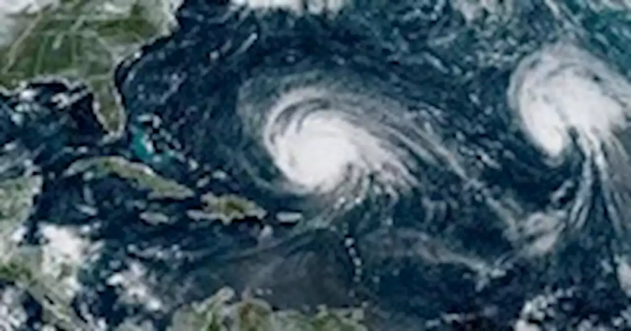
The storm could sideswipe Bermuda on Thursday before possibly bringing storm hazards to eastern New England by the weekend.
Large and powerful Hurricane Lee is plowing across the Atlantic north of the Leeward Islands and there is a growing likelihood it will affect parts of eastern North America late this week. After it makes a hard turn to the north Wednesday, it could sideswipe Bermuda on Thursday before possibly bringing storm hazards to eastern New England.
At 11 a.m. Monday, Lee was a major Category 3 hurricane with 120 mph maximum sustained winds. The storm is not anticipated to be that strong if it affects land areas later this week, but it is forecast to become larger — which means tropical storm conditions could affect areas far from its center. “It remains too soon to know what level of additional impacts Lee might have along the Northeast U.S. coast and Atlantic Canada late this week and this weekend, however, wind and rainfall hazards will likely extend well away from the center as Lee grows in size,” the National Hurricane Center said on Monday. “Regardless, dangerous surf and rip currents are expected along most of the U.S. East Coast this week.”Models have shown a slight westward trend in the forecast track for Lee since late last week, increasing the chance of effects for land areas. The most probable scenario remains for the Lee to remain offshore New England, but it’s still possible that portions of eastern New England could experience significant storm hazards, which could include strong winds, heavy rain and storm surge, which is the wind-driven rise in ocean water above normally dry land. The Canadian Maritimes and Nova Scotia, in particular, will probably experience a direct hit from the storm, barring a major shift in the storm track. On Monday at 11 a.m., Lee was located about 365 miles north of the Northern Leeward Islands early Monday and about 615 miles south of Bermuda as it traveled to the northwest at 8 mph. The storm was expected to gradually turn north by late Wednesday or early Thursday while weakening, before passing west of Bermuda late Thursday into Friday. The center of the storm will probably remain well west of Bermuda, but the island nation could still experience tropical storm conditions.Two weather systems — high pressure over the Atlantic Ocean and low pressure over the eastern United States — will gradually steer Lee northward later this week. Confidence in the forecast track is fairly high through midweek due to good agreement among models. The track forecast becomes less confident late this week and this weekend because of uncertainties in the exact positions, sizes and strengths of the high-pressure and low-pressure systems.The National Weather Service is planning to launch extra weather balloons starting Monday to collect more detailed measurements of these weather systems. Such data can lead to more accurate model forecasts of storm track and intensity. A direct hit on the Canadian maritime provinces is becoming increasingly likely as most models predict the storm to pass near or through Nova Scotia. The potential impacts for New England are less certain because they could change significantly with small changes in the storm track. The most recent track forecast from the Hurricane Center includes Nantucket, located just off Cape Cod, on the edge of the forecast cone.Lee appears to have slowed its rate of intensity change after a wild ride that began late last week. Barely a hurricane on Thursday, Lee became the third-most rapidly intensifying storm ever observed in the Atlantic Ocean when it catapulted in just 24 hours from an 80 mph Category 1 to an extreme 160 mph Category 5 by Friday. It became a Category 5 farther than southeast than any previous storm on record in the Atlantic east of the Caribbean. Then, it quickly weakened to a Category 2 by Saturday before regaining Category 3 strength Sunday.Lee was undergoing an “eyewall replacement cycle” early Monday, in which the existing eye of the storm disintegrates and is replaced by a new eye that forms around it. The phenomenon, a relatively common occurrence in strong hurricanes, can weaken or slow the strengthening of a storm while also causing its wind field to expand. The Hurricane Center predicts that Lee will further strengthen Monday — from a Category 3 storm early in the day with winds of 120 mph to a low-end Category 4 storm by early Tuesday with winds of 130 mph — as it continues to pass over record-warm Atlantic Ocean waters with sea surface temperatures near 85 degrees and through an area of lighter winds in the upper atmosphere, which should allow the storm to become more organized and stronger. Gradual weakening is then expected late Tuesday and beyond due to cooler waters and stronger upper-level winds, which tend to weaken storms, making it a Category 2 storm or lower once it reaches near and north of Bermuda’s latitude. While the maximum winds near the eye of the storm will likely decrease, how far tropical-storm force winds expand from the center is expected to increase as the storm moves north.Elsewhere in the Atlantic, Tropical Storm Margot could strengthen into a hurricane Monday, but remains of no threat to land areas as it tracks northward through the central Atlantic Ocean. A disturbance to the southeast of Margot has a low chance of development during the next week, while another disturbance near Africa has a higher chance of developing into a tropical depression or tropical storm in the next week and could bear watching. It’s not unusual to be tracking multiple tropical systems in mid-September, which historically is the peak of the Atlantic hurricane season.
Scratch the next story
United States Latest News, United States Headlines
Similar News: You can also read news stories similar to this one that we have collected from other news sources.
 Hurricane Lee is charting a new course in weather and could signal more monster stormsHurricane Lee is rewriting old rules of meteorology, leaving experts astonished at how rapidly it grew into a goliath Category 5 hurricane.
Read more »
 Mike Lee Calls for 'New Leadership' as McConnell Plans to Ram Ukraine AidMike Lee called for new Senate Republican leadership, citing a story that Mitch McConnell plans to ram Ukraine aid down the 'House's throat.'
Read more »
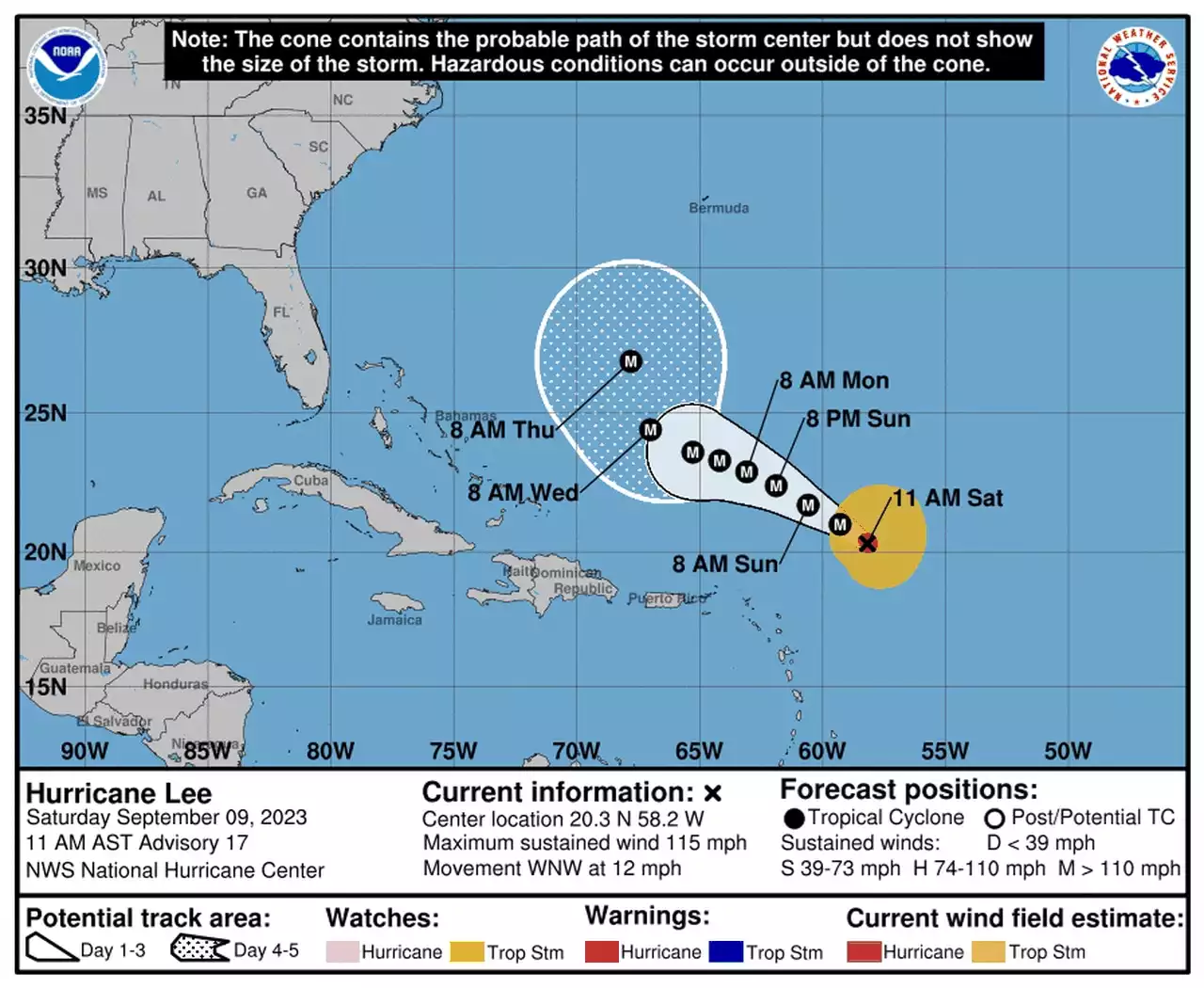 Hurricane Lee update: Lee weaker but still Category 3It's still too soon to say if Lee will come close to the US.
Read more »
 Honey Lee, Bang Hyo Rin, Jin Sun Kyu, And Jo Hyun Chul Confirmed For New DramaHoney Lee, Bang Hyo Rin, Jin Sun Kyu, And Jo Hyun Chul Confirmed For New Drama
Read more »