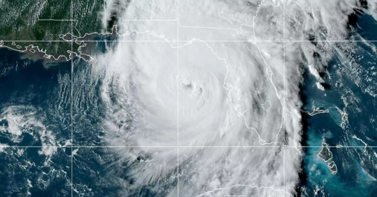
Hurricane Helene is gaining strength in the Gulf of Mexico on a path for the Big Bend area on Florida's Gulf Coast.
Hurricane Helene strengthened to a dangerous Category 4 on Thursday as it continued becoming more powerful in the Gulf of Mexico on a path for Florida's Big Bend area, according to the National Hurricane Center in Miami.
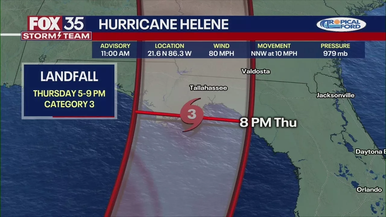
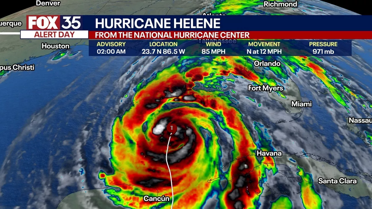
Helene is forecast to crash ashore Thursday evening with 'catastrophic and deadly' storm surge that could be as high as 20 feet in some areas, as well as strong, damaging winds, the hurricane center said.The hurricane center's director, Michael Brennan, described the expected storm surge along Florida's northwestern coastline as 'a really unsurvivable scenario.''That can destroy houses, move cars, and that water level is going to rise very quickly with the approach of Helene tonight and could cut off escape routes,' Brennan said.Helene strengthened earlier to a Category 2 storm Thursday morning and by Thursday afternoon was packing maximum sustained winds of 125 mph, making it a Category 3, which forecasters consider to be a major hurricane. Thursday evening, Helene's maximum sustained wind speed had increased to 130 mph, becoming what the hurricane center described as 'an extremely dangerous Category 4 hurricane.'More than 346,000 customers in Florida were without power as of Thursday evening, according to utility tracker PowerOutage.us. Live radar map of Hurricane HeleneCBS Miami's live radar map shows the current location and rainfall impacts of Hurricane Helene. The hurricane center said 'sustained tropical-storm-force winds' and gusts approaching hurricane strength were already being felt along Florida's west coast prior to landfall Thursday evening.After the storm makes landfall, which is expected Thursday evening, it is forecast to move inland over Georgia. Serious flooding is possible in the Southeast, with half a foot of rain forecast in Atlanta and 10-20 inches in a narrow swath of the southern Appalachian Mountains.Helene's outer bands began hammering the entire west coast of Florida on Thursday morning. In the Big Bend region south of Tallahassee, Gulf waters spilled over barriers and flooded roadways.Gov. Ron DeSantis warned residents to move to higher ground as soon as possible. 'Every minute that goes by brings us closer to having conditions that are going to be simply too dangerous to navigate,' DeSantis said.At the White House, the head of the Federal Emergency Management Agency urged people to take the threat from storm surge seriously. FEMA Administrator Deanne Criswell said most of the 150 people who were killed by Hurricane Ian in 2022 died from drowning.'Remember that you may only need to go 10 or 15 miles inland to get away from the threat of the storm surge itself because water is the No. 1 reason that we see people lose their lives in these storms, so please don't underestimate what the impacts could possibly be,' Criswell said.Several airports closed because of the storm, and airlines canceled hundreds of flights.The huge storm's hurricane-force winds were extending outward up to 60 miles from its center and tropical-storm-force winds were extending outward up to 345 miles, the hurricane center said.CBS News senior weather and climate producer David Parkinson called Helene a 'gargantuan' storm and noted that Helene 'will have a wind field so large that there will be a point afternoon where 60 of Florida's 67 counties will all experience winds gusting above tropical storm force' of 39 mph, with the western Panhandle an exception.NASA shared video of the hurricane as seen from the International Space Station, showing the size of the storm as it churned through the Gulf of Mexico Thursday afternoon.In a Category 3 storm, well-built framed homes in the hardest-hit coastline communities may incur major damage or removal of roof decking, the hurricane center said. Many trees will be snapped or uprooted, blocking roadways. Electricity and water will likely be unavailable for several days to even weeks after the storm passes. In a Category 4, homes can sustain severe damage, including loss of roofs and/or exterior walls, trees will be snapped or uprooted, and power poles downed.DeSantis said Wednesday that thousands of lineworkers were coming to the state to restore power after the storm passes.In Florida's Big Bend area, from Carrabelle to the Suwannee River, forecasters expected the water to reach 15-20 feet above ground if the storm surge's peak occurred at the same time as high tide. Other areas could see anywhere from 3-15 feet of water, the hurricane center warned. Fifteen to 20 feet of water would be enough to cover a two-story house, Parkinson pointed out.'The water impacts are probably going to be the most impactful part of the storm, the most deadly part of the storm,' Jamie Rhome, a deputy director at the hurricane center, told CBS News.President Biden and DeSantis declared emergencies in the state earlier in the week, and evacuation orders were issued in several counties. At the University of Tampa, officials were trying to evacuate all residential students by Wednesday afternoon.DeSantis discouraged Floridians from traveling hundreds of miles from their homes to flee the storm because Helene was expected to move inland after making landfall. He instead urged people to move to higher ground in their own area by going to a friend or family member's home or to a shelter.States of emergency were also declared in Georgia, North and South Carolina and as far north as Virginia.Scramble to prepare for Hurricane HeleneAlong Florida's west coast, residents prepared for the storm by boarding up windows, fueling up their vehicles and filling up sandbags before Helene's potentially dangerous hit.In Tallahassee, Dorothy Richardson was getting ready to hunker down with six of her grandchildren.'Either which way it go, I need to prepare,' Richardson said. 'Getting my sandbags … got my coal, got my lighter fluid, got my propane tank.'Russell King was preparing to evacuate his Mexico Beach home. He said the house barely withstood Hurricane Michael in 2018.'We lost our shower, we lost our elevator, we lost all of our ground floor walls,' King said. 'We think we're OK with these now, but, you know, we don't know — 125 miles an hour, they get blown out.'Tallahassee Mayor John Dailey said the city is doubling its workforce with crews from other states coming in to help restore power and deliver aid to the area after Helene hits.'It's very concerning,' Dailey said. 'I'm from Tallahassee, this is my hometown. We have never seen a storm of this magnitude that could possibly be a direct hit to Tallahassee.'Farther south, in Tampa, a makeshift wall was installed outside Tampa General Hospital to keep out water from the nearby bay. The area was expected to see 5-8 feet of storm surge. Officials said the wall held back about 2 1/2 feet of water last year when Hurricane Idalia hit.Warm water in Gulf fuels hurricaneRecord-warm water in the Gulf would act like jet fuel in intensifying the storm. Brian McNoldy, senior research associate at the University of Miami Rosenstiel School of Marine, Atmospheric, and Earth Science, recently noted that ocean heat content in the Gulf of Mexico is the highest on record. Warm water is a necessary ingredient to strengthen tropical systems.Sea surface temperatures in the path of Helene are as warm as 89 degrees Fahrenheit — 2 to 4 degrees F above normal. These record water temperatures have been made significantly more likely by human-caused climate change, according to Climate Central. The North Atlantic Ocean as a whole has seen record warm temperatures in 2024, storing 90% of the excess heat from climate change produced by greenhouse gas pollution.
Hurricane National Hurricane Center
United States Latest News, United States Headlines
Similar News:You can also read news stories similar to this one that we have collected from other news sources.
 Tropical Storm Helene To Become Hurricane Before Potentially Devastating Landfall in Florida's Big BendTropical Storm Helene is rapidly intensifying in the Gulf of Mexico and is forecast to become a major hurricane (Category 3 or higher) before making landfall in Florida's Big Bend region late Thursday. This storm could be more destructive than Hurricane Idalia, which hit the same area last year.
Read more »
 Hurricane Helene Strengthens To Category 1, Expected To Become Major Hurricane Before Florida LandfallHurricane Helene intensified into a Category 1 storm Wednesday and is projected to strengthen further, potentially reaching major hurricane status (Category 3 or higher) before making landfall in Florida Thursday. The storm threatens life-threatening storm surge, damaging winds, torrential rain, and flooding across parts of the Sunshine State.
Read more »
![]() Hurricane Helene tracker, live updates: Major hurricane expected to slam Florida's Big Bend regionHelene strengthened into a hurricane on Wednesday and is expected to strengthen further – potentially becoming a major hurricane – before making landfall over Florida on Thursday. Life-threatening storm surge, damaging winds, torrential rain, and flooding are possible.
Hurricane Helene tracker, live updates: Major hurricane expected to slam Florida's Big Bend regionHelene strengthened into a hurricane on Wednesday and is expected to strengthen further – potentially becoming a major hurricane – before making landfall over Florida on Thursday. Life-threatening storm surge, damaging winds, torrential rain, and flooding are possible.
Read more »
![]() Hurricane Helene tracker, live updates: Storm could strengthen into Cat 4 hurricane before Florida landfallHelene strengthened into a hurricane on Wednesday and is expected to strengthen further – potentially becoming a major hurricane – before making landfall over Florida on Thursday. Life-threatening storm surge, damaging winds, torrential rain, and flooding are possible.
Hurricane Helene tracker, live updates: Storm could strengthen into Cat 4 hurricane before Florida landfallHelene strengthened into a hurricane on Wednesday and is expected to strengthen further – potentially becoming a major hurricane – before making landfall over Florida on Thursday. Life-threatening storm surge, damaging winds, torrential rain, and flooding are possible.
Read more »
 Hurricane Helene forecast to strike Florida as a major hurricaneHELENE DISCUSSION: Helene is now a Category 2 hurricane located about 320 miles SW of Tampa, Florida. It's moving into an environment with low wind shear and de
Read more »
 Hurricane Helene Strengthens to Category 1, Poised to Become Major Hurricane Before Florida LandfallHurricane Helene intensified to a Category 1 storm on Wednesday and is projected to further strengthen, potentially reaching a major Category 4 hurricane before making landfall in Florida's Big Bend region on Thursday. The storm threatens life-threatening storm surge, damaging winds, torrential rain, and widespread flooding.
Read more »