
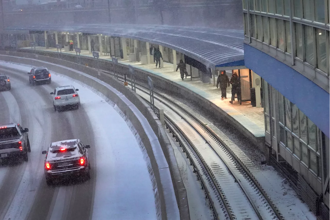
Dozens of schools in Northern Illinois were closed ahead of a major snowstorm predicted to hit the Chicago area. The storm is expected to bring 4 to 6 inches of snow to most of the region, with higher amounts possible in Lake County. Chicago's western suburbs will see the snow start moving in around 8 a.m. Wednesday, with heavier snowfall expected throughout the afternoon and evening. The storm is expected to taper off by 6 p.m. Wednesday, but some lingering flurries are possible through midnight.
Dozens of schools across Northern Illinois were closed in advance of the snowstorm, with the highest snow totals expected in Lake County. As of 5 a.m. Wednesday, a light flurries were flying across Lake and Northern Cook Counties, NBC 5 Meteorologist Alicia Roman said, with salt trucks passing through local roads. But the main snow event was still positioned out across Iowa, Kansas and Missouri. Around 8 a.m.
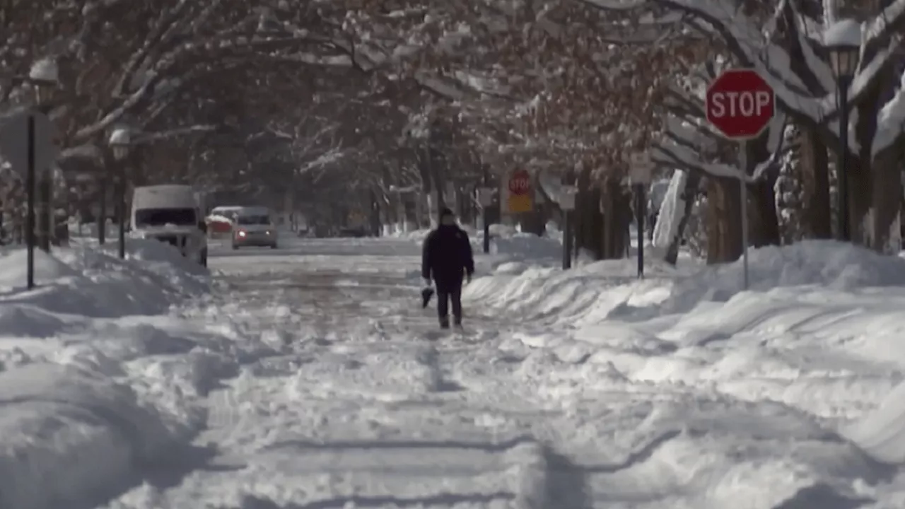
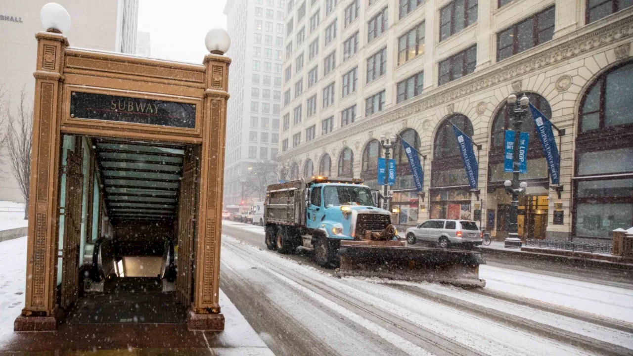
, Chicago's western counties will start to see the snow move in, Roman said, with snow picking up as the morning goes on. At 9 a.m., a winter weather advisory will go into effect for the entire Chicago area and Northwest Indiana, the National Weather Service said. The advisory is not set to expire until 3 a.m. 'Snow chances really ramp up and stay that way through the afternoon,' Roman said. 'Expect a four-to-six hour period of non-stop snow.'Here is a look at the timing of the highest snowfall rates which could last around 4 to 6 hours in any given location. This is when we expect quickly deteriorating travel conditions! One inch of snowfall per hour is possible in the afternoon, Roman said, with afternoon and evening commutes expected to be impacted, with slush-covered roads, reduced visibility and gusty winds. 'If you don’t have the flexibility to stay home later today, plan ahead for much longer travel times,' the NWS warned. Heavy, steady snow was expected to fall, Roman said. By around 6 p.m., the snow will gradually taper off, with some lingering flurries through midnight. South of I-80, a wintry mix with freezing drizzle was possible. 'The heavier, more impactful snow will last around 4-6 hours in any given location,' the NWS said,'Resulting in quickly deteriorating travel conditions.'On average, the majority of the Chicago area can expect to see between four and five inches of snow, NBC 5 Meteorologist Kevin Jeanes said. South of I-80, where temperatures will be warmer, between two and four inches of snow was possible, along with a wintry mix and freezing rain. The'bullseye' spot with the highest snow totals of around six inches or even more was in northern Lake County, Jeanes said, just south of Waukegan and into Milwaukee. According to the NWS, a winter storm warning was in effect beginning at 12 p.m. Wednesday for southern Wisconsin including Waukesha, Milwaukee, Racine and Kenosha, with total snow accumulations between five and nine inches possible.Wednesday's system is the first of two rounds of snow expected this week, Roman said. While Thursday into Friday morning will be dry, snow will develop again Friday afternoon and evening, Roman said. 'Right as the afternoon and evening commute gets underway,' Roman said, of the timing. 'Continuing all night long and into Saturday morning.
SNOWSTORM CHICAGO ILLINOIS WEATHER WINTER STORM TRAVEL WARNING SCHOOL CLOSINGS
United States Latest News, United States Headlines
Similar News:You can also read news stories similar to this one that we have collected from other news sources.
 Winter Storm Watch Issued for Chicago Area, Heavy Snow PossibleA winter storm watch has been issued for much of the Chicago area, with officials warning of the potential for more than 6 inches of snow. Snowfall rates of up to an inch per hour are possible.
Read more »
 Potential Chicago-area winter storm could make for ‘very poor' commute WednesdayForecasters are warning of serious impacts that a potential winter storm could have on the Chicago area later this week.
Read more »
 Chicago Braces for Heavy Winter Storm, Hazardous Travel Conditions ExpectedA winter storm is set to hit the Chicago area on Wednesday, bringing heavy snow and hazardous travel conditions. The storm is expected to continue through Wednesday night, with snowfall rates potentially exceeding 1 inch per hour during the evening commute.
Read more »
 Chicago Braces for Winter Storm with Heavy Snow and Travel ImpactsA winter storm is set to bring significant snowfall to Chicago, starting Wednesday morning and lasting through the weekend. The heaviest snow is expected during the afternoon and evening Wednesday, with accumulations ranging from 3 to 6 inches. Travel disruptions are anticipated due to rapid snowfall accumulation and reduced visibility.
Read more »
 Heavy Thunderstorms and Rain Expected Wednesday in Southeast TexasSoutheast Texas will experience heavy thunderstorms and rain throughout Wednesday before cooler air moves in. While no tornadoes or damaging winds are predicted, heavy rainfall is anticipated. Morning temperatures will start in the 40s, with daytime highs reaching only the upper 50s. Three cold fronts are forecast for the next 10 days, with another expected Saturday and potentially freezing temperatures by Wednesday of next week.
Read more »
 LIVE RADAR: Heavy thunderstorms, downpours across Houston make for messy, inconvenient start to WednesdayA cold front is bringing showers to SE Texas.
Read more »