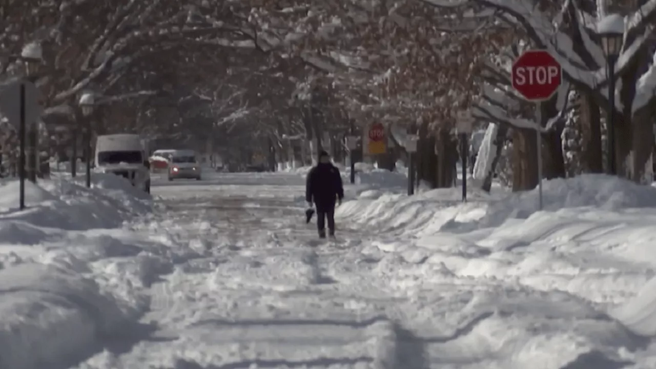
A winter storm is set to hit the Chicago area on Wednesday, bringing heavy snow and hazardous travel conditions. The storm is expected to continue through Wednesday night, with snowfall rates potentially exceeding 1 inch per hour during the evening commute.
A winter storm watch will be in effect for the entire Chicago area starting Wednesday morning, with hazardous travel conditions and snow-covered roads predicted across Illinois. Some areas in the Chicago region woke up to light flurries on Tuesday morning as a weak cold front moved through parts of Northeast Illinois, potentially leaving a light dusting or coating of snow on roads, according to NBC 5 Meteorologist Alicia Roman.
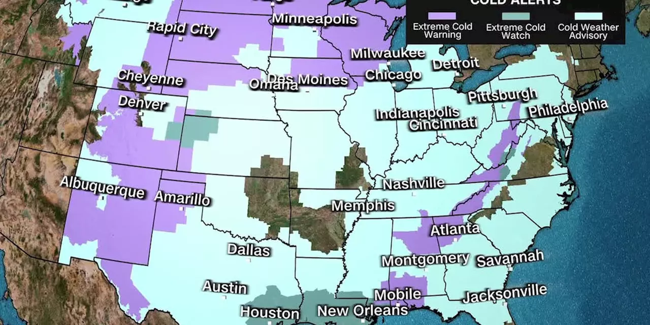
These flurries are unrelated to the approaching winter storm, although brief bursts of snow were possible throughout Tuesday morning, followed by lake-effect snow in some areas during the afternoon. \Beginning at 9 a.m. Wednesday, the entire Chicago area will be under a winter storm watch, with heavy accumulating snow expected throughout the day. The snow is forecast to be steady at times, with a potential rate of up to an inch per hour falling during the evening hours. Snow is anticipated to start around 6 a.m. or 7 a.m. Wednesday, initially affecting Chicago's western counties. The snow will continue to move eastward, with the winter storm watch expanding to encompass all of Northeastern Illinois by 9 a.m. \Heavy, widespread snow is expected to persist throughout Wednesday, likely impacting the afternoon and evening commutes, especially during peak travel times when snowfall rates could exceed 1 inch per hour. The National Weather Service predicts an impactful winter storm with snow accumulations of 6 inches or more. Motorists are advised to prepare for hazardous travel conditions, particularly during the evening commute. Stay tuned for the latest forecast updates. Snowfall is expected to continue across the region through late Wednesday night, with the watch remaining in effect until 3 a.m. Thursday. Roman estimates that 3 to 5 inches of snow could fall in southern areas, while northern and western counties are projected to receive 4 to 7 inches, with some areas potentially experiencing even greater accumulations. The National Weather Service warns that southeastern Wisconsin, including Milwaukee, Racine, Lake Geneva, Waukesha, and Kenosha, could see up to 9 inches of snow. Reduced visibility, snow-covered roads, and treacherous driving conditions are all possible. The highest snow totals are likely north of a line drawn from Pontiac, IL to Valparaiso, IN. A mix of sleet and freezing rain may reduce snowfall farther south
WINTER STORM CHICAGO SNOW TRAVEL WARNINGS WEATHER FORECAST Hazardous Conditions
United States Latest News, United States Headlines
Similar News:You can also read news stories similar to this one that we have collected from other news sources.
 Chicago Braces for Heavy Snowfall This WeekThe Chicago area is set to experience multiple snow chances this week, with a potentially significant storm on Wednesday. A Winter Storm Watch has been issued for much of Chicagoland as the region prepares for heavy accumulations.
Read more »
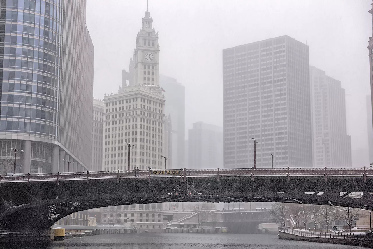 Chicago Braces for Freezing Rain and Possible Sleet WednesdayA wintry system is expected to bring freezing rain, sleet, and the possibility of icy accumulations to the Chicago area on Wednesday. While the exact track and intensity of the system remain uncertain, the potential for impacts on the afternoon and evening commutes is high. Temperatures are expected to drop sharply after a warm-up on Monday, with below-average temperatures persisting through mid-February.
Read more »
 Deep South braces for a rare winter storm threatening heavy snow, sleet and iceResidents across parts of the Gulf Coast and South are bracing for a rare winter storm expected to drop heavy snow and create treacherous conditions, including freezing rain and sleet.
Read more »
 Deep South braces for a rare winter storm threatening heavy snow, sleet and iceMillions of people across the northern Gulf Coast braced Tuesday for a rare winter storm that's expected to scatter heavy snow, sleet and freezing rain
Read more »
 Deep South braces for a rare winter storm threatening heavy snow, sleet and iceResidents across parts of the Gulf Coast and South are bracing for a rare winter storm expected to drop heavy snow and create treacherous conditions, including freezing rain and sleet.
Read more »
 Deep South braces for a rare winter storm threatening heavy snow, sleet and iceResidents across parts of the Gulf Coast and South are bracing for a rare winter storm expected to drop heavy snow and create treacherous conditions, including freezing rain and sleet.
Read more »