
Some locations may remain mostly cloudy Monday afternoon, but temperatures still warm into the 70s area-wide. Winds turns northwest at 7 to 14 mph, which ushers in much colder air Monday night. Lows fall into the low 40s area-wide by sunrise Tuesday.
The weekend featured plentiful sunshine with warm afternoons. However, Monday morning was mostly cloudy, and much colder air arrives in Alabama Monday night. A cold front moved into southeast Alabama Monday morning, and pushes southeast of our area during the afternoon. The sky was still mostly cloudy south of highway 80 at noon Monday. Some locations may remain mostly cloudy during the afternoon, but temperatures still warm into the 70s area-wide.
Winds turns northwest at 7 to 14 mph Monday afternoon, which ushers in much colder air Monday night. Lows fall into the low 40s area-wide by sunrise Tuesday. Winds remain out of the northwest at 5 to 10 mph overnight, so wind chills may be in the 30s early Tuesday. A north wind may gust over 20 mph at times Tuesday, and afternoon temperatures may struggle to reach 60° despite a mainly sunny sky.
Tuesday night could be one of if not the coldest nights of the week. Lows fall to near freezing. A freeze watch begins at midnight Tuesday night for central Alabama, and 1 AM Wednesday for southwest Alabama. Temperatures may fall to freezing area-wide, but at least into the mid 30s in most locations. The first frost or freeze typically occurs in November, so these are abnormally cold temperatures.
Temperatures recover into the 60s Wednesday afternoon with abundant sunshine. Although, temperatures likely fall into the mid 30s again Wednesday night, potentially to freezing in some locations. Temperatures may not reach 70° again on Thursday, with highs in the mid to upper 60s despite a mostly sunny sky. Thursday night lows fall into the 40s, but Friday looks mostly sunny and warmer with highs in the low to mid 70s.
The weekend looks even warmer and rain-free. Temperatures range from the mid to upper 70s Saturday afternoon with a mostly sunny sky. Sunday’s afternoon warmth could be near 80° with a partly cloudy sky. Meanwhile. overnight lows remain close to 50° Saturday night, and low to mid 50s Sunday night. A small rain chance returns to the forecast next Monday, but may trend a bit higher next Tuesday or Wednesday.
United States Latest News, United States Headlines
Similar News:You can also read news stories similar to this one that we have collected from other news sources.
 Cloudy, Windy Day Expected Sunday, but Could Snow Loom in Forecast for Monday?Sunday will get off to a pleasant start for much of the Chicago area, but things are expected to change quickly, leading up to a weather system that could bring cooler temperatures and even snow to the region by Monday.
Read more »
 Possible strike could stop bus service in OC as soon as MondayA strike could stop bus service in Orange County as soon as Monday if authorized.
Read more »
 With Flurries Possible Monday, Here's When Chicago Typically Sees Its First Snow of the SeasonThe Chicago area could potentially see its first snowflakes of the season on Monday, but how does that compare with the average first snowfall of the season in the city?
Read more »
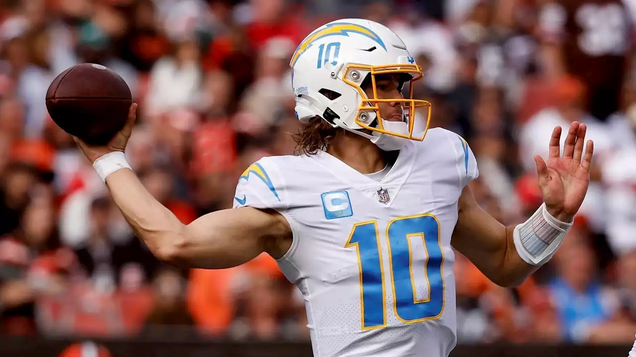 Broncos vs. Chargers: FrontPageBets looks at best bets for Monday Night FootballRussell Wilson and the struggling Denver Broncos play their fourth prime-time game in six weeks when they visit the Los Angeles Chargers.
Read more »
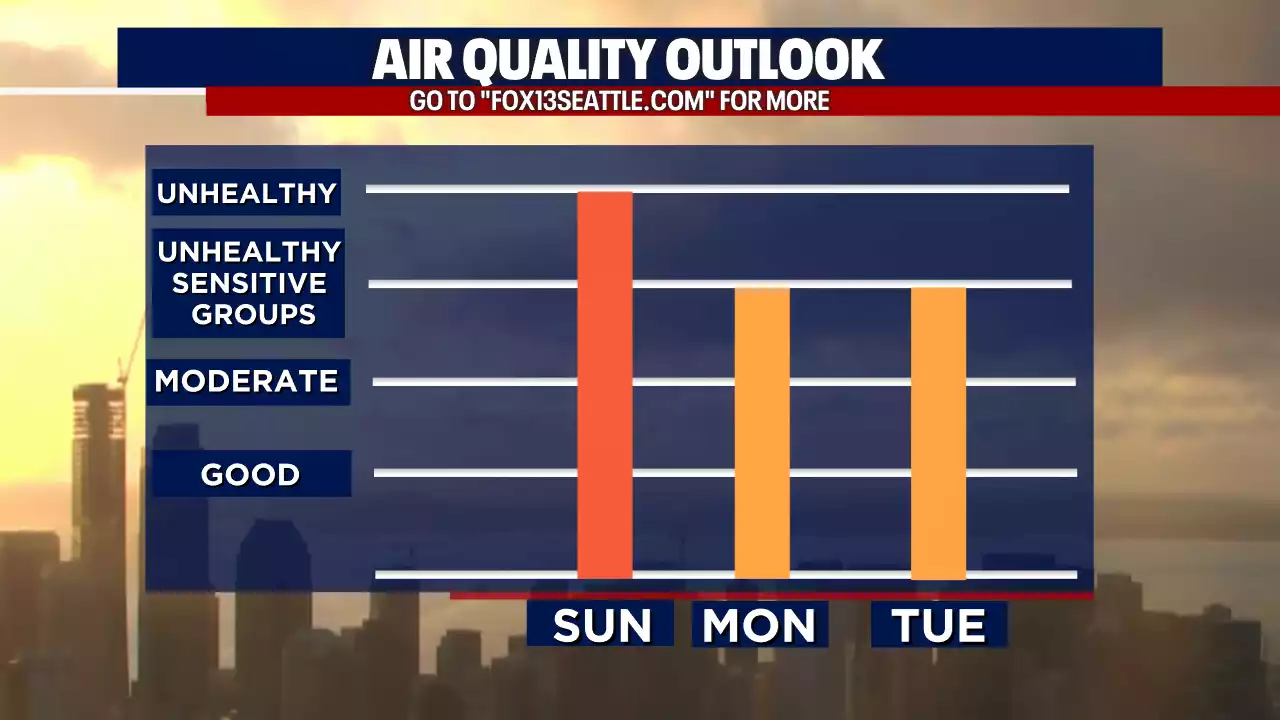 Seattle weather: Smoky Sunday ahead with improving air MondaySmoke continues to be a problem in Western Washington today. Air quality will improve at least a little on Monday. Until then, plan on record warmth and high fire danger. FOX13
Read more »
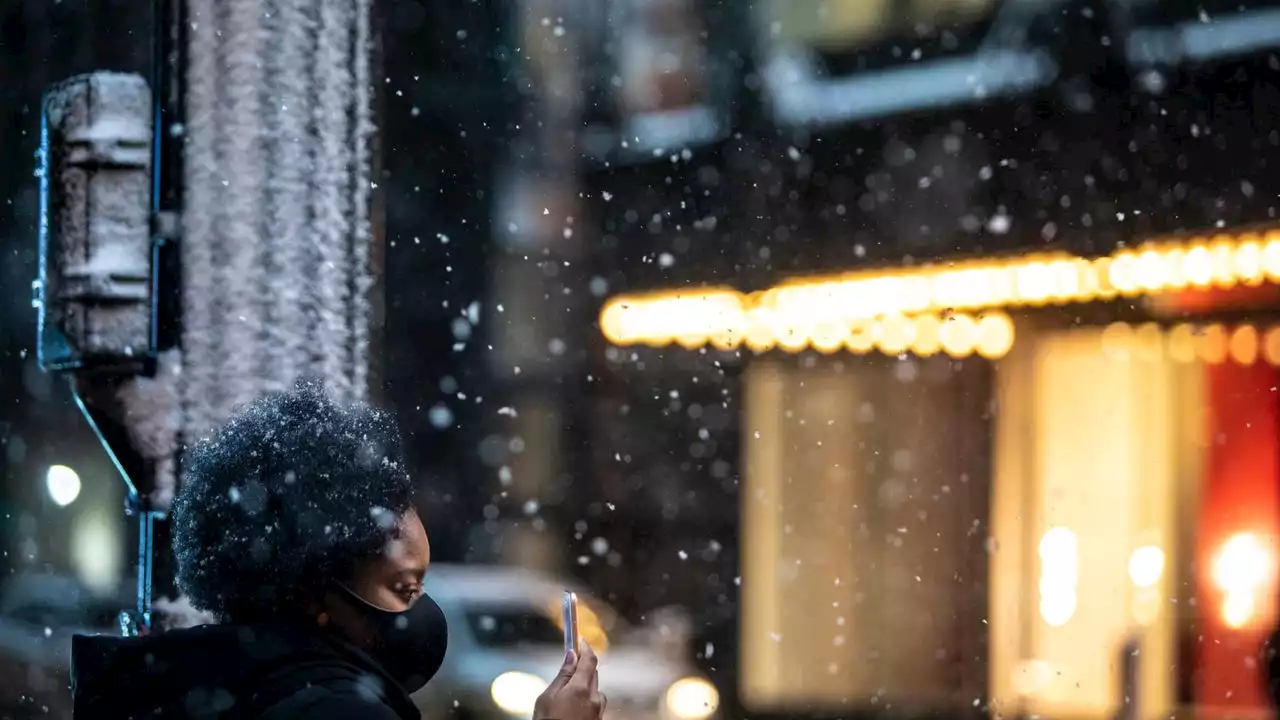 Snow possible in Chicago area, Northwest Indiana on MondayPrepare for winter weather: Chicago-area residents could see flurries on Monday, and lake effect snow and rain are possible in Northwest Indiana.
Read more »