
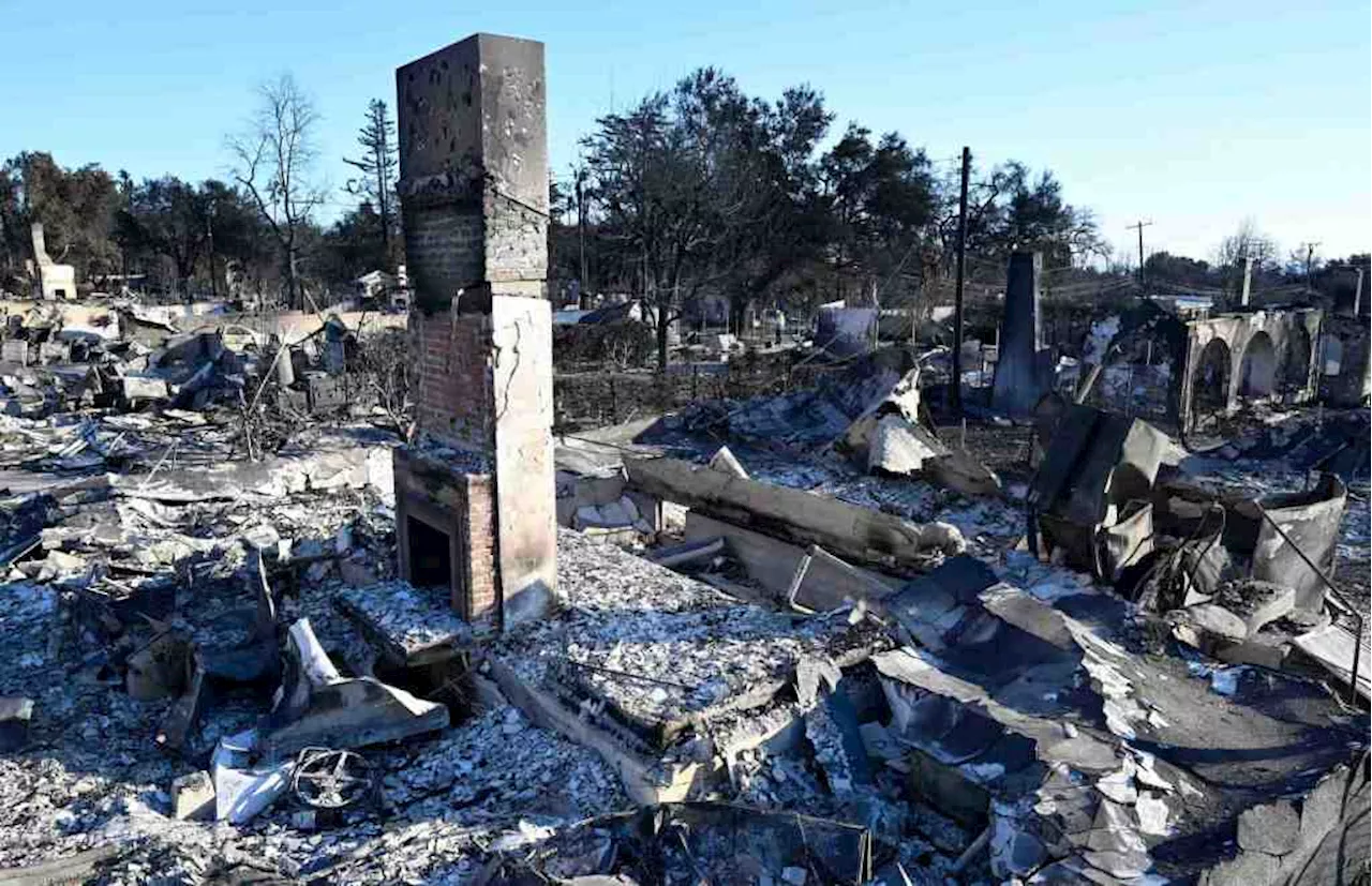
A flash flood warning has been issued for Malibu, California, as heavy rainfall triggers dangerous debris flows near burn scars from the Franklin Fire and the Palisades Fire. Officials report flooding and road closures due to the severe weather. The warning remains in effect through Sunday evening, prompting concerns for life-threatening situations. Debris flows are possible across roads, posing a significant risk to motorists.
The National Weather Service has issued a flash flood warning for Malibu near the Franklin Fire and Palisades Fire burn scars through Sunday evening as heavy rain moves through the region. Officials reported flooding along Pacific Coast Highway due to the rain at around 8:15 p.m., according to NWS officials. 'While not immediately likely, a life-threatening debris flow will be possible,' a release said. As such, the warning remained in place through 10 p.m.
on Sunday evening near both the burn scar from the Franklin Fire, which scorched thousands of acres in December, and the western portion of the Palisades Fire burn scar west of Las Flores Canyon Road, NWS officials said. 'This is a life-threatening situation,' the release said. 'Heavy rainfall will cause extensive and severe flash flooding of creeks, streams, and ditches in the Burn Scar. Severe debris flows are possible across roads.' Earlier in the day, a number of significant mudflows forced the closure of multiple roads in the Palisades Fire burn scar. The first closure, on Palisades Drive downhill from Avenida De Santa Ynez and Paseo Vista Hermosa, happened in the area devastated by the wildfire in early January, was reported at around 4 p.m. SkyCal flew over the spot of the slide, where one tractor could be seen working to clear the debris from the two-lane road. Some trucks could be seen wading their way across the thick material at a slow pace. About 30 minutes later, California Highway Patrol also closed the Pacific Coast Highway, just west of Topanga Canyon Boulevard for a separate mudflow, according to a post from the department on X. There appeared to be some debris from the burn scar that included large branches, bushes, and other charred objects with SkyCal over Topanga Canyon Boulevard. Just north over the Santa Monica Mountains, a different mudflow trapped multiple cars in Woodland Hills. At least four vehicles became trapped on Mulholland Drive near Alhama Drive, according to the Los Angeles Fire Department. While nobody needed to be rescued, tow trucks and LA Department of Transportation officials were called to the location to remove the cars and handle traffic in the area. While leaving the scene of a fire in Sun Valley, a Los Angeles Fire Department truck also got stuck in a debris flow. Firefighters could be seen working to free the vehicle by shoveling the muck from around the engine's tires
FLASH FLOOD DEBRIS FLOW MALIBU CALIFORNIA FRANKLIN FIRE PALISADES FIRE BURN SCARS HEAVY RAIN ROAD CLOSURES NATIONAL WEATHER SERVICE
United States Latest News, United States Headlines
Similar News:You can also read news stories similar to this one that we have collected from other news sources.
 Urgency builds to remove Eaton, Palisades fire debris, mindful of tragic debris flows, floodingAfter the tragic flooding after the Thomas fire in Santa Barbara in 2017, authorities put debris removal on fast-track.
Read more »
 Malibu couple escapes Palisades Fire weeks after fighting off flames from Franklin FireJust weeks after having their lives threatened by the Franklin Fire in Malibu, one couple once against forced to literally run for their lives when the Palisades Fire descended upon their home.
Read more »
 Cal Fire's Fire Hazard Severity Zone Map Shows California Fire RiskCal Fire's new Fire Hazard Severity Zone map allows Californians to search for an address and see the location's probability of being affected by fire. The map assesses fire hazard, rather than risk, based on the physical conditions that create a likelihood of fire behavior over a 30 to 50-year period. The map considers terrain, local weather, and fire history over 50 years. Areas are ranked as moderate, high, or very high fire severity. The map is effective as of April 1, 2024 and focuses on areas under state responsibility, excluding federal land like the Sierra Nevada Mountains and some parts of the Bay Area.
Read more »
 Cal Fire's Fire Hazard Severity Zone Map Helps Californians Assess Fire RiskCal Fire's new Fire Hazard Severity Zone map allows residents to search for an address and see the location's probability of being affected by fire. This map focuses on fire hazard, not risk, and considers factors like terrain, weather, and fire history.
Read more »
 Southern California braces for flooding, mudslides as intense rainfall expected among wildfire-ravaged areasMuch-needed rain in California bringing risk of flash flooding, debris flows in burn scar areas
Read more »
 Fan Art Imagines Lucas Till and Antony Starr as The Flash and Reverse-Flash in DCUNew fan art imagines Lucas Till as The Flash and Antony Starr as the Reverse-Flash in James Gunn's DCU. While a new The Flash movie isn't currently in development, fans continue to speculate on who should portray the iconic speedster. The artwork, created by Hip Beach, highlights the popularity of these fan castings and the enduring interest in seeing them realized.
Read more »