
The Pioneer fire burning on the north shore of Lake Chelan has grown by almost 1,000 acres in the last two days.
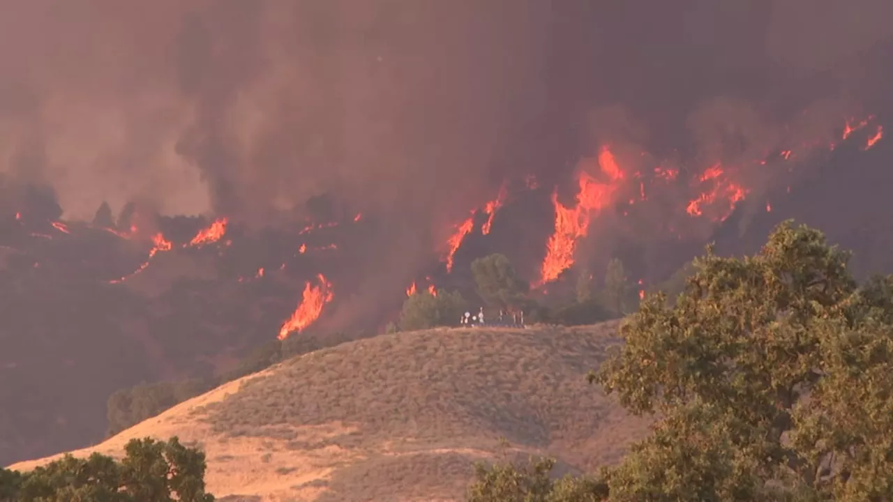
Smoke fills the air in Lake Chelan from the Pioneer fire on July 21, 2024. Due to the fire’s growth, evacuation levels for the community of Stehekin have been raised as of 8 a.m. Thursday to Level 2 , meaning people should "be prepared to leave the area in an emergency," according to officials.
Two days ago, the fire was just over 30,600 acres, but as of Thursday, the fire had grown to 31,584 acres. It is still 14% contained. On Facebook, emergency officials wrote that “the fire continues on a northwest trajectory towards Fourmile Creek and in the direction of Stehekin.”said crews had been successful in protecting homes and outbuildings along the lake shore. Aircrafts are flying in the area to drop water onto the fire.
Officials said on Thursday they will continue to protect homes along the lake shore and are prepared to strategically burn out vegetation between control lines and the fire’s edge to slow the spread toward Stehekin. Firefighters will be laying a hose and sprinklers system and testing to ensure it's working properly.
Stehekin Evacuation Lake Chelan Acres Chelan County Emergency Management Fire Growth Level 2
United States Latest News, United States Headlines
Similar News:You can also read news stories similar to this one that we have collected from other news sources.
 Map: Thompson Fire and evacuation zones at Lake OrovilleAlmost 50 square miles on Lake Oroville’s west shore was under evacuation order for the Thompson Fire.
Read more »
 Map: Thompson Fire perimeter and evacuation zone near Lake OrovilleAbout 10 square miles on the lake’s west shore remained under the order, down from almost 50 square miles.
Read more »
 Lake Fire spreads to more than 4,600 acres in Santa Barbara County, prompting evacuation warningsA wildfire that began late Friday afternoon in Santa Barbara County has spread to 4,673 acres as of Saturday morning, prompting an evacuation warning, officials said.
Read more »
 Lake Fire spreads to more than 4,600 acres in Santa Barbara County, prompting evacuation warningsA wildfire that began late Friday afternoon in Santa Barbara County has spread to 4,673 acres as of Saturday morning, prompting an evacuation warning, officials said.
Read more »
 Lake Fire grows to more than 13,000 acres in Santa Barbara County, prompting evacuation warningsA wildfire that began late Friday afternoon in Santa Barbara County has spread to more than 13,000 acres Sunday prompting an evacuation warning, officials said.
Read more »
 Map: Lake Fire’s evacuation zone expands in Santa Barbara CountyThe map shows the approximate fire perimeter as a black line and the evacuation zone in red.
Read more »