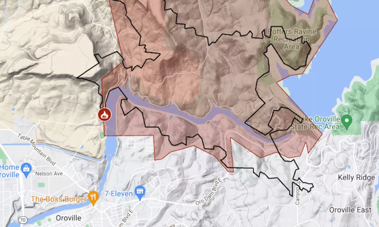
About 10 square miles on the lake’s west shore remained under the order, down from almost 50 square miles.
Except for zones within the perimeter of the fire, evacuation orders were downgraded to warnings. About 10 square miles on the lake’s west shore remained under the order, down from almost 50 square miles shortly after the fire started on Tuesday.
As of Friday morning, the fire had burned 3,789 acres and was 29% contained, said the California Department of Forestry and Fire Protection. The map above shows the approximate fire perimeter as a black line and the evacuation area in red.
United States Latest News, United States Headlines
Similar News:You can also read news stories similar to this one that we have collected from other news sources.
 Map: Thompson Fire and evacuation zones at Lake OrovilleAlmost 50 square miles on Lake Oroville’s west shore was under evacuation order for the Thompson Fire.
Read more »
 Thompson Fire Evacuation Map Shows California Areas at RiskMultiple areas are still under evacuation warnings and orders.
Read more »
 Thompson Fire Evacuation Map Shows California Homes in DangerThe blaze began on Tuesday morning and has since spread to more than 3,000 acres near Lake Oroville.
Read more »
 Thompson fire conjures traumatic memories for Camp fire survivor who lost everything but her lifeButte County has been buffeted by disaster after disaster in recent years. But the Camp fire, California’s deadliest wildfire to date, left deep wounds.
Read more »
 Salt Lake City Fire Dept. unveils state-of the-art bright green fire truckShanti Lerner joins FOX 13 News as a multimedia journalist focusing on digital content for the station.
Read more »
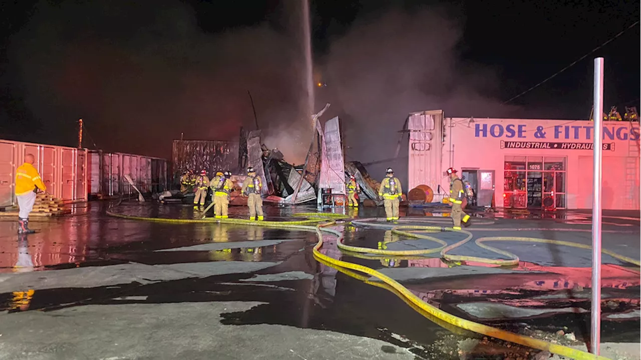 Salt Lake Fire asking public to 'avoid the area' after 3-alarm fire near Jordan RiverFire crews responded to a 2-alarm fire, later upgraded to a 3-alarm fire, at an industrial area of Salt Lake City's west side.
Read more »