
The largest fire was the Post Fire burning in Los Angeles and Ventura counties. More than 15,000 acres have burned.
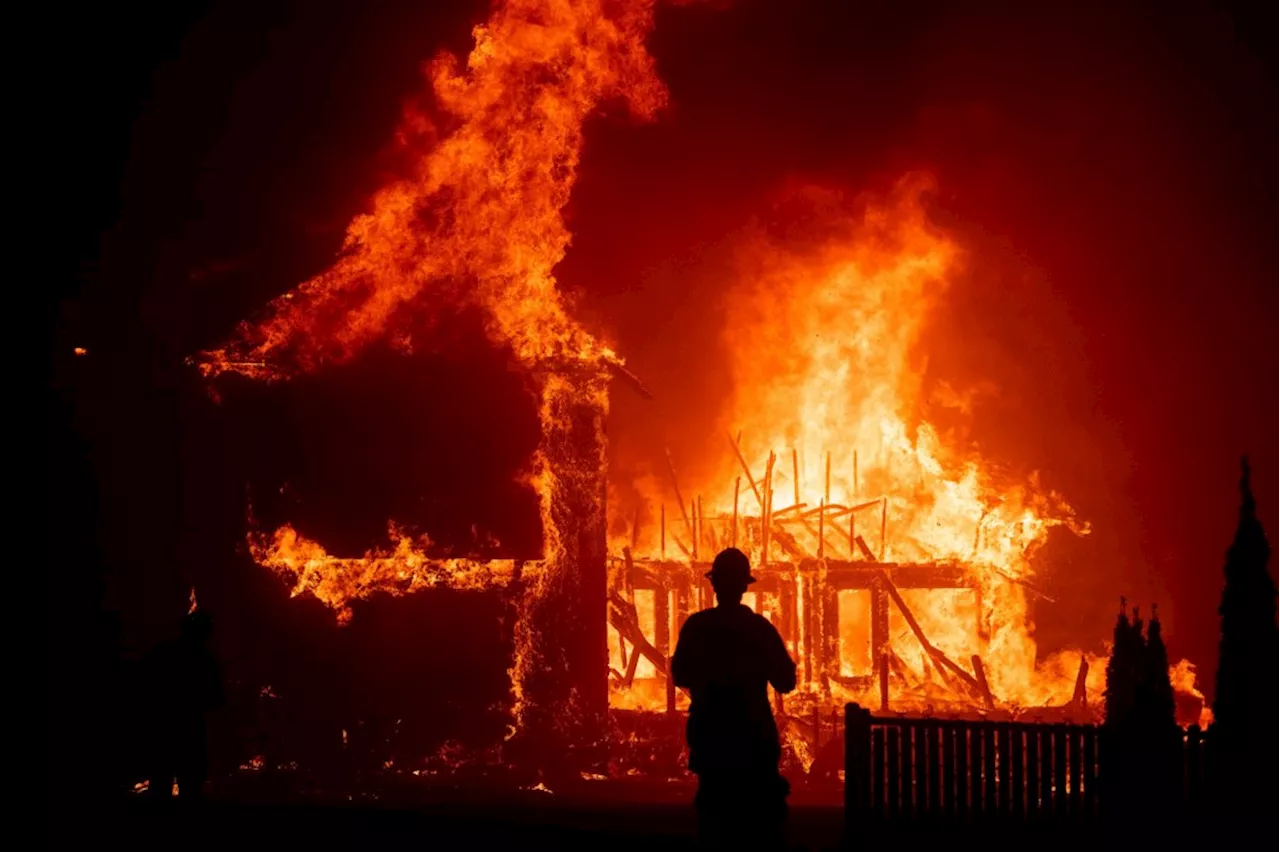
A California fire map shows that 36,145 acres of land have been burned by ongoing wildfires as dry weather and hot temperatures spur flames statewide.As of Tuesday afternoon, there were at least 14 wildfires burning across California. Many of them were battled by the California Department of Forestry and Fire Protection , the state agency responsible for fighting and preventing wildfires. Fires ranged from 15 acres in size to 15,611 acres, with evacuations ordered for susceptible areas.
There are no evacuation orders, although an evacuation warning is in place for Arrowhead Equestrian Estates.Junes Fire: The Junes Fire in Butte County is almost completely contained at 98 percent. Flames ignited on Saturday and have spread to 1,056 acres. CAL FIRE expects the fire to be completely contained by the end of the day, and there are no evacuation orders in place.Hernandez Fire: Flames from the Hernandez Fire in San Benito County have burned 642 acres after igniting on Saturday.
United States Latest News, United States Headlines
Similar News:You can also read news stories similar to this one that we have collected from other news sources.
 California Wildfire Map Shows Fires as 66,000 Acres BurnHundreds of people have been evacuated as wildfires burn across thousands of acres in California.
Read more »
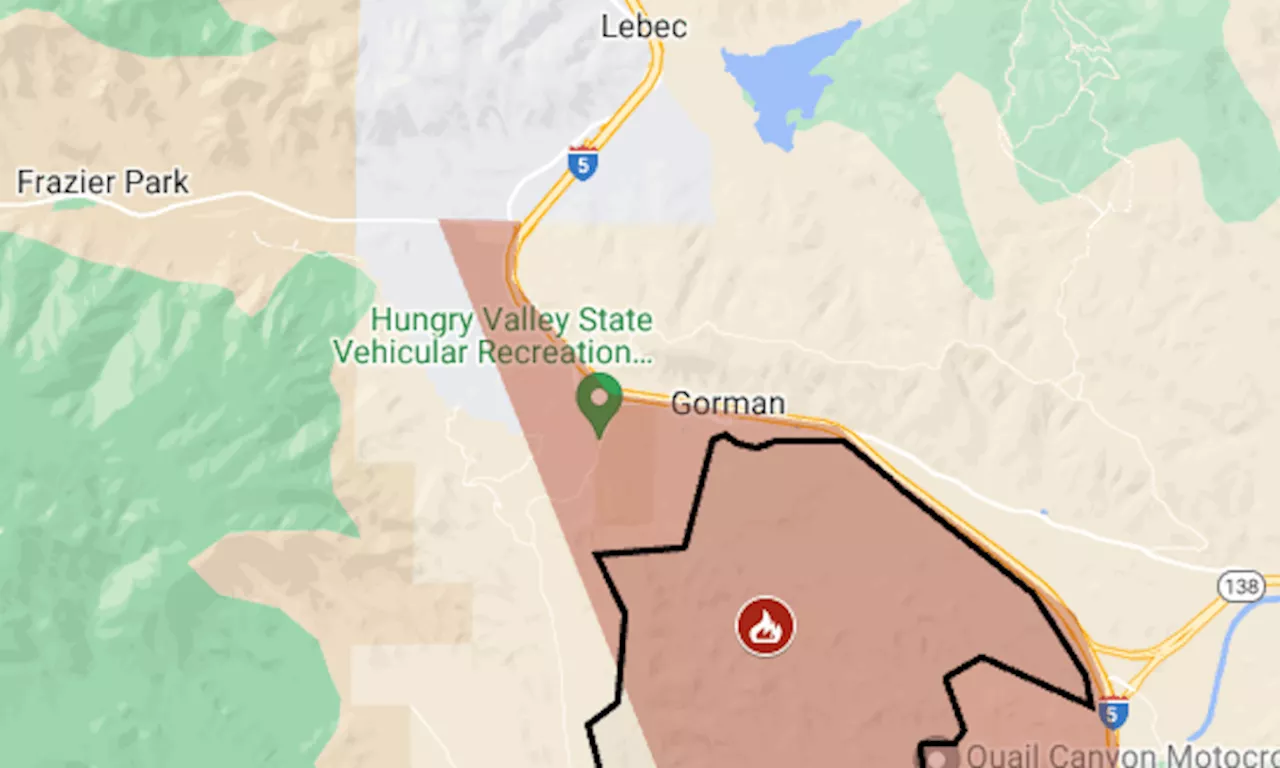 Post Fire map: Evacuation for biggest wildfire of California’s seasonWildfire in Los Angeles and Ventura counties has reached Pyramid Lake, along I-5’s Grapevine section.
Read more »
 Map: Here’s where California could push insurers to cover more fire-risk homesConsumer advocates say the changes would also mean rate hikes for many Californians.
Read more »
 Interactive Map Shows California Heat Warning—Check Your AreaThe National Integrated Heat Health Information System issued its highest level of heat warning for the Pacific Southwest.
Read more »
 Map Shows California Cities Will 'Roast' From HeatwaveMuch of the state has been slapped with an 'excessive heat' warning, with temperatures predicted to soar into triple-digit figures.
Read more »
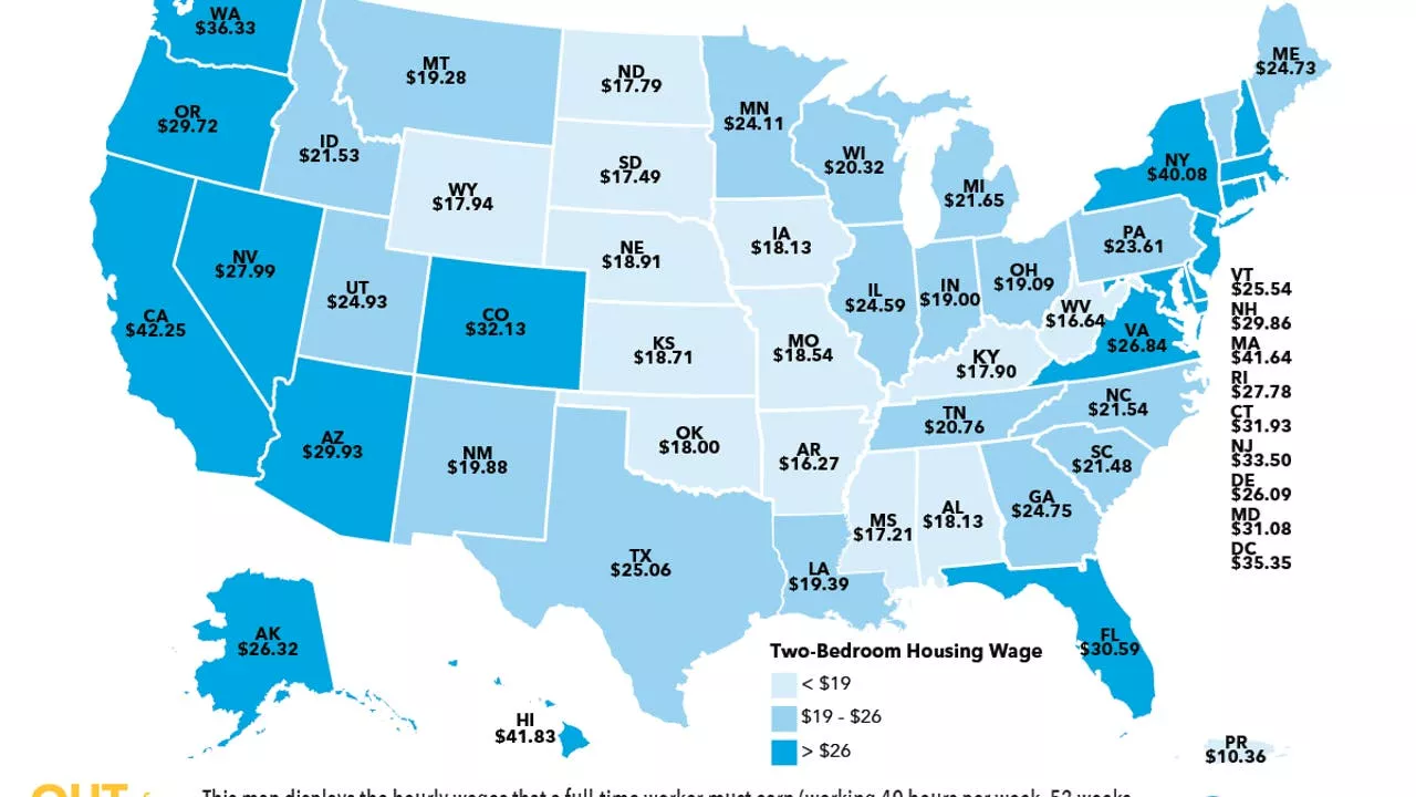 This map shows the hourly wage needed to afford rent in CaliforniaA new study conducted by the National Low Income Housing Coalition (NLIHC) looked at the hourly wage needed to afford rent in every state and to no one’s surprise, California topped the list.
Read more »