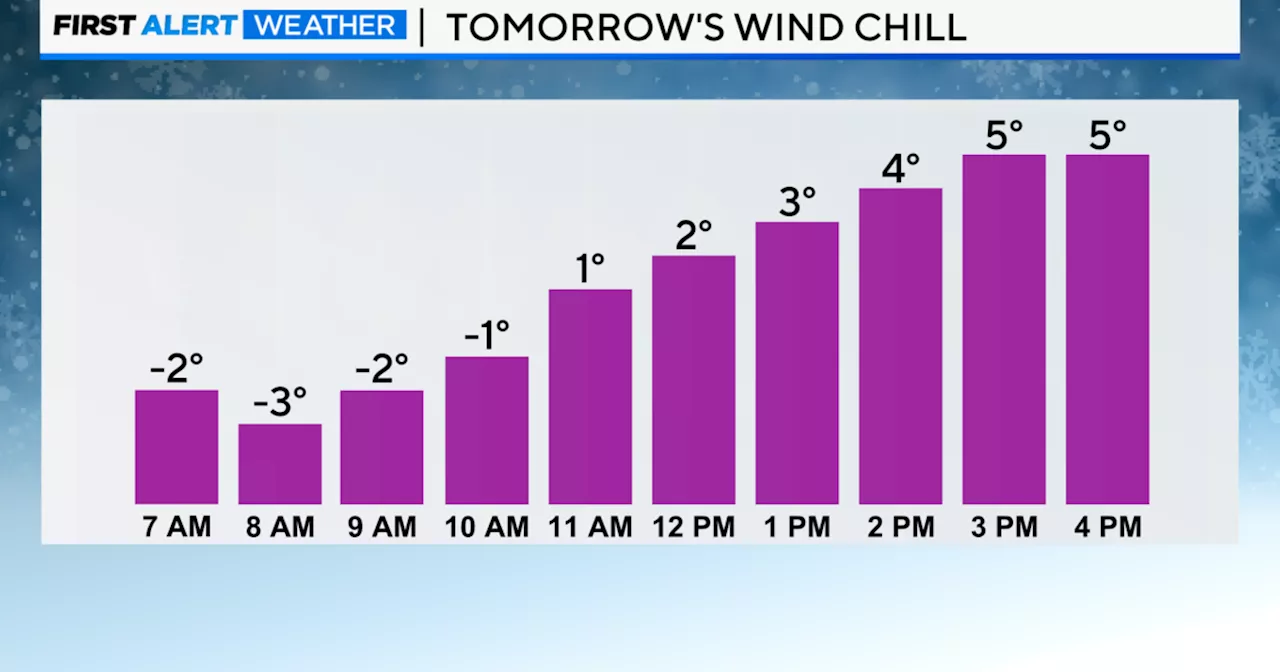
Chicago faces frigid conditions with temperatures plunging to the low teens and wind chills as low as -5 overnight Sunday into Monday. Icy patches are possible, so caution is advised while driving or walking. While Monday brings sunshine with a high of 19 degrees, a quick-hitting system Tuesday morning brings snow showers and reinforces the cold with wind chills ranging from -10 to -15.
CHICAGO — Bitterly cold temperatures are the weather headline to start the workweek.Overnight Sunday into Monday, temperatures are expected to drop to the low teens, but due to breezy conditions, wind chill values will drop as low as -5 late Sunday night through Monday morning. Any wet surfaces overnight have the potential to refreeze, so be mindful of slick and icy area roads and sidewalks. On Monday afternoon, highs will peak in the upper teens with wind chills remaining in the single digits.
Clearing skies overnight will give us sunshine throughout Chicago on Monday. A quick-hitting system will impact the Midwest Tuesday morning, which returns snow showers and reinforces a cold shot of air. Snow showers will be minimal, but the feels-like temperatures will range from -10 to -15 Tuesday morning. Actual highs during the afternoon will only reach mid-teens. Forecast at a glanceSunday night: Low of 12, breezy. Wind chills of 0 to -5. Clouds move out. Monday: Cold and sunny. High of 19.
CHICAGO COLD SNOW WINDCHILL TEMPERATURES
United States Latest News, United States Headlines
Similar News:You can also read news stories similar to this one that we have collected from other news sources.
 Sunday warmup before a rainy Monday and bitter cold temperatures settle inFreeze Warning and Frost Advisory remain in effect until 9 a.m. as temperatures continue to fall before sunrise. We’ll have mostly clear skies warming into the low-to-mid 60s. Overnight temperatures stay in the 50s.
Read more »
 All One Chicago Crossover Events, RankedMatt Casey in Chicago Fire, Erin Lindsay in Chicago PD, and April Sexton in Chicago Med.
Read more »
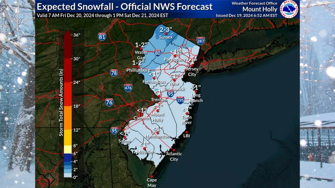 New Jersey to See Snow and Bitter Cold WeekendParts of northern New Jersey are expected to get 1 to 3 inches of snow Friday night into Saturday, while the rest of the state could see some accumulation of less than 1 inch from a wintry mix. Temperatures will be frigid, with highs only in the 20s and 30s and overnight lows dropping into the teens and single digits.
Read more »
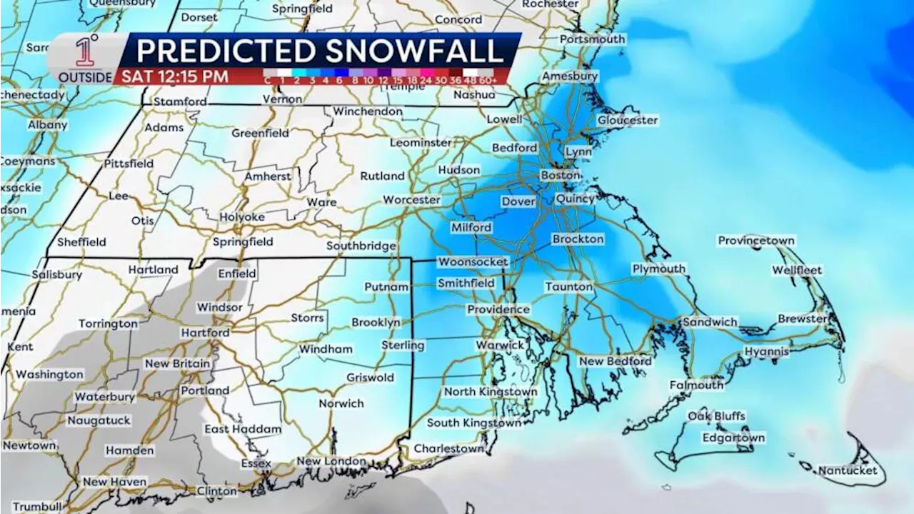 Forecast: A slippery evening commute, and a bitter cold weekendWhile it won’t be a blockbuster snow event, it will bring accumulation for much of the region, followed by an Arctic blast this weekend.
Read more »
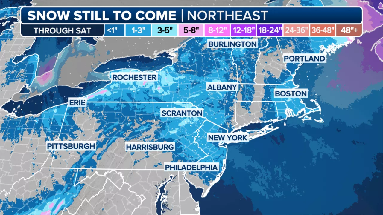 Snow, bitter cold to grip NYCNew York City will see a mixture of rain and snow this evening before an arctic blast sweeps into the northeast this weekend, bringing freezing temperatures and gusty winds.
Read more »
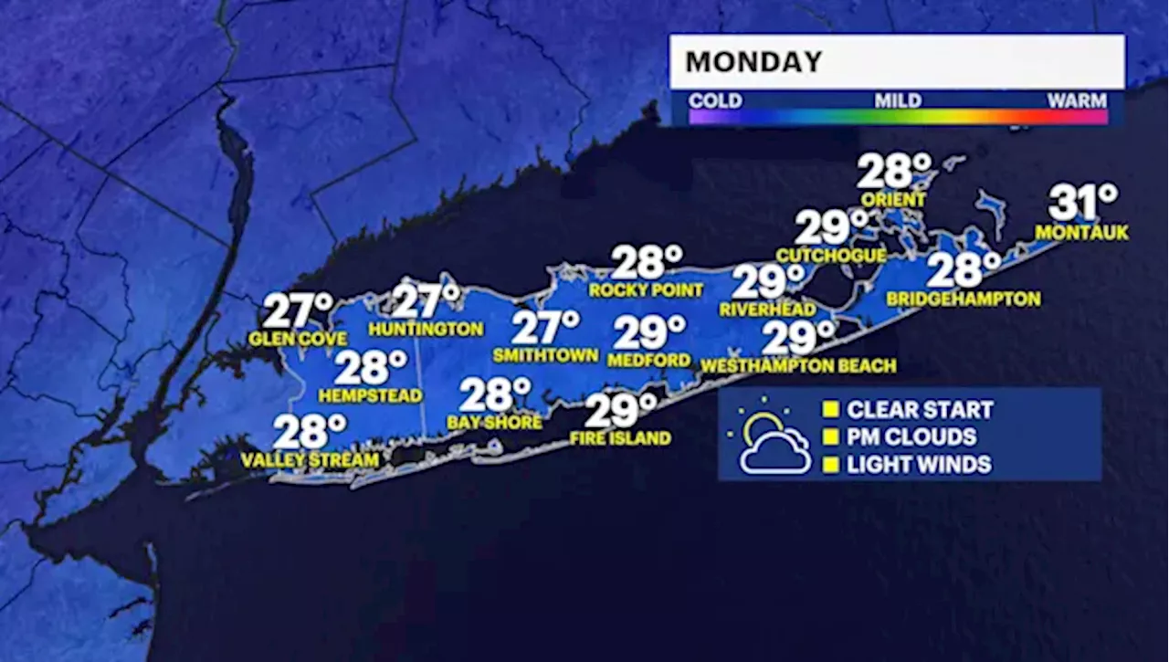 BITTER BLAST: Frigid temperatures for Monday; tracking overnight snow showers for Long IslandTemperatures will remain below freezing overnight, but changes are on the way for the holiday.
Read more »