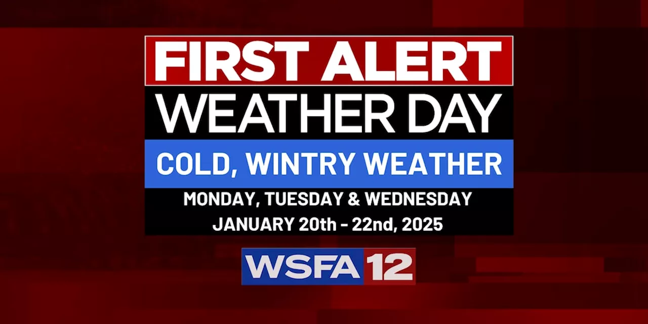
An Arctic front is set to sweep through Alabama, bringing a significant drop in temperatures and the possibility of wintry weather. Forecasters are monitoring two potential scenarios for Tuesday and Wednesday, one with dry, brutally cold conditions and another with the potential for precipitation and colder temperatures.
An Arctic front is moving through the state on Sunday, bringing significantly colder temperatures. Highs will be in the 30s and 40s, with lows dropping into the 20s. Wind chills could reach as low as the teens, prompting a First Alert Weather Day for Monday, Tuesday, and Wednesday of next week. There are two potential scenarios for Tuesday and Wednesday regarding precipitation.
A weak low-pressure system may stay south of the state, over the central Gulf, resulting in dry and extremely cold weather for Alabama for most of next week. Alternatively, a stronger low could track farther north, bringing moisture over the cold air. This scenario would increase the likelihood of wintry weather, especially in the southern half of the state. It's still too early to determine which scenario will materialize, as forecast models are constantly changing their predictions. For the most up-to-date information, continue to check back daily. In the meantime, there are local weather developments to monitor. Clouds are beginning to move back into the sky, leading to overnight and early morning rain. While warmth will persist for now, much colder air will arrive in the state starting Sunday and last for the next 7-10 days.Friday was a relatively warm day compared to the forecast for next week, with highs reaching the 60s under a mix of sun and clouds and a southeast breeze. A weather system is targeting the state tonight into Saturday morning, bringing a brief period of rain. Most of the rain will fall overnight while you're sleeping, with a chance of a few rumbles of thunder. However, the air is expected to be too cool and stable for any severe weather. Rainfall amounts from the Friday night/Saturday system will range from one-half to one inch. Scattered showers may linger into Saturday afternoon before ending Saturday evening
Arctic Front Wintery Weather Cold Temperatures Alabama Weather Forecast
United States Latest News, United States Headlines
Similar News:You can also read news stories similar to this one that we have collected from other news sources.
 Arctic Cold Front Brings Dramatic Temperature Drop This WeekendAn Arctic cold front will bring a dramatic temperature drop to the region starting Sunday, following mild temperatures in the 60s on Friday and Saturday. The high for Sunday will occur early in the morning, with temperatures dropping sharply into the 40s and 30s by midday.
Read more »
 Arctic Front Brings Potential Snow to Houston, School Closures AnnouncedAn arctic front is expected to reach Houston on Saturday, bringing the possibility of snow late Monday into Tuesday morning. As a result, several Houston-area school districts, including Cleveland ISD, Dayton ISD, and Tarkington ISD, have announced closures or delays for Tuesday, January 21, 2025. Warming centers have also been set up in Cleveland to help residents cope with the expected cold weather.
Read more »
 Arctic Front to Bring Chilling Temperatures to North TexasAn Arctic winter front has brought snow and freezing temperatures to North Texas. A cold front is expected to continue chilling Dallas-Fort Worth through the weekend, with the potential for an even stronger Arctic front next week.
Read more »
 ERCOT issues Weather Watch from Jan. 20-23 for next week's arctic cold frontERCOT's website shows that it expects to have enough power to meet demand over the next six days.
Read more »
 CenterPoint planning on having extra crews on standby ahead of arctic cold frontABC13 asked the energy provider about its plan to prepare for the cold weather heading to Houston next week.
Read more »
 Arctic Front Prompts Preparations for Snow and Freezing Temperatures in HoustonThe Houston Independent School District (HISD) is preparing for the arrival of an Arctic front expected to bring snow and freezing temperatures to the city early next week. Meteorologists predict 2 to 6 inches of snow accumulation, prompting HISD to activate its weather response plan.
Read more »