
The Washington State Department of Transportation utilizes a specialized snow study plot at Snoqualmie Pass to monitor snowpack stability and mitigate avalanche risks to Interstate 90. The plot's location and unique characteristics allow WSDOT to analyze the layering, density, and temperature variations within the snowpack, providing crucial insights into potential avalanche hazards. By understanding the factors that influence snow stability and employing advanced tools, WSDOT aims to predict avalanche occurrences, estimate their size and trajectory, and implement timely avalanche control measures to ensure public safety.
As spring approaches, the snow accumulation at Snoqualmie Pass intensifies, typically peaking in March and April. At the Washington State Department of Transportation 's (WSDOT) snow study plot located along Snoqualmie Pass , a prominent five-meter pole extends from the ground, serving as a benchmark for avalanche control measures.
This crucial site, positioned across from The Summit at Snoqualmie, a renowned ski resort, allows WSDOT to monitor the stability of the snowpack and mitigate the risks posed by avalanches to Interstate 90. WSDOT Avalanche Program Supervisor John Stimberis highlighted the three primary avalanche zones west of Snoqualmie Pass: Denny Mountain, Granite Mountain, and Shedwall and Airplane Curve, situated near the Summit West ski area. These zones present a significant hazard, particularly during late winter and early spring, when the threat of snow collapse and slides onto the roadway heightens. Direct access to these avalanche-prone areas for daily assessments of snowpack instability would be highly perilous and impractical. Consequently, WSDOT relies on the snow study plot to gain crucial insights into the snowpack's behavior. The plot's flat and sheltered location, coupled with its characteristic weak layers, makes it ideal for employing specialized tools to analyze the snowpack's composition. WSDOT personnel utilize piercing tools to determine the depths of various snow layers and weigh and measure the density of the snow. Stimberis explained that the analysis focuses on three key aspects: the layering or stratigraphy of the snow, the potential for snow release, and the size and trajectory of a potential avalanche. He emphasized the importance of understanding the weather's influence on snow stability, as rapid changes, such as heavy snowfall or rainfall, can significantly alter the snowpack's structure. Rainfall, while a contributing factor to avalanche formation, can also lead to more stable conditions by removing sugary snow, a type of weak, light snow that is prone to avalanches. The study plot is equipped with advanced research tools, including a temperature profiler, which monitors temperature variations within the snowpack, revealing potential weak points. Sub-freezing temperatures at depth can contrast with above-freezing temperatures at the surface, creating unstable conditions. Infrared thermometers measure surface temperatures, identifying the formation of frosty crusts, another potential trigger for avalanches. The goal is not only to predict the likelihood of avalanches but also to estimate their size and potential impact on the roadway. When the risk warrants action, WSDOT implements avalanche control measures, which may involve temporarily closing I-90 to detonate explosives and trigger controlled avalanches, ensuring that snow slides are managed proactively rather than becoming uncontrolled natural disasters. The timing of these measures is often dictated by seasonal snow accumulation patterns, with peak snowpack depths typically occurring in early March. WSDOT has been diligently collecting snow reports at the Snoqualmie Pass site since the 1930s, with a particular emphasis on analyzing the physical properties of the snowpack since the 1970s.
Avalanche Snowpack Interstate 90 Washington State Department Of Transportation (WSD Snoqualmie Pass Avalanche Control Snow Study Safety
United States Latest News, United States Headlines
Similar News:You can also read news stories similar to this one that we have collected from other news sources.
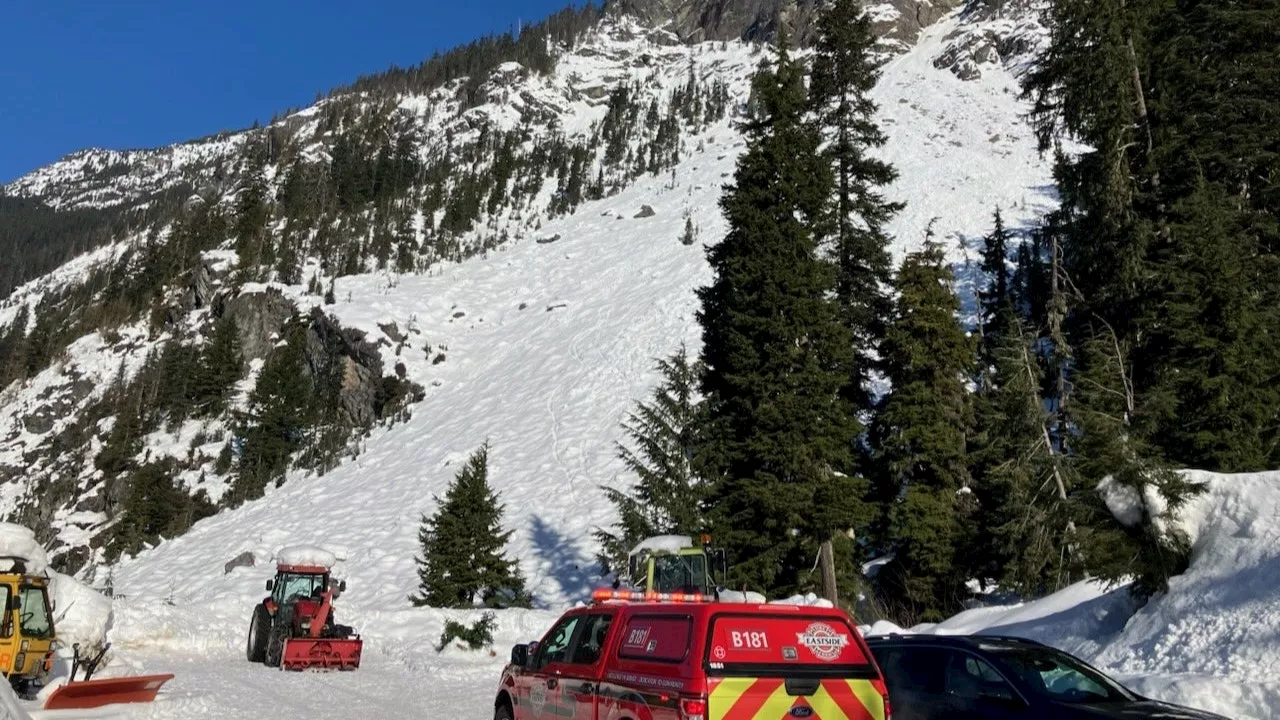 Search and rescue teams trying to reach fallen hiker on Guye Peak, WAA hiker has fallen in the Guye Peak area of Snoqualmie Pass on Sunday afternoon.
Read more »
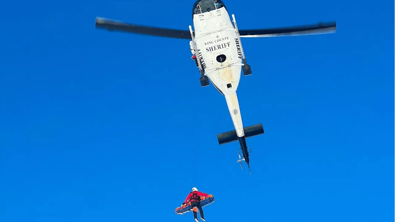 Experienced base jumper rescued from peak after nearly 100-foot fall near Snoqualmie PassIt took several ground teams and a helicopter crew to rescue a climber who was hurt in an approximately 100 foot 'nasty fall' near Snoqualmie Pass Sunday.
Read more »
 Chains Required on Snoqualmie Pass as Winter Weather HitsHeavy snowfall on Snoqualmie Pass this weekend led to chain requirements for vehicles without all-wheel drive. Drivers experienced significant delays and traffic backups as they stopped to put chains on their vehicles. Washington State Patrol conducted chain checks to ensure compliance with the law.
Read more »
 Snoqualmie Pass Residents Prepare for Potential SnowstormResidents and commuters in the Snoqualmie Pass area are closely monitoring weather forecasts as the potential for snow looms. Skiers enjoy ideal conditions, while others prepare for potential travel disruptions.
Read more »
 WSDOT to Deploy Mobile Speed Cameras in Work Zones to Improve SafetyThe Washington Department of Transportation (WSDOT) is implementing mobile speed cameras in freeway work zones to address the increasing number of work zone crashes and improve safety for both workers and drivers.
Read more »
 Snow and Ice Blanket Seattle, Schools Close, WSDOT Treats RoadsThe Puget Sound region, including Seattle, woke to fresh snow and icy conditions Wednesday morning, leading to school closures and road treatment efforts. Several Seattle neighborhoods received approximately two inches of snow overnight, with freezing temperatures expected to persist until the afternoon. The Washington State Department of Transportation (WSDOT) is using salt and sand to treat roads and prevent accidents. While some sunshine is expected by Friday, cold temperatures are anticipated to remain.
Read more »