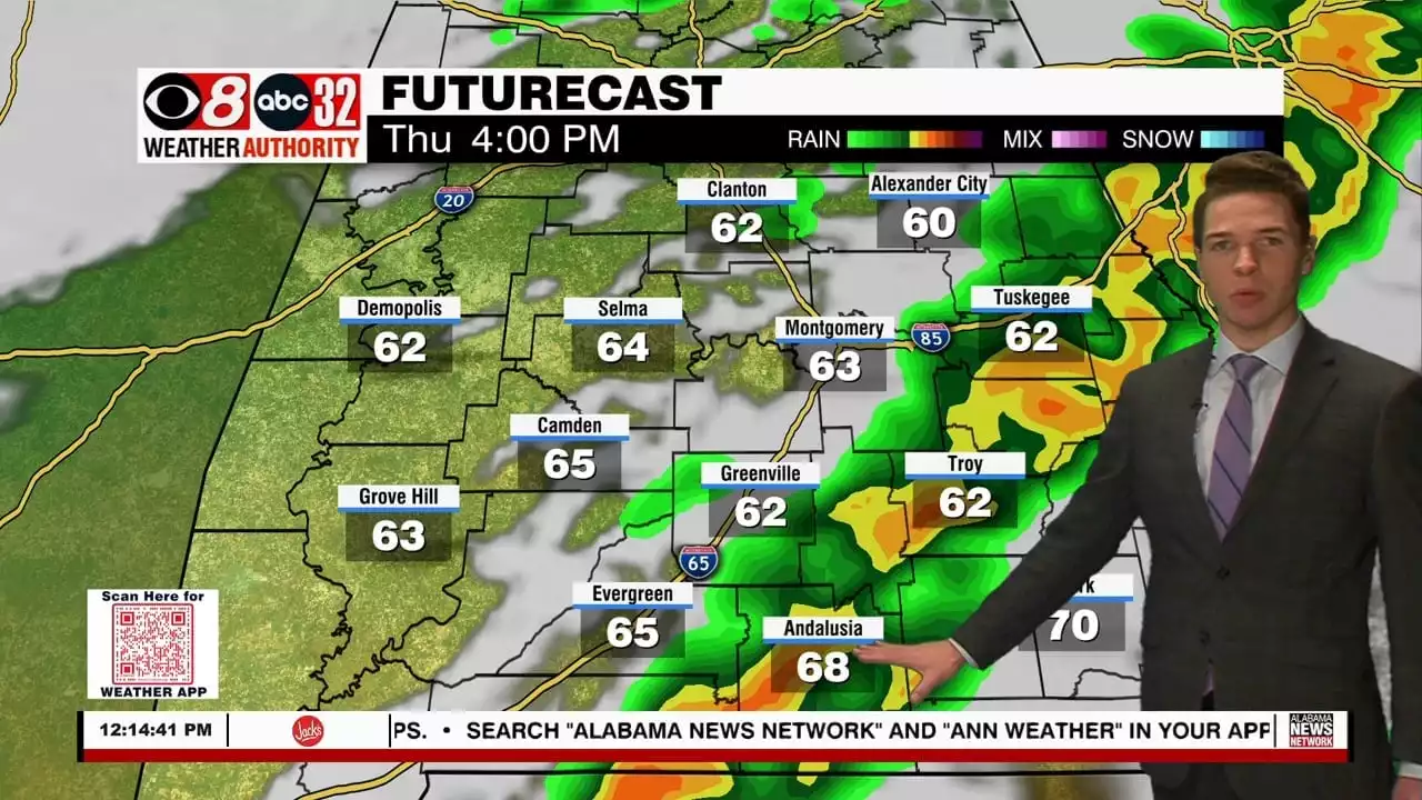
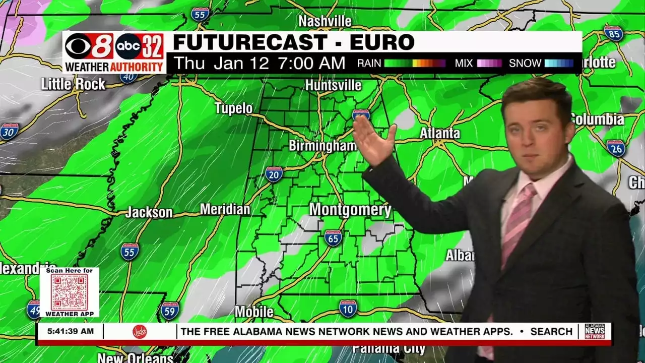
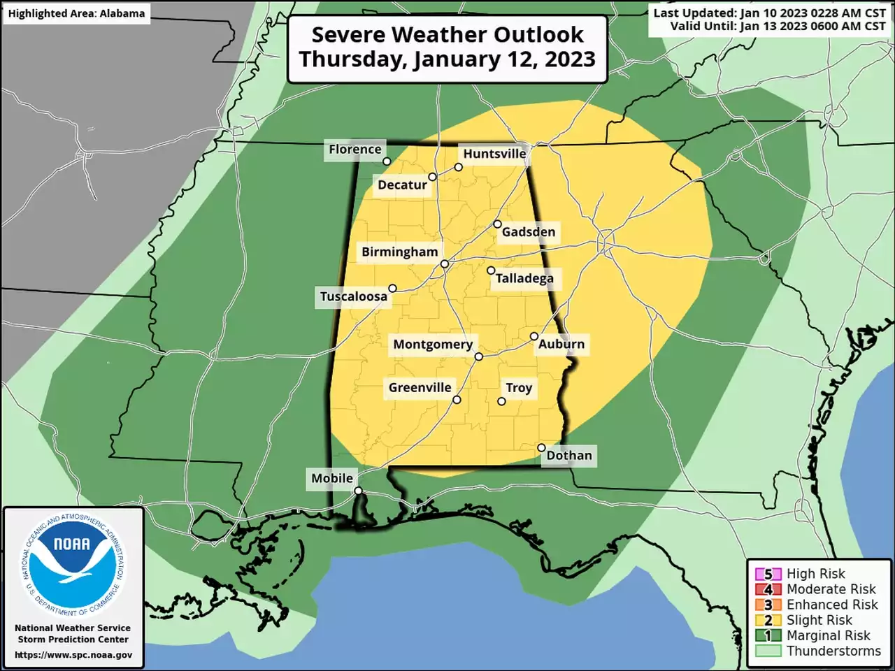
Another round of storms, some severe, move through central and south Alabama Thursday. The storm prediction center places a slight (level 2/5) severe risk across all of our viewing area of central and south Alabama.
Compared to recent severe weather events, the tornado risk appears muted. However, a brief tornado or two cannot be ruled out. Although, damaging straight-line winds up to 60 mph appear to be the primary severe hazard. Severe-size hail of quarter size or larger appears unlikely. The flash flood risk looks low too, although many locations may pick up around 1″ of rain.
The severe weather window opens around 10AM in west Alabama. A line of storms crosses I-20 into our west Alabama communities during the late morning. From there, it continues southeast, exiting our southeast communities by 7PM. A cold front pushes through our area behind the storms, ushering in much colder air Thursday night. Friday morning lows range from the upper 30s to low 40s.
A northwest wind remains brisk Friday while the sky remains mostly cloudy. Friday’s high temperature could be at midnight Thursday night. Afternoon temperatures may remain in the 40s. Friday night lows fall into the 30s, potentially below freezing . Sunshine returns in abundance Saturday, but temperatures remain cool, with highs in the 50s and lows in the 30s. Sunday remains dry with sunshine, some clouds, and highs near 60°.
Temperatures trend milder next week. Clouds increase Monday, and isolated showers appear possible by late in the day. The rain chance appears higher Tuesday, with a mainly cloudy sky and highs in the 60s otherwise. Clouds linger with isolated to widely scattered showers Wednesday. Another system may bring another round of rain and perhaps storms to Alabama next Thursday.
United States Latest News, United States Headlines
Similar News:You can also read news stories similar to this one that we have collected from other news sources.
 Severe Storm Threat Thursday - Alabama NewsHigh pressure has set up just to our southeast and that’s allowing a southwesterly wind flow into the area. This will bring in warmer air along with some moisture overnight. Clouds will be on the increase and temps won’t drop as low as last night. I’m thinking mid to upper 40s are more likely for lows. Wednesday is setting up...
Read more »
 Bay Area Braces for Next Storm Expected Wednesday to ThursdayA day after hail, thunder and lightning bashed the Bay Area, another storm is lining up to dump more heavy rain Wednesday and leave more flooding in its wake.
Read more »
 Clouds Moving In; Strong Storms Thursday - Alabama NewsClouds will be around this afternoon and evening, but rain remains out of the forecast until Thursday, in which we could see some stronger storms. alwx
Read more »
 Sunny Tuesday; Strong to Severe Thursday - Alabama NewsSunshine will be abundant for our Tuesday, but the risk for strong to severe storms exists for Thursday. alwx
Read more »
 Severe weather possible Thursday in AlabamaStraight-line winds, tornadoes, hail and heavy rain will all be possible on Thursday as storms track across the state ahead of a cold front. The main concern with this system will be damaging winds. However, a tornado can’t be ruled out. Stay aware!
Read more »
 Sunny Tuesday Afternoon; Strong Storms Thursday - Alabama NewsThe rest of the day will feature tons of sunshine and warmer temperatures, but a severe threat looms for Thursday. alwx
Read more »