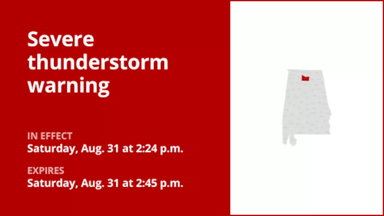
The National Weather Service issued an updated severe thunderstorm warning at 2:24 p.m. on Saturday in effect until 2:45 p.m. for Morgan County.
Updated: Aug. 31, 2024, 2:30 p.m."At 2:23 p.m., a severe thunderstorm was located 10 miles east of Falkville, or 12 miles east of Hartselle, moving southwest at 10 mph," says the weather service. "Expect damage to roofs, siding, and trees."
Lightning can follow conductive pathways, and these precautions reduce the risk of electrical surges.After the last lightning strike or thunderclap, wait at least 30 minutes before resuming outdoor activities. Camping in an open setting during a thunderstorm is strongly discouraged. If you have no alternative, set up camp in a valley, ravine, or other low-lying areas. It's crucial to note that a tent provides no protection against lightning.
Enhance your visibility in heavy rain by activating your headlights. Be particularly vigilant for vehicles in blind spots, as rain-smeared windows can obscure them.The first half-hour of rain is when roads are slickest due to a mix of rain, grime, and oil. Exercise heightened caution during this period.Large trucks and buses can reduce your visibility with tire spray. Avoid tailgating and pass them swiftly and safely.Heavy rain can overload the wiper blades.
Weather Alerts @River-State @Exalerts
United States Latest News, United States Headlines
Similar News:You can also read news stories similar to this one that we have collected from other news sources.
 Update: Expect damaging winds and penny-sized hail with thunderstorms in Shelby County SaturdayOn Saturday at 4:23 p.m. an updated severe thunderstorm warning was issued by the National Weather Service valid until 5 p.m. for Shelby County.
Read more »
 Update: Thunderstorms with penny-sized hail and damaging winds in Erie County SaturdayOn Saturday at 2:53 p.m. an updated severe thunderstorm warning was issued by the National Weather Service valid until 3:15 p.m. for Erie County.
Read more »
 Update: Penny-sized hail and damaging winds anticipated with thunderstorms to hit Jackson County SaturdayThe National Weather Service issued an updated severe thunderstorm warning at 1:41 p.m. on Saturday valid until 2 p.m. for Jackson County.
Read more »
 Update: Flood warning issued for Bradford County until Saturday morningOn Friday at 4:32 p.m. the National Weather Service issued an updated flood warning valid from 7 p.m. until Saturday 8:52 a.m. for Bradford County.
Read more »
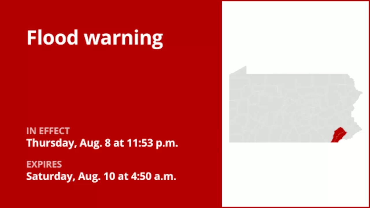 Update: Flood warning for Chester County until early Saturday morningOn Thursday at 11:53 p.m. an updated flood warning was issued by the National Weather Service in effect until Saturday at 4:50 a.m. for Chester County.
Read more »
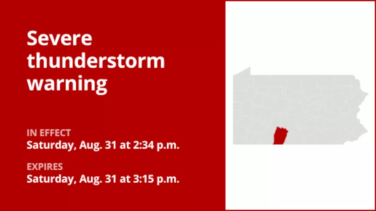 Look for damaging winds and quarter-sized hail with thunderstorms in Bedford County SaturdayA severe thunderstorm warning was issued by the National Weather Service on Saturday at 2:34 p.m. valid until 3:15 p.m. for Bedford County.
Read more »