A new world map called the Equal Earth World Map is being hailed as the most accurate ever created. It addresses the size and shape distortions found in previous maps like Mercator and Gall-Peters.
Every map of the world that you have ever seen is inaccurate. Well, of course, you might think. How could they map out the world when it’s round, not flat? True. But that isn’t the point. See, the world map s we’ve been using for centuries don’t show the most accurate appearance of the landmasses, either. But the Equal Earth World Map is changing that. Cartographers presented this solution in a new article published in the International Journal of Geographical Information Science.
According to that new article, this new world map is not only the most accurate ever created, but it actually showcases the proper size of the landmasses and continents that make up our planet. The Equal Earth World Map builds off previously released maps like the Mercator projection map and the Gall-Peters projection map. However, these two maps had problems of their own. The first, the Mercator projection map, shows everything where it should be, but it makes landmasses further from the equator appear larger than they actually are. The Gall-Peters projection map addressed part of this issue by making the landmasses more rounded to what they should look like. However, it distorted the shape of the continents. As such, it didn’t provide an accurate view of the world, either. The Equal Earth World Map, on the other hand, builds on a combination of these two—a hybrid map known as the Robinson projection map, which took bits and pieces of each map to make it highly suitable for world maps. The authors of the new study say it provided the best foundation for their new, more accurate map, though they worked to retain the relative size of areas, something the Robinson map struggled to do. As it stands, this new map may very well be the most accurate world map that we have ever seen. It not only portrays the landmasses as accurate size, but it also portrays them as their accurate shape, too. This, thereby, resolves the two issues that the previously accepted world maps suffered fro
WORLD MAP GEOGRAPHY MAPPING ACCURACY CARTOGRAPHY
United States Latest News, United States Headlines
Similar News:You can also read news stories similar to this one that we have collected from other news sources.
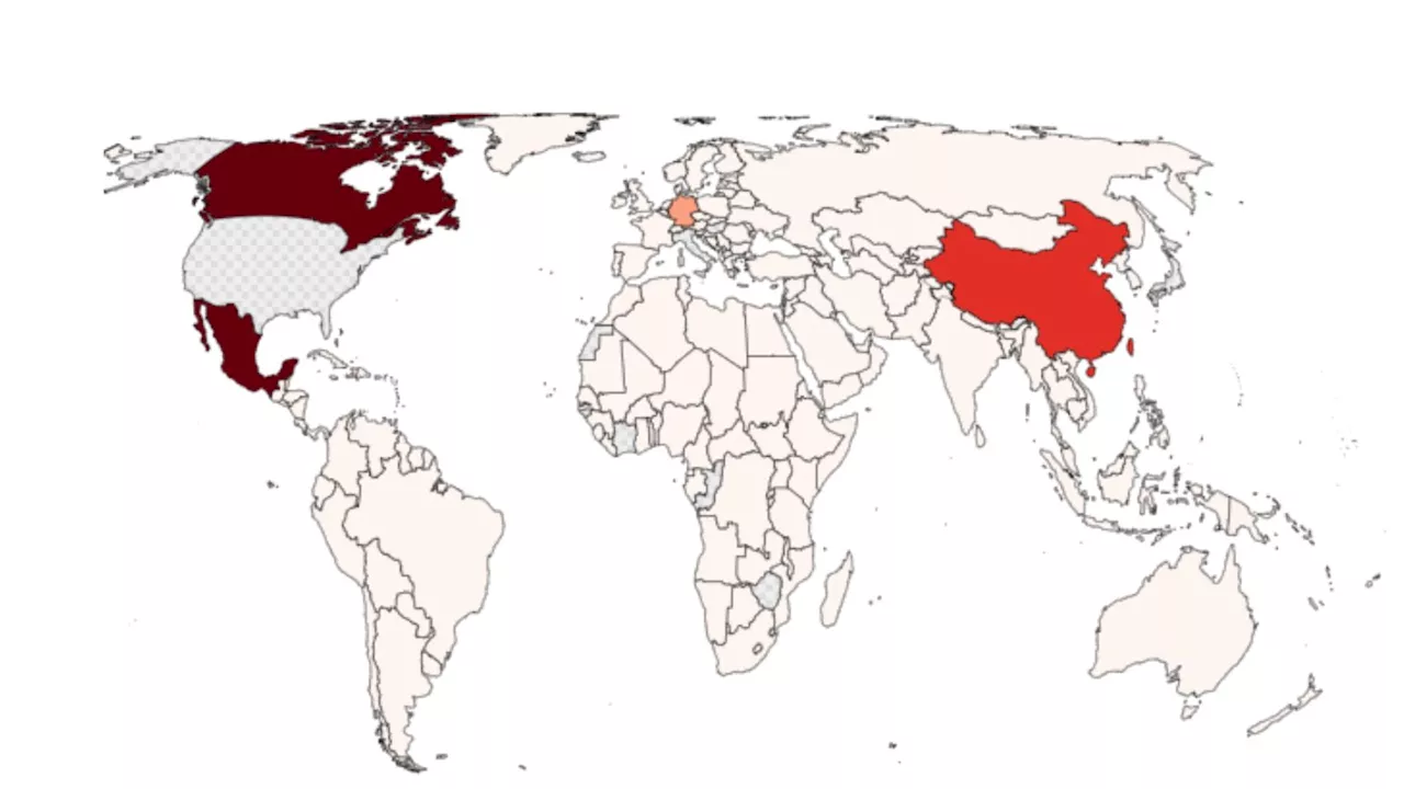 Map Shows US Biggest Trading Partners Around the WorldAs Donald Trump readies an aggressive tariff policy, Newsweek has created a map showing the U.S.'s biggest trading partners.
Read more »
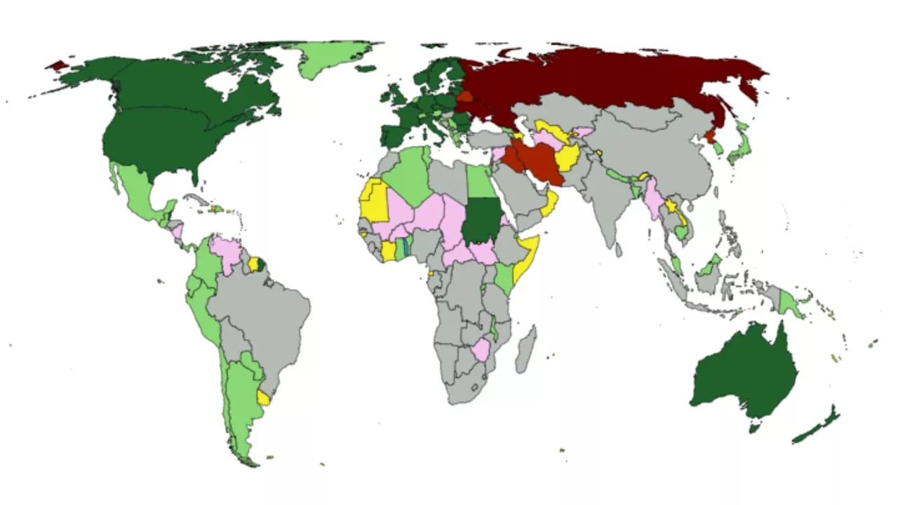 Map Shows Where the World Stands on UkraineWith the war in Ukraine escalating to new levels in recent weeks, Newsweek has mapped the international perspectives on the conflict.
Read more »
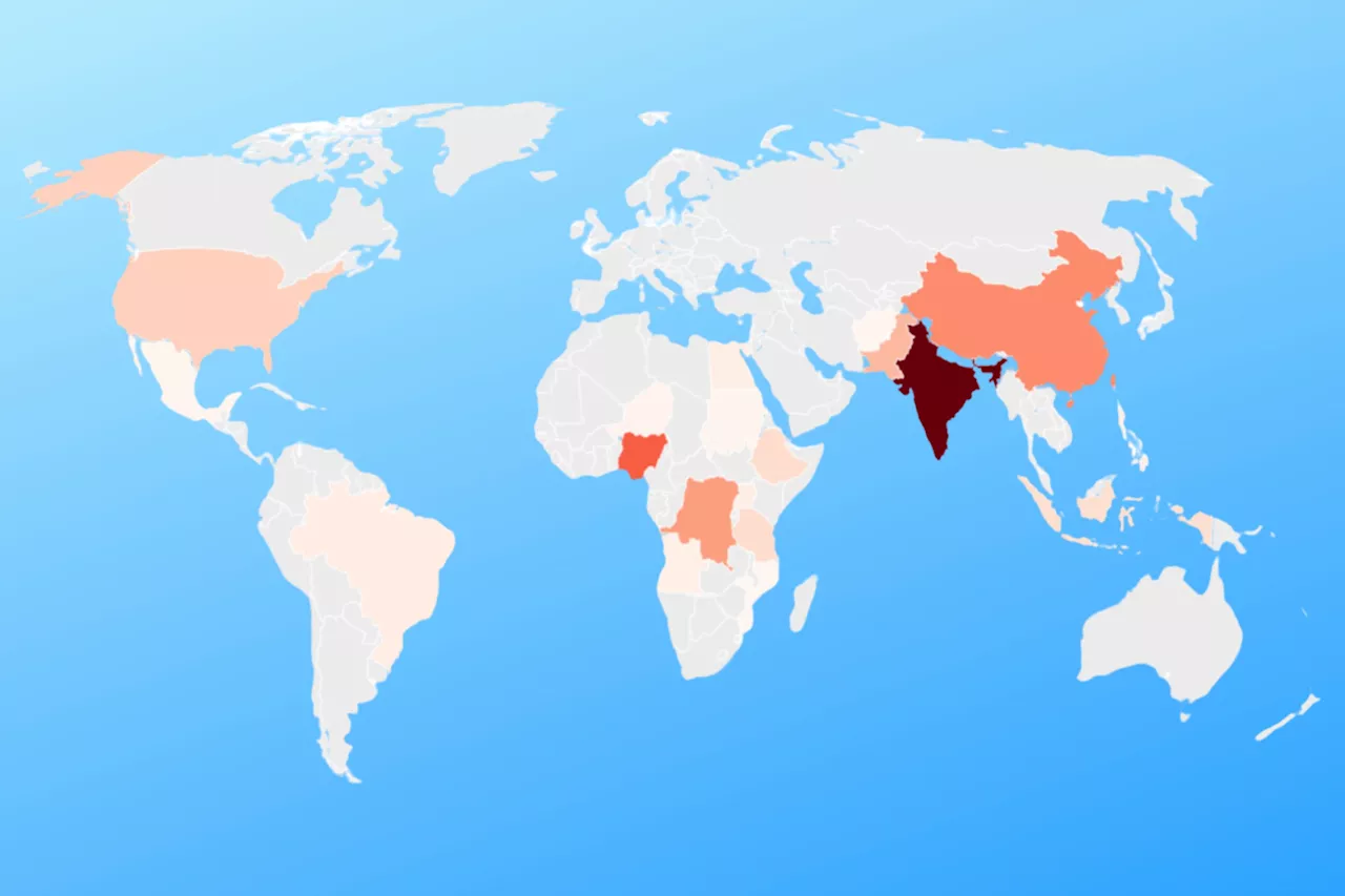 Map Reveals How World's Population Will Change by 2100The Census Bureau has revealed how much populations will change across the world, with vastly different changes between nations.
Read more »
 Map Shows the World's Most Dangerous CitiesA new global risk map has identified the most dangerous cities and countries for travelers in 2025, ranking locations based on a number of factors.
Read more »
Map Shows the World's Most Dangerous CitiesA new global risk map has identified the most dangerous cities and countries for travelers in 2025, ranking locations based on a number of factors.
Read more »
 FIFA Sparks Anger With Crimea Map During World Cup DrawThe organization displayed a map during a qualifying draw that showed Ukraine without including Crimea as part of the country,
Read more »