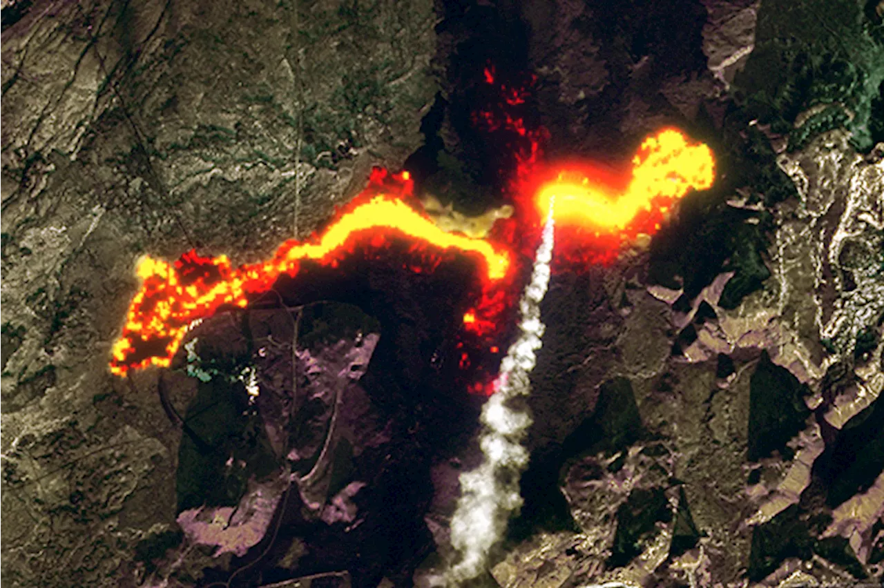
As a gargantuan plume of magma rises from the depths, tectonic forces are wrenching the island nation apart, triggering the outpouring of lava.
The eruption of lava near Iceland's world famous Blue Lagoon geothermal spa is seen here in an image acquired by the Landsat 9 satellite on Nov. 24, 2024. Infrared data collected by the satellite reveals the glow from the flowing lava on the Reykjanes Peninsula. Reykjanes Peninsula is so voluminous that it's easily visible to orbiting satellites.
Here's a different version of the Landsat 9 satellite showing more of the surrounding landscape of the Reykjanes Peninsula: Iceland lies along a giant seam in Earth's crust running roughly down the middle of the North and South Atlantic Oceans. The seam is marked by a ~10,000-foot-high undersea mountain range known as theare pulling apart, including in Iceland. Here, the North American plate is moving roughly west by southwest, while the Eurasian Plate is pulling toward the east.onto the surface. This phenomenon is not unique to Iceland — it happens all along the 10,000-mile-long Mid-Atlantic Ridge.
United States Latest News, United States Headlines
Similar News:You can also read news stories similar to this one that we have collected from other news sources.
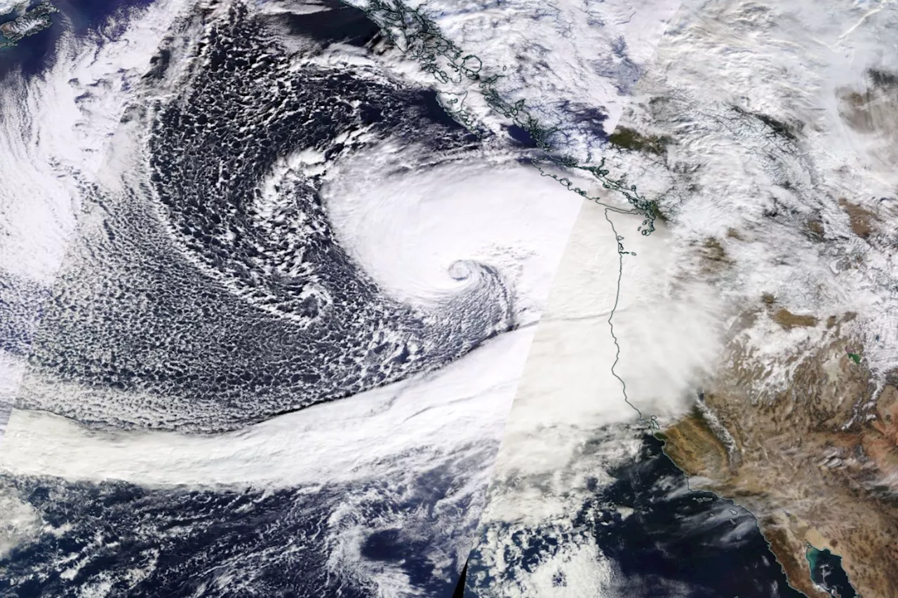 Satellite Images Show Scale of 'Bomb Cyclone' Hitting US West CoastAt least one person has been killed in the cyclone.
Read more »
 Israel's military is building along U.N.-patrolled demilitarized zone in Syria, satellite images showIsrael is apparently laying asphalt for a road along a demarcation line that separates the Israeli-occupied Golan Heights from Syria.
Read more »
 Chinese ships gather near island disputed with Philippines, satellite images showSatellite images obtained by Reuters show a build-up of Chinese civilian vessels near contested Thitu Island, Manila's key outpost in the South China Sea.
Read more »
 Satellite images show China working on nuclear propulsion for new aircraft carrierFor the first time, a group of U.S. researchers has concluded that China has built a land-based prototype nuclear reactor to power future aircraft carriers. The researchers have come to the conclusion after poring over satellite images and public documents from a span of several recent years.
Read more »
 Satellite Images Show North Korea Expanding Key Missile Factory: ReportThe close ally of Russia is expanding a weapons-manufacturing complex that assembles short-range missiles, according to Reuters.
Read more »
 Satellite images show the devastation from Spain's deadly floodsThe images show a devastating transformation of eastern Spain, where at least 205 people have been killed by flash floods.
Read more »