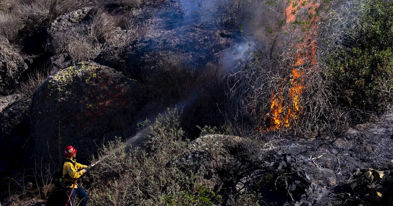
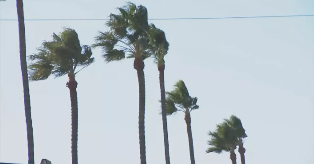
Recent wildfires in Los Angeles County have left areas vulnerable to flooding and landslides as the region prepares for its first significant rainfall of the season. Forecasters warn of a 10% to 20% chance of flash flooding and debris flows in burned regions, particularly around Pacific Palisades, Malibu, Altadena, Pasadena, Lake Castaic, and Glendora. Residents are urged to prepare by avoiding recently burned areas, using sandbags, and stocking up on supplies.
Areas recently scorched by wildfires in Los Angeles County are facing a heightened risk of flooding and landslides as Southern California braces for its first substantial rainfall of the winter this weekend. The National Weather Service office in Oxnard emphasized the gravity of the situation on social media, urging residents to prepare for the worst-case scenario.
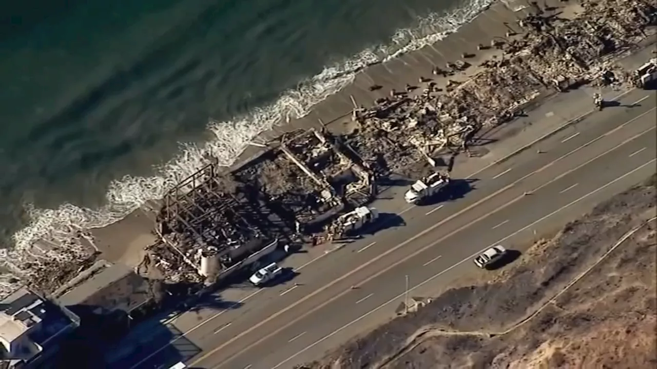
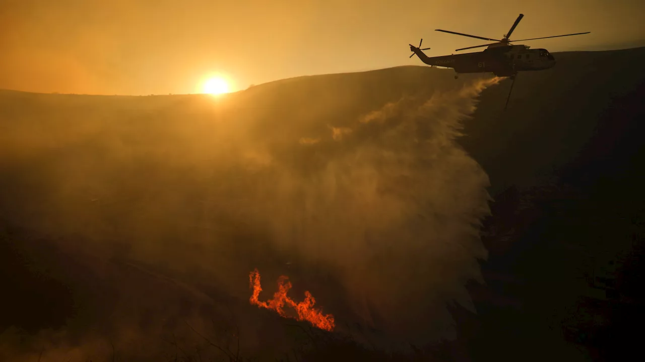
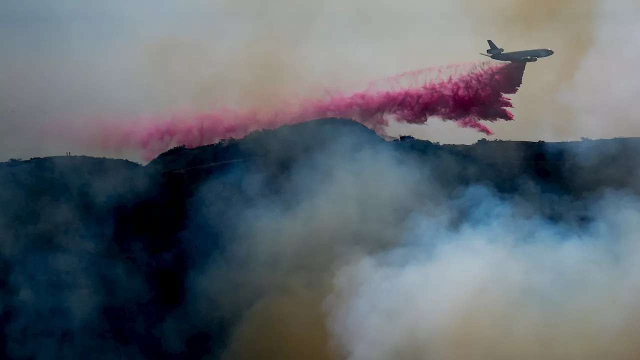
Forecasters predict a 10% to 20% chance of significant flash flooding and debris flows capable of inflicting damage on roads and homes in the most vulnerable regions ravaged by recent fires. These areas include the burn scars of the Palisades and Franklin fires encircling Pacific Palisades and Malibu, the Eaton fire around Altadena and Pasadena, the Hughes fire near Lake Castaic, and the Bridge fire within the Angeles National Forest north of Glendora. The Bridge fire, which consumed over 56,000 acres across Los Angeles and San Bernardino counties in the autumn, resulted in the destruction of 81 structures and injuries to eight firefighters. Based on a U.S. Geological Survey assessment, these burn areas are deemed most susceptible to substantial debris flows, according to Ryan Kittell, a meteorologist with the weather service. Kittell explained that these areas exhibit several key characteristics that elevate their risk: they are among the freshest burn scars, situated in close proximity to communities and vulnerable infrastructure, and the terrain's orientation favors the potential for higher rainfall intensities and totals. The probability of flooding and debris flows in these recently burned zones, issued on Friday afternoon, has climbed from the 5% to 10% chance forecast a day earlier. 'While damaging debris flows are not the most likely outcome, there is still a considerable amount of uncertainty surrounding this storm,' the weather service stated. The threat stems from the fact that the intense heat of the wildfires impairs the soil's capacity to absorb water, rendering it hydrophobic. Consequently, water flows over the surface downhill, accumulating rocks and debris, potentially leading to mudflows (where water carries primarily mud) or, more destructively, debris flows (where water rushes downhill carrying rocks, branches, and even massive boulders). Both mudflows and debris flows are categorized as landslides. 'The most probable scenario is that there will be no significant debris flows, but the likelihood is high enough to warrant a strong message that it's a possibility, that the threat is increasing,' Kittell said. 'It's a risk that people should at least plan for and take into serious consideration.' Kittell added, 'The most likely outcome is that there might be some shallow debris flows that cause minor impacts.' The weather service has issued a flood watch for the 24-hour period of highest risk – from Sunday at 4 p.m. through Monday at 4 p.m. Sunday night is anticipated to be of particular concern. A flood watch signifies that weather conditions are favorable for flooding, although it does not guarantee its occurrence. The weather service recommends several precautions: avoiding recently burned areas during the watch period, utilizing sandbags to protect property, and residents who choose to remain should 'stock up on supplies in case road access is blocked.' The planned flood watch does not encompass the Mountain fire burn scar in Ventura County. The onset of rainfall is expected to increase Saturday afternoon in Los Angeles and Ventura counties, with the most intense rainfall anticipated between Sunday afternoon and Monday noon in those areas. While the rain may appear light and intermittent throughout the weekend into Monday, this is a 'slow-moving storm, so it's going to be persistent. It's going to linger,' according to Alex Tardy, a meteorologist with the National Weather Service office in San Diego. 'It's going to send waves of moisture through Monday. So I think that's really going to add up to significant rain and snow.' Forecasters have revised their rainfall projections upward. The updated forecast is attributed to the low pressure system, originating from Canada, veering slightly more westward than initially predicted, bringing the storm closer to the coast of Southern California, resulting in increased rainfall. 'This has led to heightened concerns for debris flows over some of the burned scars,' Kittell stated. The mountains of Los Angeles and Ventura counties could receive 2 to 3 inches of rain, while coastal areas might experience half an inch to 1 inch. Between Saturday and Monday, Thousand Oaks and Oxnard could anticipate three-fifths of an inch of rain; Redondo Beach, Santa Clarita, and Fillmore, seven-tenths of an inch; Long Beach, four-fifths of an inch; and downtown Los Angeles and Covina, nine-tenths of an inch
Wildfires Flooding Landslides Debris Flow Southern California Los Angeles County Weather Forecast Winter Storm
United States Latest News, United States Headlines
Similar News:You can also read news stories similar to this one that we have collected from other news sources.
 Wildfire Scars Run Deep: Survivors in Central California Relive Trauma as Southern California BurnsThe devastating wildfires raging in Southern California are stirring up painful memories for wildfire survivors in Central California, who are experiencing a resurgence of fear and anxiety as they witness the unfolding tragedy. The images of destruction and the familiar sight of flames and smoke are triggering PTSD symptoms for many, bringing back the terror and uncertainty of their own evacuation experiences.
Read more »
 Rain Threatens Burn Scar Areas in Southern CaliforniaSouthern California residents recovering from the Eaton and Palisades fires are bracing for a new threat: rain. Heavy precipitation is expected to bring risks of mudslides, debris flows, and flash flooding to the burn scar regions. Additionally, snow levels could drop to the pass level, impacting travel along the Grapevine.
Read more »
 Fire officials plead for people to not fly drones over wildfire-ravaged areas of Southern CaliforniaIf a drone is in the air, then all firefighting aerial operations shut down. That's just one of the many warnings officials hope people take to heart.
Read more »
 Fire officials plead for people to not fly drones over wildfire-ravaged areas of Southern CaliforniaIf a drone is in the air, then all firefighting aerial operations shut down. That's just one of the many warnings officials hope people take to heart.
Read more »
 Fire officials plead for people to not fly drones over wildfire-ravaged areas of Southern CaliforniaIf a drone is in the air, then all firefighting aerial operations shut down.
Read more »
 Santa Ana Winds Increase Wildfire Risk for Southern California New Year's EveSanta Ana winds will bring increased wildfire risk to Southern California on New Year's Eve. The National Weather Service has issued a red flag warning for parts of Los Angeles and Ventura counties.
Read more »