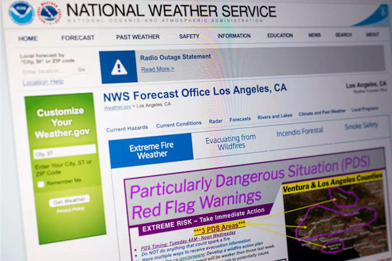
Southern California is facing a day of extreme fire weather, with bone-dry vegetation and powerful Santa Ana winds, raising the risk of a rapid spread of wildfires. Officials have issued a 'particularly dangerous situation' warning, a heightened level of a red flag warning, for large portions of Los Angeles and Ventura counties.
Southern California is bracing for a day of extreme fire weather, with dangerously dry vegetation and powerful Santa Ana winds that could rapidly escalate any small fire into a massive inferno. A 'particularly dangerous situation' warning, a heightened level of a red flag warning, is set to take effect Monday at noon and remain in place through Tuesday at 10 a.m., encompassing large portions of Los Angeles County and most of Ventura County .
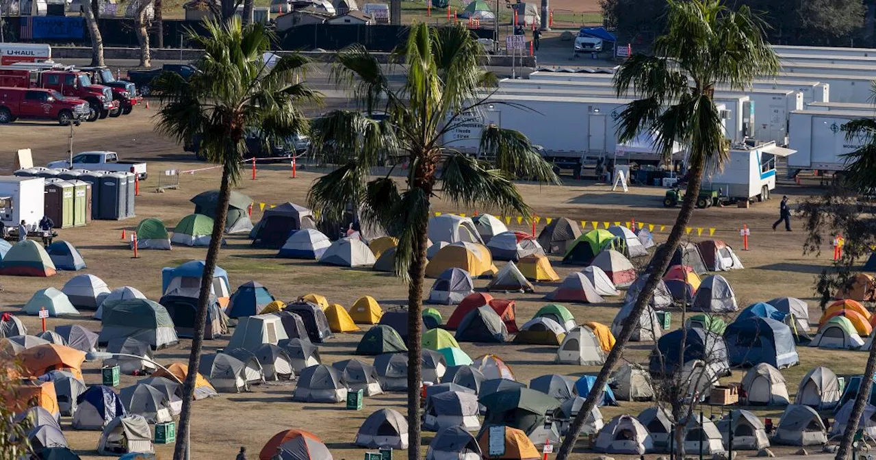
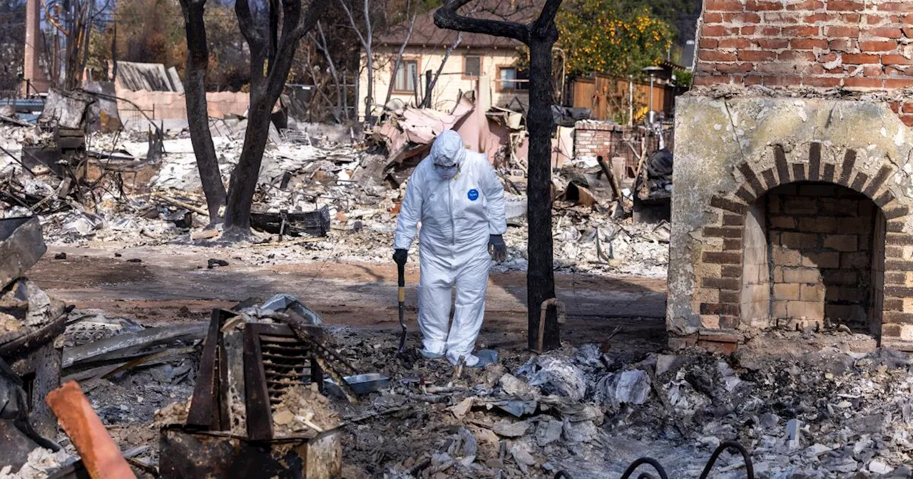
This marks the unprecedented fifth time this season that the National Weather Service has issued this severe fire weather alert.The National Weather Service predicts peak gusts of 50 mph to 70 mph along the coast and valleys, while sustained winds are anticipated between 25 mph to 40 mph. Isolated gusts of up to 100 mph are possible in the mountains and foothills, with sustained wind speeds ranging from 30 mph to 50 mph. Meteorologist Rose Schoenfeld from the National Weather Service office in Oxnard emphasized that this 'particularly dangerous situation' distinguishes itself from the previous four warnings issued since November due to the exceptionally dry conditions, making it one of the driest fire weather events experienced this year.In anticipation of the severe conditions, Los Angeles Fire Chief Kristin Crowley announced that the fire department has deployed all available resources and strategically positioned fire patrols and engines in high-risk areas across Los Angeles, including Sun Valley, Woodland Hills, West Los Angeles, and Hollywood. Parking restrictions have also been implemented in specific locations to facilitate rapid response to hillside communities in case of a fire ignition. Chief Crowley highlighted that the staffing levels for this wind event exceed those deployed during the strong winds that ignited the Eaton and Palisades fires earlier this month. She urged the public to remain vigilant as the danger has not yet subsided. The fire department has 30 pre-deployed rigs and 64 augmented engines that supplement the regular firefighting force during emergencies. This event sees a significantly higher deployment compared to the Jan. 7 winds, where the department had 14 pre-deployed engines and 15 augmented engines. This proactive approach comes amidst criticism directed towards the agency's preparedness for the devastating winds that sparked the Palisades fire and caused damage to thousands of structures. Mayor Karen Bass expressed confidence that the city's planning measures are adequate to handle any potential fires, stating that the city is 'well positioned to deal with any fires that might break out.' Areas designated as being in a 'particularly dangerous situation' in Los Angeles County include the northern San Fernando and San Gabriel valleys, Malibu, Calabasas, Agoura Hills, the Santa Clarita Valley, and other areas northwards. This includes Altadena and Pasadena, as well as areas to the northwest, ranging from La Crescenta to the Porter Ranch area. The northern San Gabriel Valley areas affected by this warning are located north of Interstate 210, encompassing Altadena and a significant portion of Pasadena. The parts of the San Fernando Valley included in this warning area encompass Reseda, Burbank, and areas situated further north. A substantial portion of Ventura County is also under the 'particularly dangerous situation' warning, encompassing cities such as Oxnard, Thousand Oaks, Simi Valley, Ventura, Camarillo, Moorpark, Santa Paula, Port Hueneme, and Fillmore. Ryan Kittell, a meteorologist with the National Weather Service office in Oxnard, described the 'particularly dangerous situation' areas as experiencing 'the extreme of extreme conditions — almost as bad as it can get.'Dennis Burns, a fire behavior analyst, stated that if a fire ignites, the anticipated rate of spread, considering the expected wind speeds, would range from 1 to 4 mph with spotting capabilities reaching up to 2 mph. He explained that if a fire were to ignite and encounter structures, the spotting distance could potentially increase to almost four miles. Burns calculated that during an eight-hour event with a 4 mph fire spread, the fire could theoretically spread up to 32 miles. He added that another challenge is that if a fire ignites amidst 30- to 40-mph winds, firefighting aircraft may be unable to operate, significantly hindering quick containment efforts. Burns' assessment painted a rather dire picture, stating, 'It's kind of a dire prediction. Hopefully, nothing does occur today.'Forecasters predict that wind speeds will likely fall between the experience of the region during the Jan. 7 Eaton and Palisades fires and the weaker Santa Ana wind event that occurred last week. James White, a meteorologist with the National Weather Service working on the Eaton fire, commented that while it won't be as prolonged or severe as the Jan. 7 event, there are strong indications that it will be stronger and more widespread than the Jan. 13 event. A conventional red flag warning took effect at 8 a.m. Monday for a wider swath of Southern California, expected to persist through 10 a.m. Tuesday. This warning encompasses a broader area compared to the 'particularly dangerous situation' alert
FIRE WEATHER SANTA ANA WINDS RED FLAG WARNING WILDFIRES SOUTHERN CALIFORNIA LOS ANGELES VENTURA COUNTY
United States Latest News, United States Headlines
Similar News:You can also read news stories similar to this one that we have collected from other news sources.
 Southern California Braces for 'Particularly Dangerous Situation' Amid High Fire RiskA 'Particularly Dangerous Situation' red flag warning has been issued for Southern California due to strong winds and low humidity, increasing the risk of destructive wildfires.
Read more »
 California Braces for 'Particularly Dangerous Situation' as Winds Fuel Fire RiskSouthern California faces a heightened risk of wildfires as strong Santa Ana winds return, prompting a 'particularly dangerous situation' warning from the National Weather Service. Firefighters continue to battle two major blazes that ignited nearly two weeks ago under similar weather conditions. Authorities urge caution, warning against activities that could spark a fire and stressing the importance of preparedness.
Read more »
 Southern California Faces 'Particularly Dangerous' Fire WeatherSouthern California is bracing for its most extreme fire weather of the season, with bone-dry vegetation and strong Santa Ana winds that could rapidly escalate any small fire into a major inferno. Officials have issued a 'particularly dangerous situation' warning, the fifth of its kind this year, for swathes of Los Angeles and Ventura counties.
Read more »
 Southern California Faces 'Particularly Dangerous Situation' Amidst Extreme Fire WeatherSouthern California is under a 'particularly dangerous situation' warning due to extreme fire weather conditions, with strong winds, low humidity, and a high risk of fire spread. This is the fifth such warning issued since November, highlighting the severity of the situation.
Read more »
 Rare 'Particularly Dangerous Situation' Wildfire Warning Issued for Southern CaliforniaA rare 'Particularly Dangerous Situation' red flag warning for wildfires has been issued for Southern California, signaling extreme fire risk. The warning, first used for tornado outbreaks, has been expanded to include other severe weather threats. This warning highlights the growing risk of wildfires in the face of climate change.
Read more »
 'Particularly Dangerous Situation': Red Flag Warning Issued for Southern California WildfiresA 'Particularly Dangerous Situation' red flag warning has been issued for Southern California due to the extreme risk of wildfires. The warning, a rare designation, aims to grab attention and highlight the urgent need for preparedness.
Read more »