
Maxar satellite images show before and after Hurricane Idalia made landfall in Florida, flooding parts of the state's Big Bend region. The Category 3 storm left multiple areas across the Sunshine State under water and several residents stranded.
United States Latest News, United States Headlines
Similar News:You can also read news stories similar to this one that we have collected from other news sources.
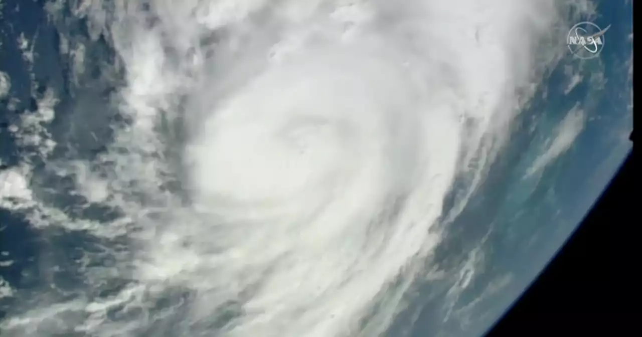 See Hurricane Idalia from space: Satellite views from International Space Station show storm off Florida coastHurricane Idalia is expected to make landfall on Florida's Gulf Coast on Wednesday.
Read more »
 Satellite images capture Hurricane Idalia's flooding in Florida's Big BendBefore Idalia, no major hurricanes on record had ever passed through the bay abutting the Big Bend.
Read more »
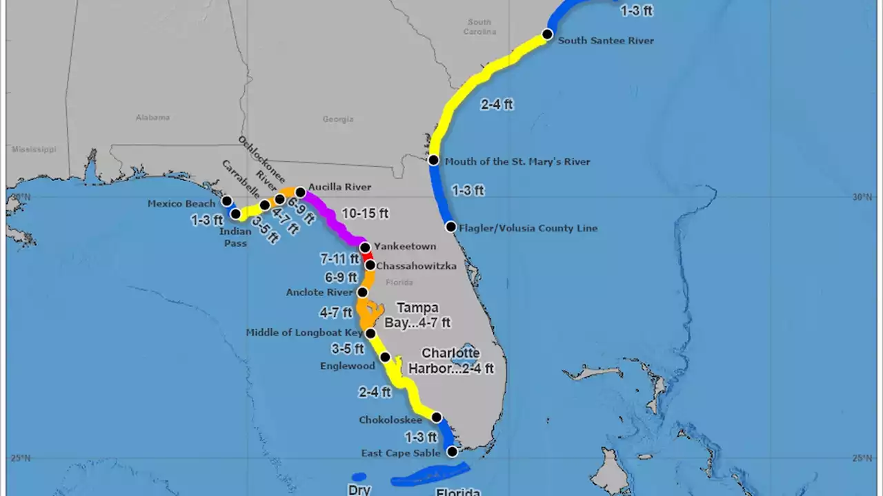 Hurricane Idalia: What is a king tide and how will it affect Idalia?The NHC expects a 10-15 foot storm surge when Idalia makes landfall.
Read more »