
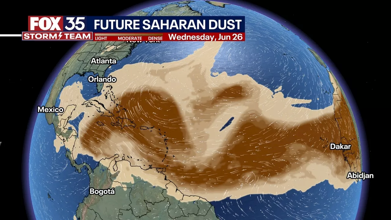
The Saharan Air Layer is the dust that forms over the Sahara in the summer and it reduces visibility in regions and negatively impacts air quality.
The state of Texas is bracing for a Saharan dust outbreak, as large plumes travel northward from the African desert and move over the Atlantic.The Saharan Air Layer is the dust that forms over the Sahara during the summer. It comprises sand and mineral particles swept up from 3.5 million square miles of the African desert. Saharan dust reduces visibility in regions and negatively impacts air quality, creating poor conditions.
These plumes are common in the Atlantic around late June and early July, according to the National Oceanic and Atmospheric Administration.Saharan dust clouds can impact locations thousands of miles away from their origins in Africa. The dust outbreaks tend to occupy a 2 to 2.5-mile-thick layer of the atmosphere with the base starting about 1 mile above the surface.
United States Latest News, United States Headlines
Similar News:You can also read news stories similar to this one that we have collected from other news sources.
 Large wave of Saharan dust is heading right for Florida and the Gulf of MexicoModels indicate a large amount of Saharan dust will traverse across the Atlantic this week and head towards the Gulf of Mexico and Florida by next weekend.
Read more »
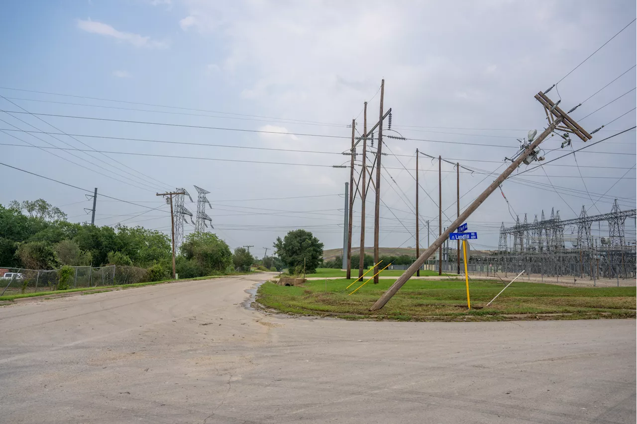 Power Outage Map Shows States Suffering Blackouts After Tornadoes StrikeSeveral states have been plunged into darkness on Memorial Day, with more than 190,000 residents or businesses without power in Kentucky alone.
Read more »
 Map Shows Possible Southeast High-Speed Rail RouteProposals are being considered for a high-speed rail along the southeast of the U.S.
Read more »
 Drinking Water Map Shows States With High Contamination LevelsPFAS, known as 'forever chemicals' because of the long time it takes them to break down, can cause harm in high exposure amounts.
Read more »
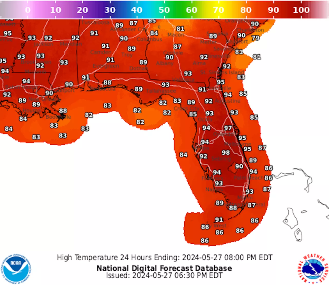 Map Shows Florida Cities Break Heat Records Amid Surging TemperaturesA heat wave rocked the Gulf Coast as residents celebrated the holiday weekend.
Read more »
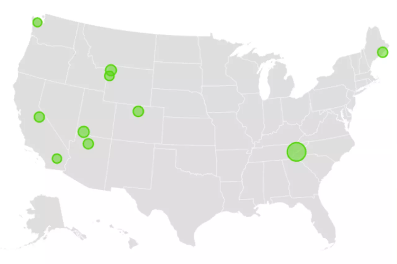 Map Shows America's Most Popular National ParksThe National Park Service recorded 325,498,646 visitors across all national parks in 2023.
Read more »