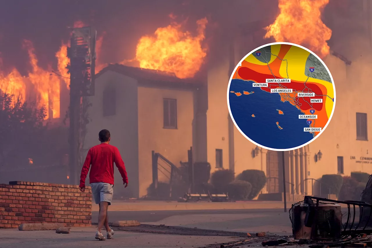
Southern California faces a heightened threat of wildfires Wednesday as a 'particularly dangerous situation' red flag warning is issued due to strong Santa Ana winds. The warning covers parts of Los Angeles and Ventura counties, with winds expected to gust up to 60 mph. Firefighters continue to battle the Palisades and Eaton fires, working to contain the blazes before the winds worsen.
The most extreme level of a red flag fire warning, a 'particularly dangerous situation,' returned to parts of Los Angeles and Ventura counties Wednesday morning, heightening concerns about the potential for new fires to start. The period of highest risk was expected to begin just before sunrise through midday. Mountain wind gusts were expected to rise to 45 mph to 55 mph, with local gusts up to to 60 mph, according to the National Weather Service office in Oxnard.
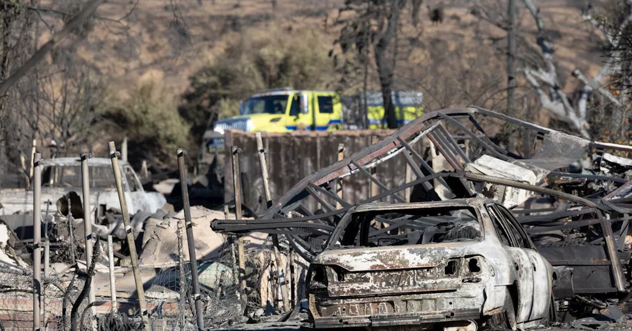
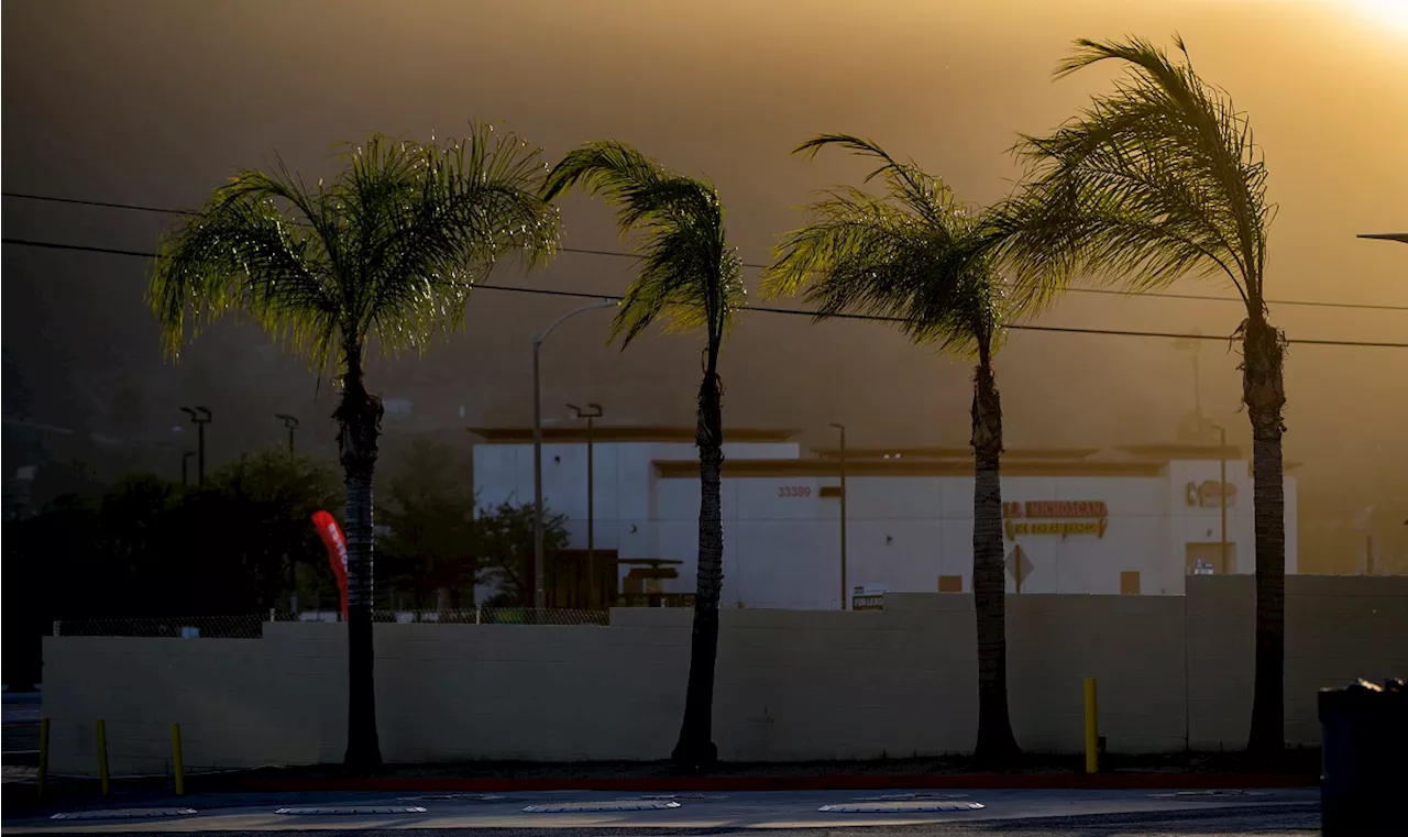
Forecasters expect Wednesday will be noticeably windier than Tuesday. Ventura County is expected to be at particular risk if a fire sparks. The northern Ventura County mountains may get stronger winds than typically seen during a Santa Ana wind event. Gusts reached as high as 54 mph — in the Santa Susana Mountains — Wednesday morning. 'The danger has not yet passed,' Los Angeles Fire Department Chief Kristin Crowley said during a news conference Wednesday. 'So please prioritize your safety.' Winds on Tuesday ended up being calmer than forecasters had anticipated — good news for firefighters. In the past several days, crews have stopped the growth of the devastating Palisades and Eaton fires and have rushed to boost containment ahead of the anticipated winds. Firefighters continue to focus on hot spots to reduce the risk that winds will pick up smoldering embers and firebrands and carry them into new areas. The Palisades fire has burned more than 23,700 acres and was 19% contained as of Wednesday morning up from 17% a day earlier. Containment is a reference to how much of the fire's edge, or perimeter, has been surrounded to the extent firefighters believe they can stop the fire from expanding. Infrared flights indicate there are still numerous hot spots burning within the Palisades fire footprint. 'Very close attention was paid to address any flare-ups swiftly as to prevent any fire spread outside of the perimeter,' Crowley said. The Eaton fire in the Altadena area has burned just more than 14,100 acres and was 45% contained as of Wednesday morning, up from 35% a day earlier. A “particularly dangerous situation” signifies the most extreme level of a red flag fire warning, although officials note that Wednesday’s winds will not be as severe as the historic windstorms that fueled the fires last week. The warning began at 3 a.m. Wednesday for portions of the San Fernando Valley and Ventura County, including Northridge, Thousand Oaks, Simi Valley, Camarillo and Fillmore and was expected to last through 3 p.m. “We are not out of the woods yet, and people need to stay on guard for a fast-moving fire,” Ryan Kittell, a meteorologist at the National Weather Service office in Oxnard, said. A conventional red flag warning — which warns of severe wildfire behavior if ignition occurs — remains in effect for large portions of L.A., San Diego, Orange, Riverside, San Bernardino and Ventura counties, as well as some mountainous areas of Santa Barbara and San Luis Obispo counties. The air is expected to be quite dry, with relative humidity as low as 8% in Los Angeles and Ventura counties. Red flag fire weather warnings are expected to last until 6 p.m. Wednesday but will extend through 3 p.m. Thursday in a few spots in Los Angeles and Ventura counties, including the Grapevine section of Interstate 5, the western San Gabriel Mountains and the Santa Susana Mountains. Fire weather conditions are expected to improve starting Wednesday night through Saturday. But starting around Monday, there is a moderate risk for another round of red flag warnings. The region is experiencing a painful dry spell that is among the driest starts to a winter on record, a major reason the fire risk is so high. There are still no significant chances of rain through Jan. 25, forecasters say. Downtown Los Angeles has received barely a drop of water for months — just 0.16 of an inch since Oct. 1, or just 3% of the seasonal average. Typically, at this point in the water year, downtown Los Angeles has received an average of 5.45 inches of rain. The annual average is 14.25 inches. 'As long as we go without seeing rain, it just doesn't take much. The vegetation is just starving for moisture, and then when you get the wind on top of it, there's definitely potential for fire behavior' after an ignition, said Alex Tardy, meteorologist with the National Weather Service office in San Diego. Exacerbating the fire risk is that January is the peak season for Santa Ana winds — powerful winds that develop when high pressure over Nevada and Utah sends cold air screaming toward lower-pressure areas along the California coast. The air dries out and compresses and heats up as it flows downslope from the high deserts — from the northeast — over California's mountains and through canyons, drying out vegetation as the wind gusts through. While Santa Anas are common in December and January it's not typical to have conditions this dry, Tardy said
WILDFIRES SANTA ANA WINDS RED FLAG WARNING LOS ANGELES VENTURA COUNTY CALIFORNIA FIRE RISK DRY CONDITIONS
United States Latest News, United States Headlines
Similar News:You can also read news stories similar to this one that we have collected from other news sources.
 Santa Ana Winds: The Fiery Winds of Southern CaliforniaExplore the powerful Santa Ana winds, their origins, effects on Southern California's landscape and the role they play in wildfires.
Read more »
 Southern California Faces Another Week of Extreme Fire Risk Amidst Powerful Santa Ana WindsSouthern California is bracing for another week of dangerous fire conditions as powerful Santa Ana winds are forecast to return. The combination of strong winds, low humidity, and dry vegetation creates a high risk of wildfire spread and exacerbates existing blazes.
Read more »
 Southern California Faces Another Week of Devastating Fire Risk as Santa Ana Winds ReturnThe return of powerful Santa Ana winds threatens Southern California with another week of extreme fire risk. Meteorologists warn of gusts reaching up to 100 mph, exacerbating existing wildfires and creating favorable conditions for new fires to ignite and spread rapidly.
Read more »
 Fire weather watch issued as moderate Santa Ana winds expected in Southern CaliforniaThe National Weather Service has issued a fire weather watch in Los Angeles and Ventura counties as Santa Ana winds are expected to lower humidity.
Read more »
 Santa Ana Winds Return to Southern California, Bringing Fire RiskSanta Ana winds are back in Southern California, posing a fire risk. A Fire Weather Watch and Red Flag Warning have been issued for the region.
Read more »
 Southern California Braces for Powerful Santa Ana Winds Fueling Wildfires and LandslidesSouthern California is facing dangerous conditions due to strong Santa Ana winds driving wildfires and landslides. High temperatures and low humidity exacerbate the situation, creating a heightened risk of fire spread. Officials have issued red flag warnings for Los Angeles and Ventura counties, urging residents to be vigilant. Meanwhile, in Rancho Palos Verdes, a massive landslide has destroyed homes and forced residents to make difficult decisions about their future.
Read more »