The World Magnetic Model, crucial for navigation, has been updated to predict the future shifts of Earth's magnetic field.
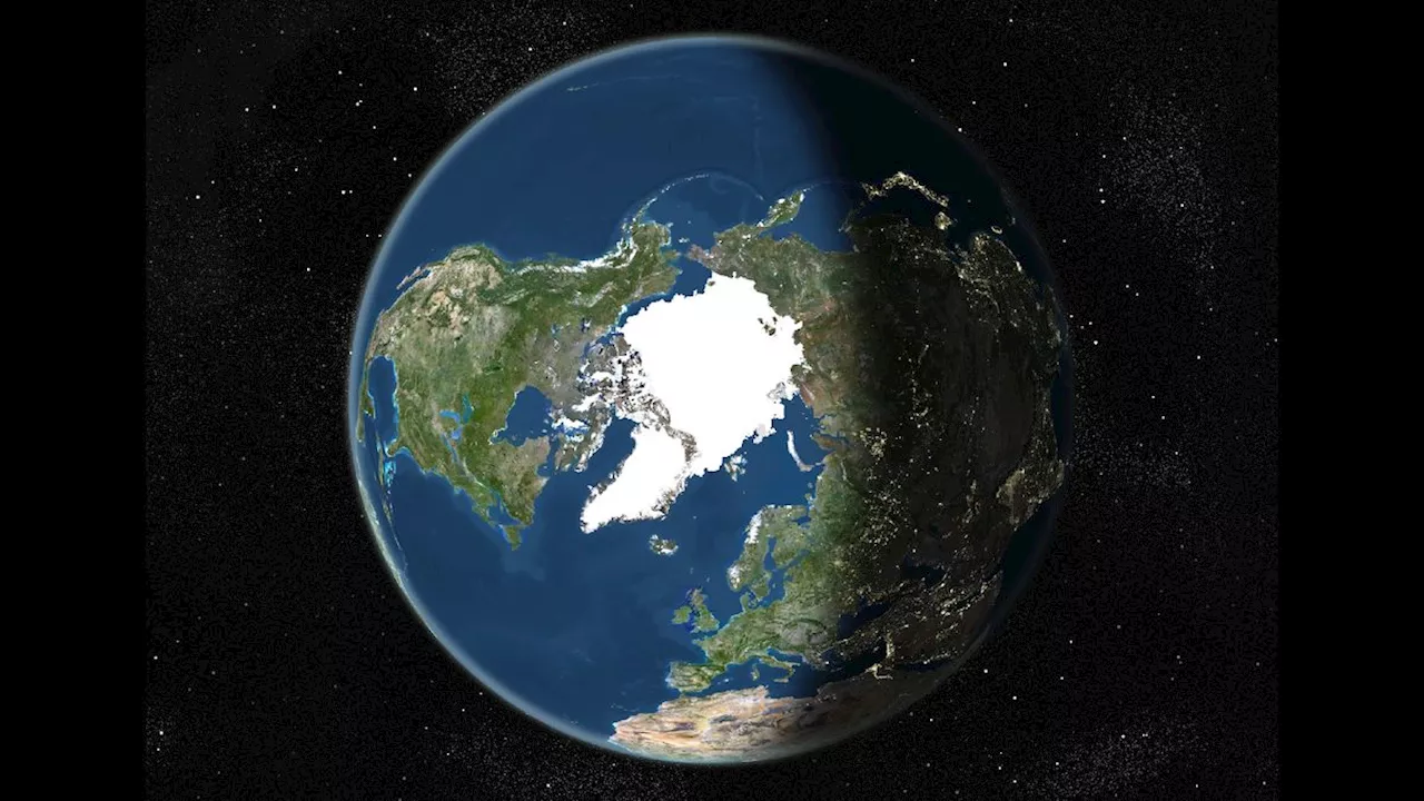
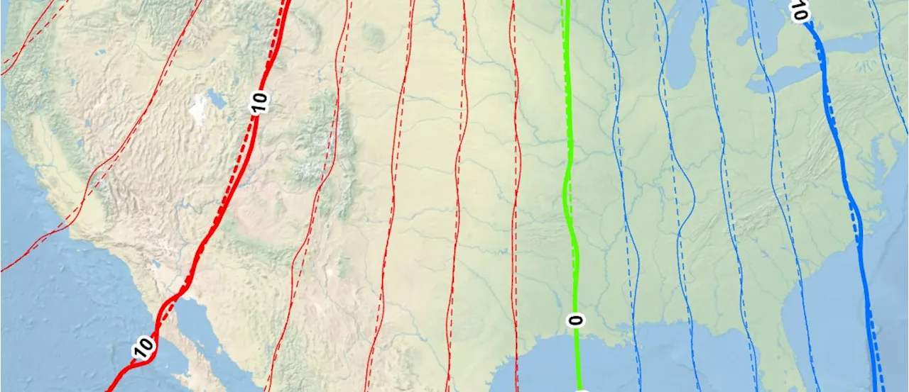
On December 17th, the National Centers for Environmental Information (NCEI) and the British Geological Survey (BGS) released an updated version of the World Magnetic Model, predicting the shifts and changes of Earth 's magnetic field over the next five years. This model predicts the difference between magnetic north and true north at every point on Earth . It plays a crucial role in satellite and aircraft navigation and helps smartphone users orient themselves using services like Google Maps.
The update, planned for years, might not be noticeable to most users. However, it's essential to maintain accurate navigational systems and improve future predictions about Earth's magnetic field. Earth's main magnetic field originates in its outer core, a layer of molten iron thousands of miles below the surface. The electrically conductive liquid iron is constantly in motion, generating an electric current when it moves through an existing weak magnetic field. This electric current creates its own magnetic field, sustaining a process called the geodynamo. This geodynamo has regenerated Earth's magnetic field for billions of years. Without this continuous regeneration, Earth would have lost its magnetic field within about 40,000 years
MAGNETIC FIELD NAVIGATION EARTH GEODYNAMO SCIENCE
United States Latest News, United States Headlines
Similar News:You can also read news stories similar to this one that we have collected from other news sources.
 New World Magnetic Model 2025 Released for Enhanced NavigationThe National Centers for Environmental Information (NCEI) has released the World Magnetic Model 2025 (WMM2025), providing more precise navigational data for various applications. WMM2025, crucial for global navigation, ensures the accurate functioning of systems relying on Earth's magnetic field. This release also includes a higher resolution model with improved spatial accuracy. The model updates blackout zones near the poles where magnetic field usage for navigation may be unreliable.
Read more »
 New World Magnetic Model 2025 ReleasedThe National Oceanic and Atmospheric Administration (NOAA) has released the World Magnetic Model 2025 (WMM2025), providing more precise navigational data for various applications. This year's release includes two model versions: WMM2025 and a higher-resolution model.
Read more »
 New World Magnetic Model Released for Improved NavigationThe National Centers for Environmental Information (NCEI) has released the World Magnetic Model 2025 (WMM2025), providing more precise navigational data for various applications. This update includes two versions: the standard WMM2025 and a high-resolution version with improved accuracy.
Read more »
 World Magnetic Model 2025 ReleasedNCEI plays a critical role in the development, maintenance, and distribution of the World Magnetic Model.
Read more »
 World Magnetic Model 2025 Released for Improved NavigationThe World Magnetic Model 2025 (WMM2025) is now available, offering more precise navigational data for various applications. Two versions are released, including a high-resolution model with enhanced accuracy.
Read more »
 Updated World Magnetic Model 2025 Improves Navigation AccuracyThe National Oceanic and Atmospheric Administration (NOAA) has released the World Magnetic Model 2025 (WMM2025), providing more precise navigational data for various applications. This update includes a higher-resolution model offering greater directional accuracy and updated blackout zones near the North and South poles where the Earth's magnetic field is unreliable for navigation.
Read more »