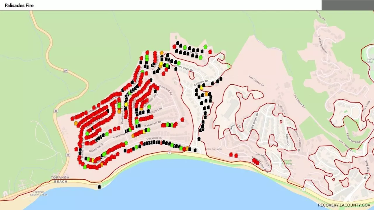
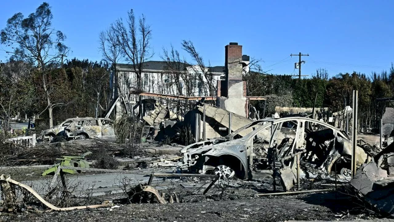
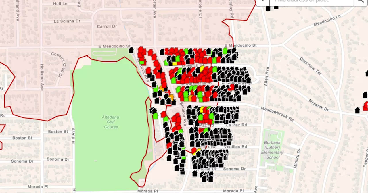
Newly released maps are providing a detailed look at the impact of the Palisades and Eaton fires in Altadena and Pacific Palisades, showing which structures were destroyed, damaged, or left untouched. The maps, featuring color-coded icons and current photos, are available on the Los Angeles County wildfire recovery website. Officials are working to fully assess the destruction left behind by both fires.
Newly released maps are providing a look at what was destroyed and damaged by the Palisades Fire and Eaton Fire in Altadena - and even what was left untouched.As officials work to fully assess the destruction left behind by the Palisades and Eaton fires in Los Angeles County , newly released maps are providing a view at what was destroyed and damaged, and even what was left untouched.
Attached to each icon are also current photos of the residential and commercial properties. If there is not a color icon on your address, it means that the building hasn't been inspected yet. Using Skymap technology, AIR7 was able to provide residents with a block-by-block aerial view of the damage from the Palisades Fire.
WILDFIRE PALISADES FIRE EATON FIRE DAMAGE ASSESSMENT LOS ANGELES COUNTY
United States Latest News, United States Headlines
Similar News:You can also read news stories similar to this one that we have collected from other news sources.
 New Maps Show Damage from Palisades and Eaton Fires in CaliforniaNewly released maps provide a detailed view of the damage caused by the Palisades and Eaton fires in Los Angeles County. The color-coded maps, available on the county's wildfire recovery website, show the extent of destruction and damage to structures, with current photos attached to each icon. The maps also indicate which buildings have been inspected.
Read more »
 Interactive Maps Show Damage from Palisades and Eaton FiresThe Damage Inspections Dashboard released interactive maps showing the damage status of homes inspected in the wake of the Palisades and Eaton fires. The maps, which utilize data from on-the-ground inspections, indicate whether homes are damaged, destroyed, or intact. Officials emphasized the ongoing nature of these inspections and the importance of providing residents with information about their homes.
Read more »
 Palisades and Eaton Fires: Interactive Maps Show Damaged StructuresInteractive maps released by the Damage Inspections Dashboard show the status of homes inspected for damage caused by the Palisades and Eaton fires. The maps display damaged, destroyed, and undamaged structures based on on-the-ground inspections. Officials estimate over 12,000 structures destroyed in both fires, potentially ranking them among the state's most destructive.
Read more »
 Los Angeles County Releases Preliminary Damage Maps for Eaton and Palisades FiresAccess remains restricted in affected areas as over 92,000 people remain under evacuation orders. Preliminary maps show damage assessments ranging from destruction to minor damage.
Read more »
 Maps show destruction of Los Angeles-area homes in Palisades, Eaton fire zonesAs access to many neighborhoods in the Eaton and Palisades fire zones remains off-limits, Los Angeles County has provided preliminary maps that show which structures and homes are damaged or destroyed.
Read more »
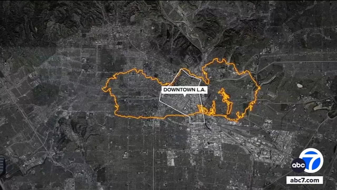 Eaton, Palisades fires continue burning as new wildfires eruptsFires ignited in Pacific Palisades, Sylmar, Altadena and Hollywood Hills, forcing thousands to evacuate amid a life-threatening and destructive windstorm slamming Southern California.
Read more »