
Analysis of data from NASA radar aboard an airplane shows that the decades-old active landslide area on the Palos Verdes Peninsula has expanded.
8 min readNASA’s UAVSAR airborne radar instrument captured data in fall 2024 showing the motion of landslides on the Palos Verdes Peninsula following record-breaking rainfall in Southern California in 2023 and another heavy-precipitation winter in 2024. Darker red indicates faster motion.
Portions of the peninsula, which juts into the Pacific Ocean just south of the city of Los Angeles, are part of an ancient complex of landslides and has been moving for at least the past six decades, affecting hundreds of buildings in local communities. The motion accelerated, and the active area expanded following record-breaking rainfall in Southern California in 2023 and heavy precipitation in early 2024.
“In effect, we’re seeing that the footprint of land experiencing significant impacts has expanded, and the speed is more than enough to put human life and infrastructure at risk,” said Alexander Handwerger, the JPL landslide scientist who performed the analysis.
Armstrong Flight Research Center Earth Earth Science Earth Science Division
United States Latest News, United States Headlines
Similar News:You can also read news stories similar to this one that we have collected from other news sources.
 D.C. Plane and Helicopter Crash: Radar Footage Reveals Collision CourseA mid-air collision between an American Airlines plane and an Army helicopter in Washington, D.C., has resulted in both aircraft crashing into the Potomac River. Radar images reveal the heart-stopping moment the two aircraft collided, offering crucial insights into the cause of the tragedy. The Federal Aviation Administration has initiated a ground stop at Ronald Reagan Washington National Airport as emergency responders work tirelessly to search and rescue individuals from the wreckage.
Read more »
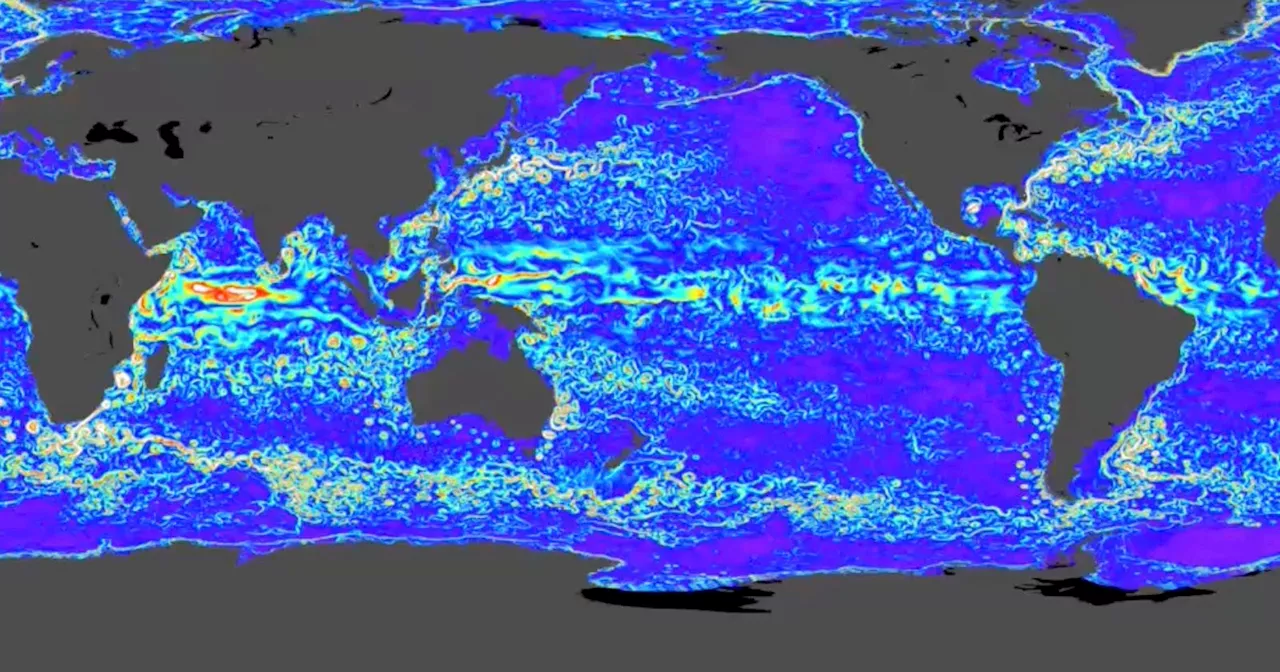 NASA Satellite Reveals Never-Before-Seen Details of the Ocean FloorA new NASA satellite is uncovering new details on the ocean's floor, 75% of which can only really be studied using satellites.
Read more »
 NASA Reveals How Astronauts Will Pilot the Orion Spacecraft for Artemis II MissionNASA has released a video detailing the controls and procedures astronauts will use to fly the Orion spacecraft during the Artemis II mission. The video features astronauts Reid Wiseman and Victor Glover discussing how they will operate Orion's software using the Cursor Control Device (CCD) and other piloting systems. The Artemis II mission, currently scheduled for 2026, will see four astronauts orbit the moon.
Read more »
 Begotten: A Silent Horror Masterpiece of Disturbing ImageryThis 1989 experimental horror film, Begotten, is considered one of the most disturbing ever made. Explore its disturbing narrative, graphic imagery, and haunting cinematography.
Read more »
 How satellite imagery can help monitor dangerous lakes formed by glacier surges near high-mountain communitiesA new study analyzing a lake formed by a glacier surge in the Karakoram Mountains has revealed how satellite images can be used to monitor the potential for lake drainage hazards.
Read more »
 AI Used to Alter Dialogue and Create Imagery in Oscar ContenderA24's film , utilizes AI to enhance authenticity in dialogue and imagery, sparking debate about the role of technology in filmmaking.
Read more »