Explore the diverse snowfall patterns across Indiana, from the heavy lake-effect snow in the north to the lighter accumulations in the south. This article delves into historical snowfall data, average accumulations, and the influence of La Niña on upcoming winter weather.
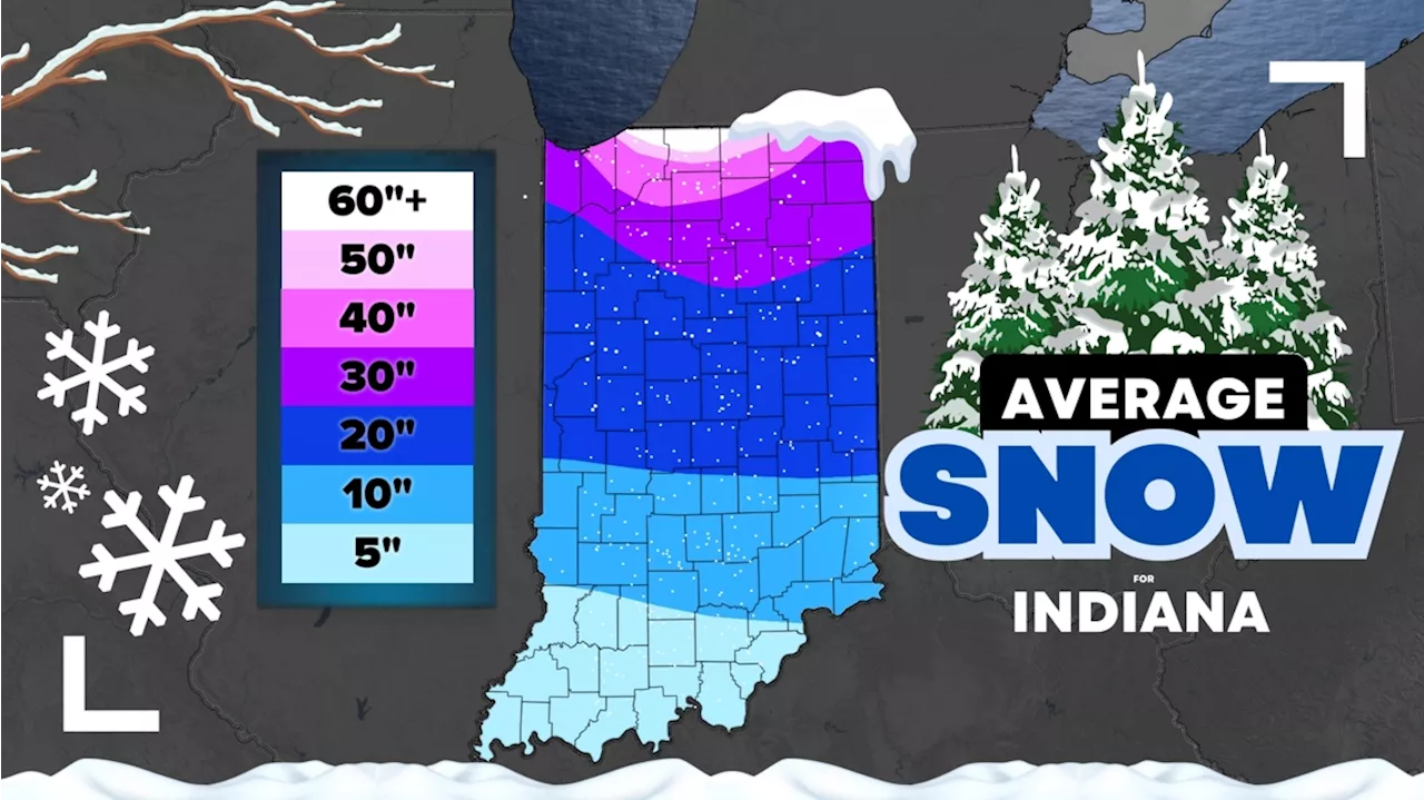
Every winter brings something different, but in Indiana, you can expect cold, cloudy and snowy days. The highest chance for snow is north of Indianapolis. Indiana has quite a range of snowfall expectations every year, from roughly 5-8 inches in southern Indiana to over 60 inches in northern Indiana. This is not a forecast for what this winter will bring, but rather an average over the past 50 years across the Hoosier State.
The chance for snow showers begins typically in November across Indiana; however, we have had snows in October before. The first average 1' of snow in northern Indiana comes in November, too, while central and southern Indiana typically waits until December for their first one inch of accumulation. The whites and pinks show areas that get over 40 inches of snow on average. This is consolidated for northern Indiana, especially Hoosiers within 50 miles of the southeast side of Lake Michigan. (NOTE: The color of band shows you your average snowfall rounded down. For example in Fort Wayne you typically get 33' of snow every year, so you are in the 30' purple band.) Northern Indiana has the biggest difference of snowfall totals, mainly thanks to the position of lake-effect snow bands. Some northern parts of LaPorte and St. Joseph counties can get over 60 inches of snow per year (on average). South Bend's average snowfall is 64.5'. Lake-effect snow bands get weaker the farther you go from the lake. We can still get some lake-effect snow showers in central Indiana, but they are usually not as intense, although snow can accumulate and stick to the roads, at least briefly. Indianapolis gets 25.5 inches of snow per winter on average (data 1990-2020). Most Hoosiers across central Indiana get between 15' to 30' of snow, with the lowest totals south of U.S. Route 40. Rarely do we hit 25' of snow in Indiana. It's usually more or less. Recently, it has been less. Here are the past 10 years: Snowfall totals typically drop down to 5-15' in southern Indiana. More rain tends to mix with the snow farther south. Lake-effect snow showers are very weak, if they can even reach this far south at times. Below is our full winter preview and a chat about La Niña's impact for our snowfall and temperatures this winter
INDIANA SNOWFALL LAKE-EFFECT SNOW WEATHER FORECAST WINTER PREVIEWS LA NIÑA
United States Latest News, United States Headlines
Similar News:You can also read news stories similar to this one that we have collected from other news sources.
 Snow Doesn't Halt Parking for Indiana Basketball GameDespite a heavy snowfall in Bloomington, Indiana, parking for the Indiana-USC basketball game is available.
Read more »
 Central Indiana sees a second snowfall just days after major accumulationAshlyn Wright joined WRTV as a digital content producer in February 2023.
Read more »
 South Bend Snowfall Has Fans Fired Up for Notre Dams vs. Indiana in the CFPIt's a snowy scene in South Bend, IN as Notre Dame hosts Indiana in the first game of the 12-team College Football Playoff.
Read more »
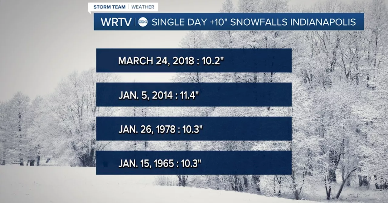 Central Indiana Braces for Significant Snowfall: A Look at Rare Double-Digit SnowfallsCentral Indiana is preparing for potentially heavy snowfall this weekend. The news prompts a look at the history of significant snowfalls in Indianapolis, revealing that double-digit snowfalls (10 inches or more) are rare occurrences.
Read more »
 Winter Storm Paralyzes Central and Eastern USA major winter storm with heavy snow, ice, and strong winds caused dangerous travel conditions and widespread school closures across the central and eastern United States on Monday. Snowfall of up to 8 inches was reported in Kansas, Nebraska, Indiana, and Missouri, while the National Guard was activated in Indiana to assist stranded motorists. The National Weather Service issued winter storm warnings from Kansas to New Jersey, with some areas expecting snowfall levels not seen in a decade. The storm, fueled by a polar vortex escaping the North Pole, also impacted schools in Kentucky, Virginia, Indiana, Maryland, and others.
Read more »
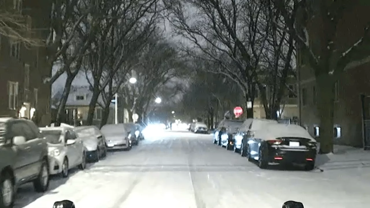 Chicago Area Faces Multiple Snow Chances This WeekMultiple chances of snow are anticipated to end the week in the Chicago area, including the potential for lake-effect snow on Saturday morning. Snowfall amounts will vary depending on location. Overnight snowfall on Wednesday morning caused slick travel conditions. Two additional rounds of snow are possible on Thursday and Friday, with Thursday seeing heavier snowfall in the northern parts of the region. Lake-effect snow showers are also expected across northwest Indiana and parts of Cook County, continuing into the weekend.
Read more »