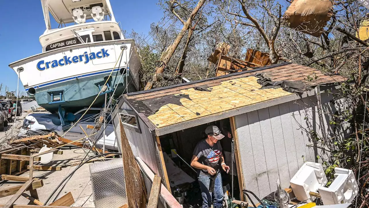
NEW: There have been at least 33 storm-related deaths in Florida, where over 1.2 million customers are still without power as Ian's remnants move north.
Bryan R. Smith/AFP via Getty Images
The remnants of Hurricane Ian, once a Category 4 hurricane that made multiple U.S. landfalls, are pushing up the mid-Atlantic and bringing widespread rain from Virginia to Connecticut.Flood watches are in effect in Virginia and West Virginia, where up to 6 inches of rain is expected through Saturday afternoon. A wind advisory is also in effect; gusts could reach 50 mph at higher elevations.
FEMA is authorized to identify, mobilize and provide equipment and resources to help the recovery efforts on the ground.
United States Latest News, United States Headlines
Similar News:You can also read news stories similar to this one that we have collected from other news sources.
 Central Pa. gets rain as remnants of Hurricane Ian move up East CoastIn State College, where Penn State football will play Northwestern this afternoon, a rainy game is likely. There’s nearly a 70% chance of rain at kickoff, 3:30 p.m.
Read more »
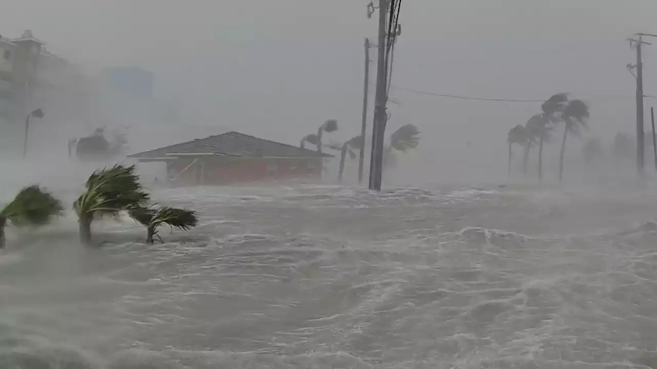
 Hurricane Ian brings deaths, floods, outages to Florida; system downgrades to tropical storm: LIVEFIERCE WINDS: This is the moment a meteorologist was hit by a tree branch while reporting on Hurricane Ian on a Florida street. When the storm first made landfall, forecasters say winds were at 150 mph. The latest:
Read more »
 Hurricane Ian: Manatees at Spring Park fighting Hurricane Ian storm surge* LOCATIONS AFFECTED\n- Bonaire\n- Centerville\n- Clinchfield\n- Elberta\n- Elko\n- Grovania\n- Grove Park\n\n* WIND\n- LATEST LOCAL FORECAST: Below tropical storm force wind\n- Peak Wind Forecast: 15-25 mph with gusts to 45 mph\n\n- THREAT TO LIFE AND PROPERTY THAT INCLUDES TYPICAL FORECAST\nUNCERTAINTY IN TRACK, SIZE AND INTENSITY: Potential for wind 39\nto 57 mph\n- The wind threat has remained nearly steady from the\nprevious assessment.\n- PLAN: Plan for hazardous wind of equivalent tropical storm\nforce.\n- PREPARE: Remaining efforts to protect property should be\ncompleted as soon as possible. Prepare for limited wind\ndamage.\n- ACT: Move to safe shelter before the wind becomes hazardous.\n\n- POTENTIAL IMPACTS: Limited\n- Damage to porches, awnings, carports, sheds, and unanchored\nmobile homes. Unsecured lightweight objects blown about.\n- Many large tree limbs broken off. A few trees snapped or\nuprooted, but with greater numbers in places where trees\nare shallow rooted. Some fences and roadway signs blown\nover.\n- A few roads impassable from debris, particularly within\nurban or heavily wooded places. Hazardous driving\nconditions on bridges and other elevated roadways.\n- Scattered power and communications outages.\n\n* STORM SURGE\n- LATEST LOCAL FORECAST: Life-threatening storm surge possible\n- Peak Storm Surge Inundation: The potential for 4-6 feet\nabove ground somewhere within surge prone areas\n- Window of concern: through Friday evening\n\n- THREAT TO LIFE AND PROPERTY THAT INCLUDES TYPICAL FORECAST\nUNCERTAINTY IN TRACK, SIZE AND INTENSITY: Potential for storm\nsurge flooding greater than 3 feet above ground\n- The storm surge threat has remained nearly steady from the\nprevious assessment.\n- PLAN: Shelter against life-threatening storm surge of\ngreater than 3 feet above ground.\n- PREPARE: Flood preparations and ordered evacuations should\nbe complete. Evacuees should be in shelters well away from\nstorm surge flooding.\n- ACT: Remain shel
Read more »
 Hurricane Ian live updates: Hundreds of rescues in Florida as Ian eyes CarolinasLATEST: City of Sanibel officials said Thursday evening they have confirmed at least two fatalities. This brings the overall death toll from Ian to at least 11 that have been confirmed so far.
Read more »
 Hurricane Ian live updates: Ian makes landfall in South Carolina two days after first hitting FloridaIan made its second landfall near Georgetown, S.C. as a Category 1 hurricane on Friday afternoon.
Read more »