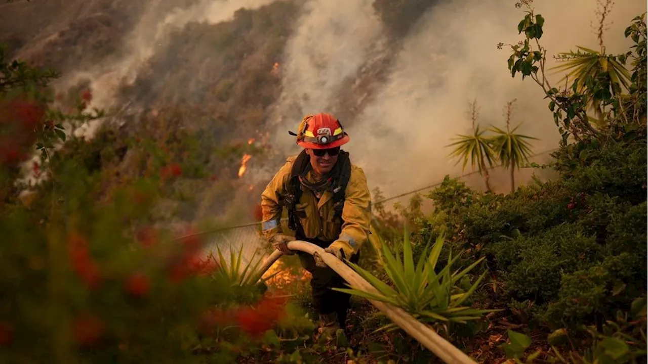
A new fire, dubbed the Hughes Fire, erupted north of Castaic, California, rapidly spreading and forcing evacuations. Fueled by strong winds, the blaze consumed over 5,000 acres in just two hours. Evacuations extended across Lake Castaic and surrounding areas, with residents scrambling to flee the advancing flames. The fire prompted concerns about the potential evacuation of the Los Angeles County Castaic jail complex due to a shortage of inmate transport buses.
A new fire erupted Wednesday north of Castaic, rapidly spreading and triggering additional evacuations in fire-weary Southern California. The Hughes fire ignited off Lake Hughes Road shortly before 11 a.m., prompting evacuation orders soon after. Within two hours, the blaze had surged to over 5,000 acres according to the California Department of Forestry and Fire Protection.
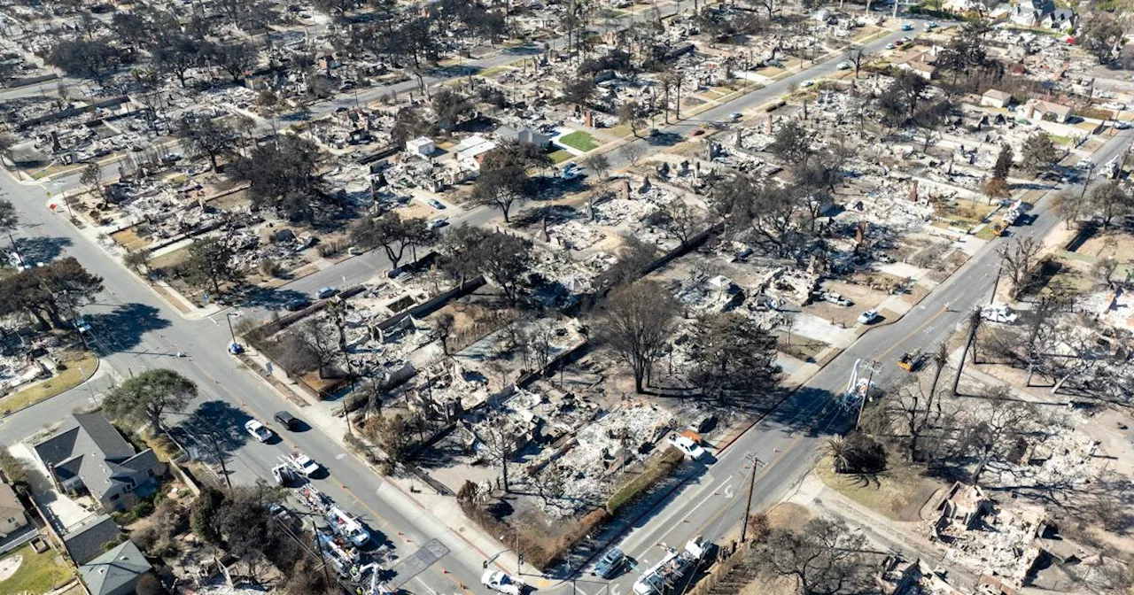
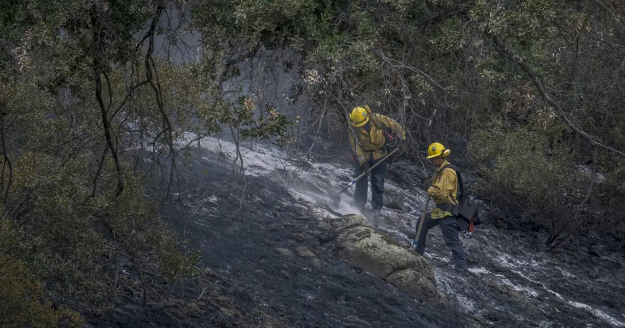
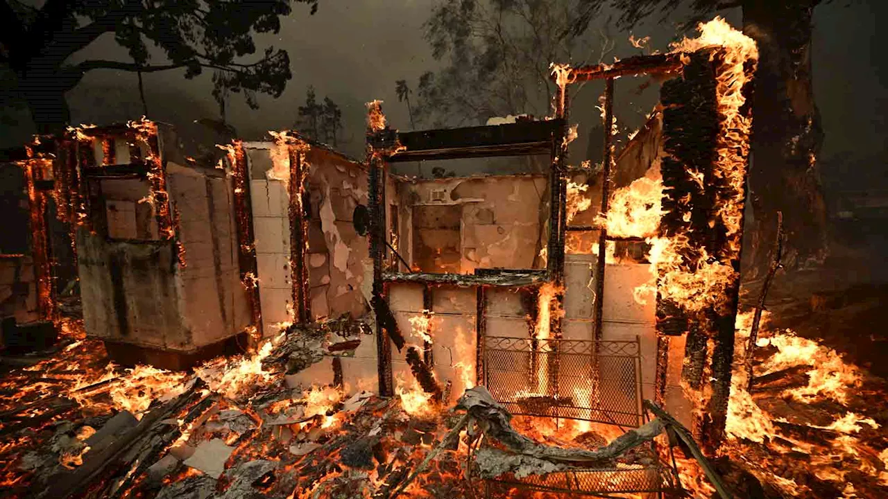
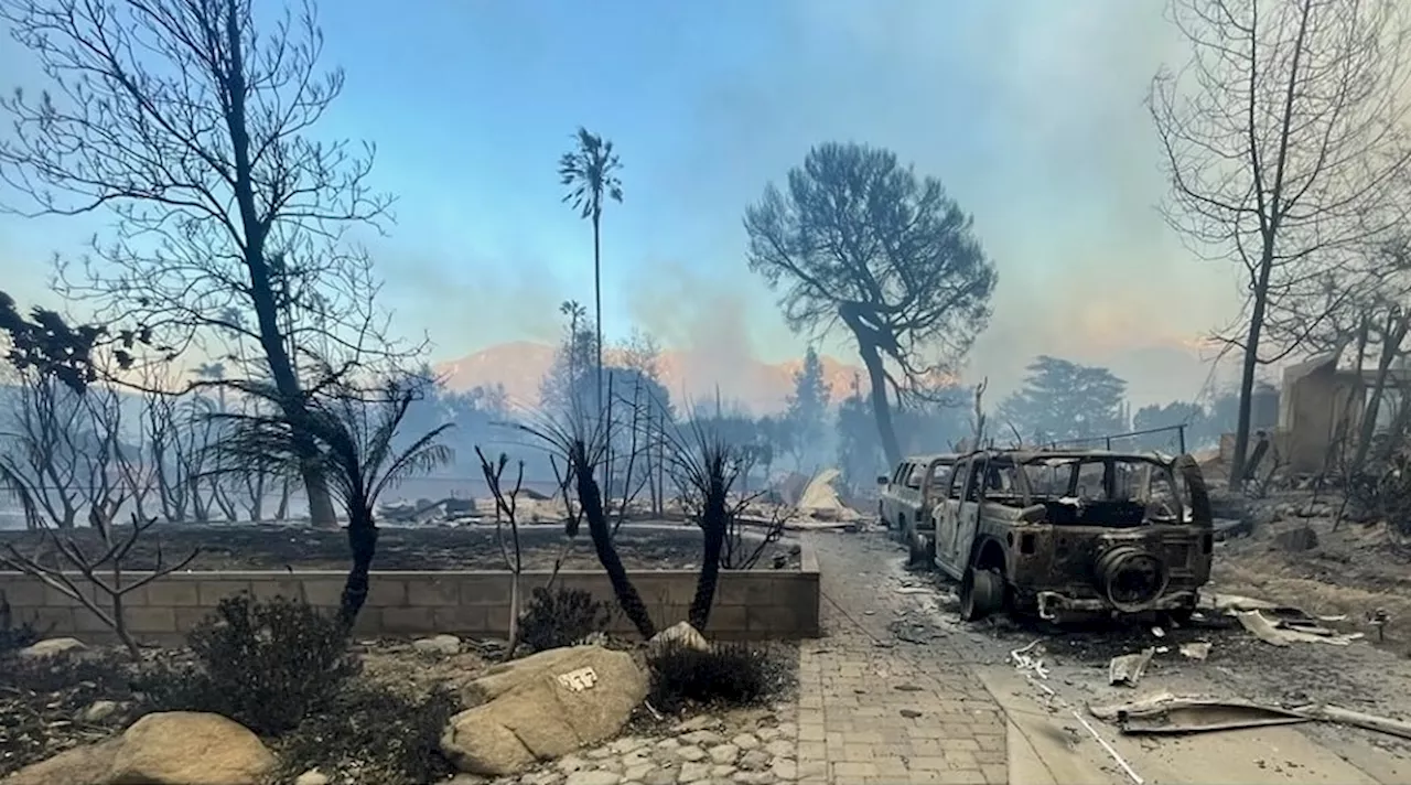
Evacuations were issued for areas surrounding Lake Castaic, extending towards Interstate 5 on the west and south of Sanberg to the north.In Castaic, residents along Pine Crest Place frantically loaded belongings into their vehicles, aiming to flee as winds continued to propel the fire southward. One resident, speaking to KTLA, stated his intention to remain as long as possible and was preparing to utilize a garden hose to spray down his roof, hoping to protect it from airborne embers. Another resident shared their fear, saying, 'I'm just praying our house doesn't burn down.' Meanwhile, a Los Angeles County Sheriff's Department patrol car traversed the neighborhood, broadcasting evacuation orders through a loudspeaker. The fire was burning roughly five miles north of the county's Castaic jail complex, but evacuations of that facility had not been ordered as of Wednesday. It remains unclear how jail officials would execute an evacuation if the situation necessitates it. For years, the Los Angeles County Sheriff's Department has grappled with a shortage of inmate transport buses due to an aging fleet that has become increasingly difficult to repair. By late last year, officials revealed to The Times that only 20 out of the department's 82 buses were operational. While the county approved funding for 20 new buses in September 2023, the first bus didn't arrive until December of last year. The remaining buses are scheduled to arrive every few weeks, with the order expected to be completed in August. A department spokeswoman stated on Wednesday that jail officials could potentially utilize state and other local resources, but the specifics of those resources remained unclear.Up to eight helicopters were deployed, dropping water onto the fire in an attempt to mitigate its spread. Road closures were implemented at Ridge Route Road at Lake Hughes Road, Ridge Route Road at Templin Highway, Lake Hughes Road at Pine Canyon Road, and Dry Gulch Road at San Francisquito Canyon Road, according to the California Highway Patrol. The 5 Freeway remained open as of 12 p.m. but was affected by smoke. Elsewhere, Castaic Union School District principals who were attending a training meeting when the Hughes brush fire broke out were instructed to immediately return to their schools. Northlake Hills Elementary received an evacuation order while the principals returned to their schools, assisting parents and guardians who arrived to pick up their children. The blaze erupted during a period of strong winds in the area. The exact cause of the fire remains unknown. Wind gusts reached 31 mph Wednesday afternoon in Castaic and are anticipated to increase over the next several hours, said Ariel Cohen, a meteorologist with the National Weather Service in Oxnard. Forecasts indicate that gusts could surge up to 40 mph in the evening and even faster overnight, according to the weather service.The Hughes fire is burning in the same region that was ravaged by the Route fire in 2022. That fire, which ignited during a heatwave in late August, burned 5,200 acres and forced evacuations in Castaic. The blaze was one of two that began Wednesday amid persistent red flag conditions in the region. In San Diego County, a fire that erupted near Rancho Bernardo and grew to at least 7 acres triggered evacuations for nearby residences and businesses. At least one person was injured, the San Diego Fire-Rescue Department posted on X. Forward progress on the fire was subsequently halted hours later, authorities stated. Looking ahead, the weekend storm is expected to bring 'a very beneficial wetting rain,' but 'it will not end the fire season,' said National Weather Service meteorologist Alex Tardy. Because the rainfall is anticipated to be light, the risk of debris flows in burned areas is low. There's a slight chance that a thunderstorm could develop directly over a recently burned area, potentially creating a risk of landslides, but it's not considered likely, said Ryan Kittell, a meteorologist with the NWS. Despite this, Los Angeles city and county officials have commenced preparations for the incoming rain. Public works will install barriers, remove debris, and divert runoff from the stormwater system into the sewer system, where it can be treated. Crews are also clearing drains and roadways, placing sandbags to reinforce vulnerable infrastructure, and preparing debris basins for the storm, officials stated Wednesday.The Palisades fire, which ignited over two weeks ago, ravaged a substantial portion of Pacific Palisades, burning over 23,400 acres and destroying at least 6,662 structures, according to the California Department of Forestry and Fire Protection. The blaze was 68% contained as of Wednesday morning.
CALIFORNIA WILDFIRES HUGHES FIRE CASTAIC EVACUATIONS WILDFIRE SPREAD RED FLAG CONDITIONS WINDS
United States Latest News, United States Headlines
Similar News:You can also read news stories similar to this one that we have collected from other news sources.
 Cal Fire's Fire Hazard Severity Zone Map Shows California Fire RiskCal Fire's new Fire Hazard Severity Zone map allows Californians to search for an address and see the location's probability of being affected by fire. The map assesses fire hazard, rather than risk, based on the physical conditions that create a likelihood of fire behavior over a 30 to 50-year period. The map considers terrain, local weather, and fire history over 50 years. Areas are ranked as moderate, high, or very high fire severity. The map is effective as of April 1, 2024 and focuses on areas under state responsibility, excluding federal land like the Sierra Nevada Mountains and some parts of the Bay Area.
Read more »
 Northern California Fire Crews Assist in Drought-Stricken Southern CaliforniaSanta Ana winds and dry conditions have prompted the deployment of firefighting crews from Northern California to assist in Southern California counties. Fears of large wildfires are heightened as the region faces drought conditions.
Read more »
 ‘It's just not enough': Fire chief on challenges of fighting Southern California fireA visiting fire chief battling the Southern California fires discussed the frustration of being unable to stop the spread.
Read more »
 Fire destroys Santa Barbara police sergeant’s home in Southern California fireBy JOSH FRIEDMAN The Santa Barbara Police Department has announced that one of its sergeants lost his home in the Southern California Eaton Fire. A Navy
Read more »
 California Wildfires: Auto Fire Ignites as Hurst Fire Contained, Looting and Scams ReportedThe Auto Fire broke out in Ventura County, burning 56 acres and prompting evacuations. While the Hurst Fire north of Los Angeles has been fully contained, high winds pose a threat. Officials address grim discoveries of wildfire victims, rising costs, and reports of looting and price gouging.
Read more »
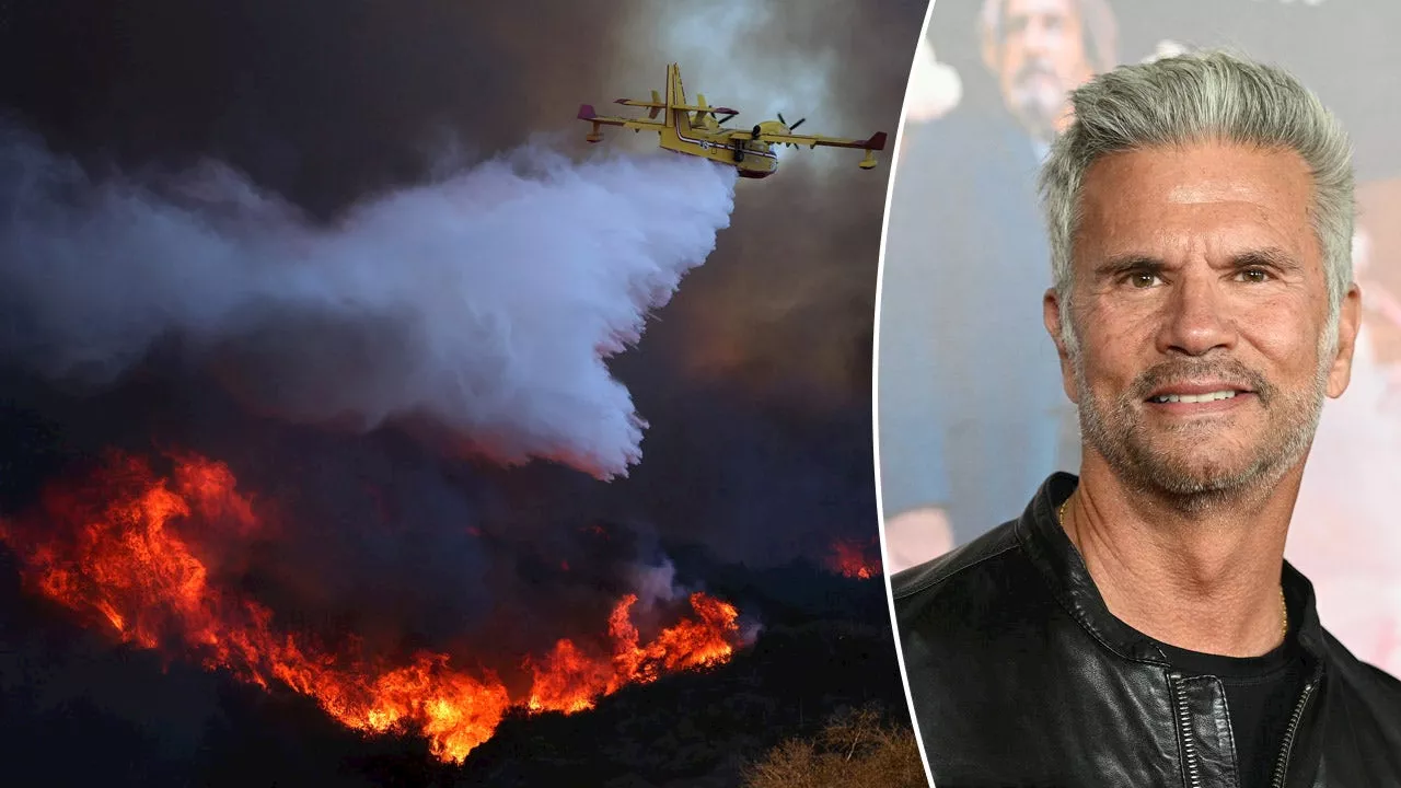 Lorenzo Lamas Blasts California for Lack of Fire Preparedness as Palisades Fire Devastates His HometownActor Lorenzo Lamas condemns California's lack of preparedness for the devastating Palisades Fire, calling for better disaster response measures to prevent future tragedies.
Read more »