
Between Wednesday and Saturday, the NWS added a moderate heat alert to five new states.
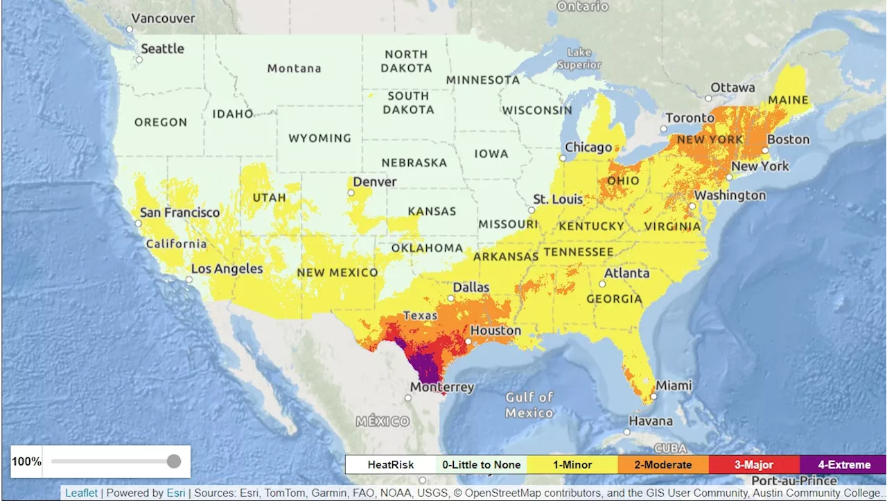
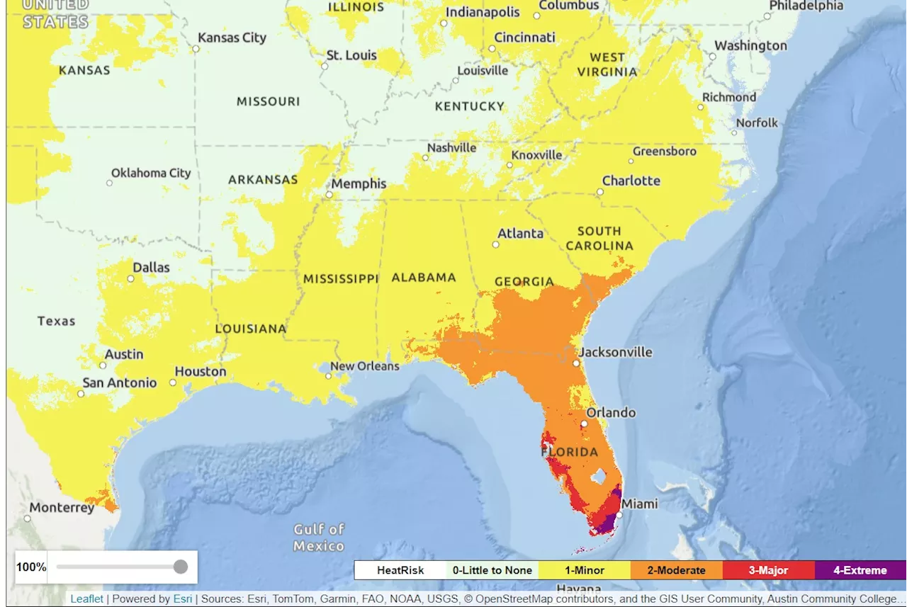
A National Weather Service moderate heat alert expanded to five new states in the south and south-eastern United States between Wednesday and Saturday, according to maps published by the federal agency.The moderate alert was extended to Georgia, Oklahoma, New Mexico, North Carolina, and South Carolina over the three-day period. However, during this time, it was also withdrawn from ten states, primarily in the north-east.
It also applies to smaller sections of New Mexico, Oklahoma, Arkansas, Tennessee, South Carolina, North Carolina, Virginia, West Virginia, Pennsylvania and New York.The highest NWS heat warning is 'extreme,' shown on the map by the color purple, which is only in place for a section of southern Texas on Saturday.
United States Latest News, United States Headlines
Similar News:You can also read news stories similar to this one that we have collected from other news sources.
 Heat Wave Map Shows US States Seeing Rising TemperaturesSome people were experiencing 'extreme' impacts from the heat.
Read more »
 Gnuastro: Simulating The Exposure Map of a Pointing Pattern - Simulating the Exposure MapOptimizing astronomical observation strategies with Gnuastro 0.21's new pointing simulation tool and improving exposure mapping accuracy.
Read more »
 Florida Heat Map as 'Emergency' Warning IssuedThe heat index was forecast to hit 110 degrees in Key West on Friday.
Read more »
 California Map Shows Power Outage Warning as Special Storm Alert IssuedThe winds will be the worst on Friday afternoon and evening.
Read more »
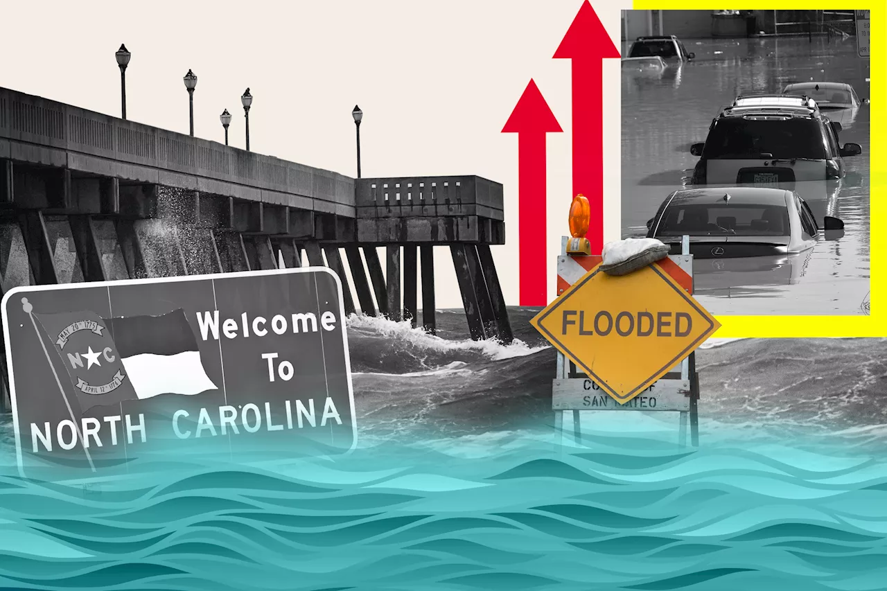 North Carolina Map Shows Where State Could Be Underwater From Sea Level Rise An interactive map shows which parts of North Carolina might be submerged by rising sea levels, with its barrier islands and long coastline at risk.
Read more »
 Virginia Map Shows Where State Could Be Underwater From Sea Level Rise The Virginia Beach and the Hampton Roads region are experiencing the highest rate of sea level rise on the Atlantic coast.
Read more »