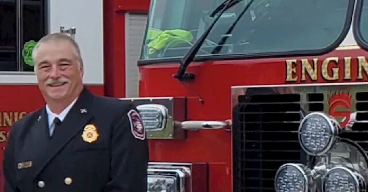
Coweta County, Georgia, fire chief Bart Cauthen was shot and killed while assisting a motorist who had hit a deer. Police believe there was a shootout involving Cauthen, the driver, and a local resident, William Randall Franklin. Franklin was wounded in the exchange of gunfire.
Coweta County, Georgia, fire chief Bart Cauthen came to the aid of a motorist who had hit a deer Sunday and was shot and killed while on scene.that law enforcement was dispatched to the scene and, upon arriving, found three people who had been shot. Cauthen was dead when law enforcement arrived and the two other individuals were taken to the hospital for treatment.
Early investigation indicates that Chief Cauthen was attempting to assist individuals that had struck a deer while traveling on County Road 267, Another individual that resided in the area opened fire on Chief Cauthen and the individual that struck the deer. All individuals were injured during the shootout. Chief Cauthen succumbed to his injuries prior to deputies arriving on the scene.
SHOOTING ACCIDENT GEORGIA FIREFIGHTER LAW ENFORCEMENT
United States Latest News, United States Headlines
Similar News:You can also read news stories similar to this one that we have collected from other news sources.
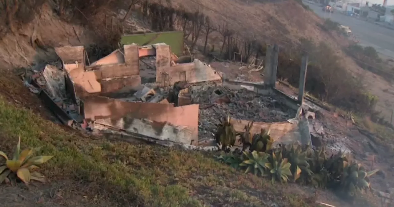 Malibu couple escapes Palisades Fire weeks after fighting off flames from Franklin FireJust weeks after having their lives threatened by the Franklin Fire in Malibu, one couple once against forced to literally run for their lives when the Palisades Fire descended upon their home.
Read more »
 Cal Fire's Fire Hazard Severity Zone Map Shows California Fire RiskCal Fire's new Fire Hazard Severity Zone map allows Californians to search for an address and see the location's probability of being affected by fire. The map assesses fire hazard, rather than risk, based on the physical conditions that create a likelihood of fire behavior over a 30 to 50-year period. The map considers terrain, local weather, and fire history over 50 years. Areas are ranked as moderate, high, or very high fire severity. The map is effective as of April 1, 2024 and focuses on areas under state responsibility, excluding federal land like the Sierra Nevada Mountains and some parts of the Bay Area.
Read more »
 Cal Fire's Fire Hazard Severity Zone Map Helps Californians Assess Fire RiskCal Fire's new Fire Hazard Severity Zone map allows residents to search for an address and see the location's probability of being affected by fire. This map focuses on fire hazard, not risk, and considers factors like terrain, weather, and fire history.
Read more »
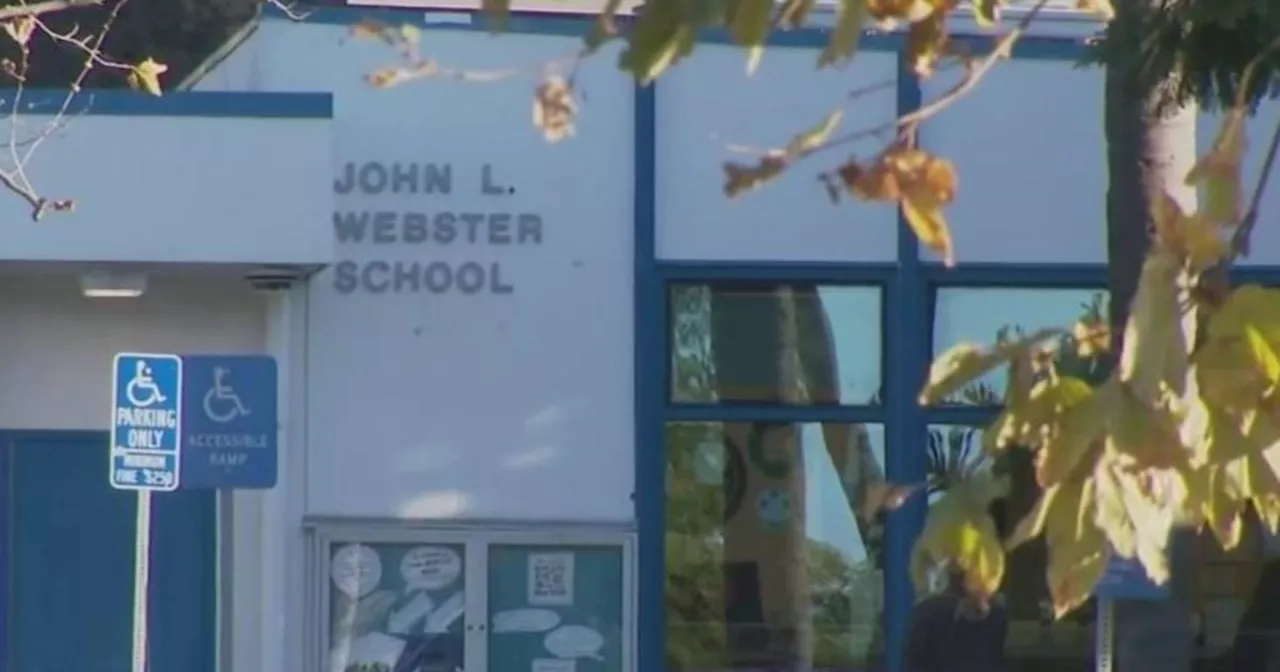 Webster Elementary School Reopens After Franklin FireWebster Elementary School in Malibu reopened to students after repairs following the Franklin Fire that damaged the campus.
Read more »
 Map: See where Los Angeles County wildfires are burningThe Palisades Fire, Eaton Fire, Hurst Fire, Lidia Fire and Sunset Fire are burning Friday in Los Angeles County. See updates and locations.
Read more »
 Georgia Fire Chief Killed in Roadside ShootingA fire battalion chief from Georgia was killed in a roadside shooting in Chambers County on Sunday night after stopping to help people who had hit a deer. The shooter, William Randall Franklin, has been identified and arrest warrants have been issued for him.
Read more »