Rain will spread from west to east through the mid to late morning. Embedded lightning is likely mid to late morning as well.
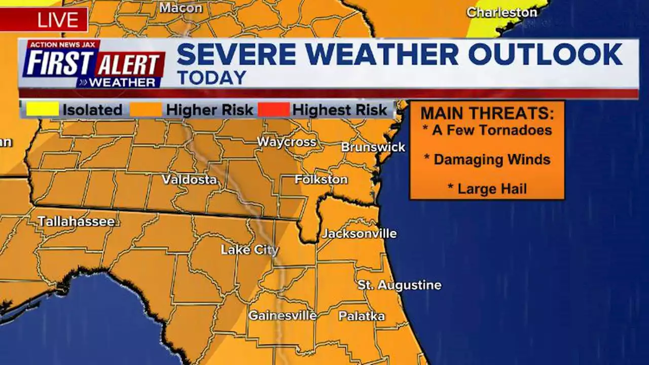
This will have implications for THE PLAYERS at TPC Sawgrass. There is at least some threat for a strong to severe storm today in NE Florida this afternoon. The main threat is gusty winds.We have an overnight severe weather threat ahead of a cold frontal passage early Saturday. Heavy rain, lightning, gusty winds, hail and even a few tornadoes are possible in NE Florida and SE Georgia.
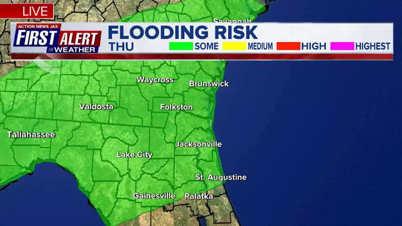
The greatest threat for tornadoes appears to be west of Jacksonville. The rain and storms will clear out by midday Saturday. We will turn windy with offshore winds gusting to 30 to 40 mph. We will see an inland freeze Sunday morning with a sunny, breezy, and much cooler afternoon. Highs will only be in the 50s. The beaches will stay just above freezing but will still be cold thanks to a northwest wind blowing in the cold air. We get back to the upper 60s to lower 70s by Monday.Flood Watch in effect for Suwannee Valley. Additional 3-4 inches possible.
United States Latest News, United States Headlines
Similar News:You can also read news stories similar to this one that we have collected from other news sources.
 First Alert Weather Day: Heavy thunderstorms, powerful arctic cold front expected SaturdayRain will spread from west to east through the mid to late morning. Embedded lightning is likely mid to late morning as well.
Read more »
 First Alert Weather Day: Impactful rainfall, a few storms that could be strongRain that will be steady to heavy at times and embedded thunderstorms that could be severe, leads to a First Alert Weather Day for the opening round of THE PLAYERS.
Read more »
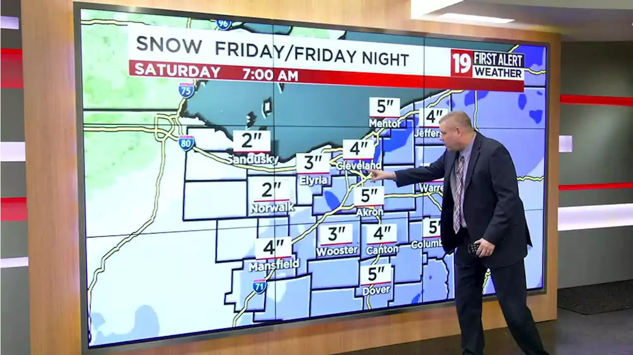 Several inches of snow on the way beginning Friday, bitter winds Saturday; 19 First Alert WeatherA mix of sun and clouds today
Read more »