
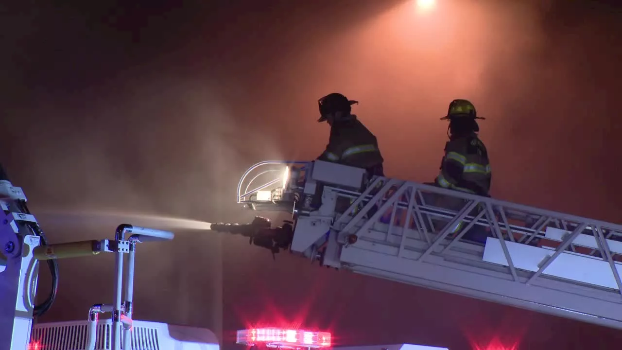
A fire broke out in the roof of the 12th arrondissement town hall in Paris early Monday morning. While no casualties were reported, the blaze severely damaged the bell tower of the 19th-century building. Firefighters worked tirelessly to extinguish the flames, but authorities warned of a risk of collapse in the upper part of the bell tower. Despite the damage, the city ensured that all public services for residents would continue to be provided from the 11th arrondissement town hall.
Fire engulfed the town hall of Paris’ 12th district early Monday, causing no casualties but severely damaging the bell tower of the 19th century building. Paris police prefect Laurent Nunez said the fire broke at 3:20 a.m. in the roof of the building. About 150 firefighters battled the flames and the fire was extinguished in the morning, Nunez said. He warned there was a “risk of collapse” of the upper part of the bell tower . A security area has been set up around the building.
Paris mayor Anne Hidalgo praised in a statement the “exceptional intervention” of the Paris fire department and said “all public services for residents have been maintained and will be provided in the 11th district town hall.” The 12th district town hall was built in 1876 with a 36-meter (118-foot) high bell tower on top of its main entrance
FRANCE PARIS FIRE TOWN HALL DAMAGE BELL TOWER EMERGENCY SERVICES
United States Latest News, United States Headlines
Similar News:You can also read news stories similar to this one that we have collected from other news sources.
 Cal Fire's Fire Hazard Severity Zone Map Shows California Fire RiskCal Fire's new Fire Hazard Severity Zone map allows Californians to search for an address and see the location's probability of being affected by fire. The map assesses fire hazard, rather than risk, based on the physical conditions that create a likelihood of fire behavior over a 30 to 50-year period. The map considers terrain, local weather, and fire history over 50 years. Areas are ranked as moderate, high, or very high fire severity. The map is effective as of April 1, 2024 and focuses on areas under state responsibility, excluding federal land like the Sierra Nevada Mountains and some parts of the Bay Area.
Read more »
 Cal Fire's Fire Hazard Severity Zone Map Helps Californians Assess Fire RiskCal Fire's new Fire Hazard Severity Zone map allows residents to search for an address and see the location's probability of being affected by fire. This map focuses on fire hazard, not risk, and considers factors like terrain, weather, and fire history.
Read more »
 Map: See where Los Angeles County wildfires are burningThe Palisades Fire, Eaton Fire, Hurst Fire, Lidia Fire and Sunset Fire are burning Friday in Los Angeles County. See updates and locations.
Read more »
 Fire Damages Row of Businesses on Fort Worth's Main StreetA fire broke out early Monday morning on North Main Street in Fort Worth, damaging a row of businesses. The cause of the fire is still under investigation.
Read more »
 East Side House Fire Damages BusinessesA fire in San Antonio damaged a house and four businesses on the East Side. The San Antonio Fire Department is investigating the cause of the fire, which started in the back of the house and was worsened by wind.
Read more »
 Fire Damages Dallas Shopping Center, Exotic Animal StoreA fire erupted at Plaza Latina shopping center in Dallas, causing significant damage to a building housing various Hispanic businesses, including one that sold exotic animals. Officials are investigating the cause of the blaze.
Read more »