
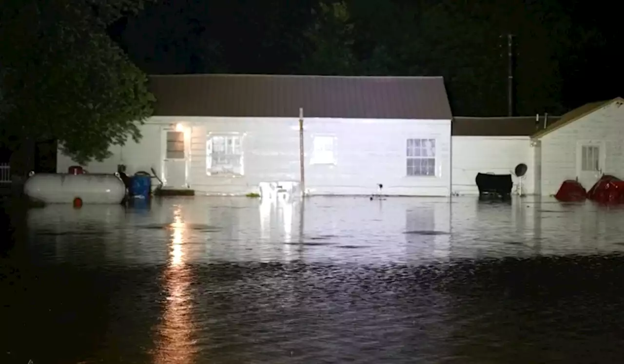
Slow-moving, torrential rainstorms were deluging parts of western Kentucky, southern Illinois and southeast Missouri on Wednesday morning, producing severe flash flooding that was entering homes, stranding vehicles and inundating entire neighborhoods.
As of midmorning, the Weather Service office in Paducah estimated that 4 to 6 inches of rain had fallen in West Paducah, and 6 to 8 inches in Mayfield and surrounding rural areas. Those values are probably conservative. Another 1 to 4 inches of rain is likely through early afternoon, meaning a few locations could see a foot or more when all is said and done.
Paducah’s Barkley Airport had logged 6.28 inches of rain as of 8:50 a.m. Central time. An exceptional 2.32 inches of rain fell between 6:53 and 7:53 a.m.; that’s the third-greatest single-hour rainfall total recorded at the airport. Already, the 4.4 inches that fell at the airport can be considered a hundred-year rain event, meaning it has less than a 1 percent likelihood of happening in any given year. A nearby station in Paducah also picked up 5.87 inches in six hours, which would be a 200-year rain event.10.45 inches in Graves County, according to Kentucky Mesonet.6.84 inches in Paducah.4.68 inches in New Concord, Ky.in a few rural areas in between weather stations.
It’s estimated that the threshold for a thousand-year rain event, or one that has a 0.1 percent chance of striking a location in a particular year, is 9.83 inches in 24 hours. Therefore, the 10-inch totals qualify the ongoing event as a thousand-year storm.The heavy rain developed along a stagnant boundary known as a stationary frontIt marks the divide between a cooler, drier air mass to the northeast and a warmer, moisture-rich Gulf of Mexico air mass banked to the southwest.
That stationary front serves as the focus for downpours, which ride along it like rail cars on a track. That induces what meteorologists call “training,” which means exceptionally heavy rainfall continues to move over the same area.It also is a recipe for the process by which humid air rides up and over a shallower lip of cooler/denser air. That acts as a ramp to pump moisture high into the atmosphere, forming clouds and bands of intense precipitation.
United States Latest News, United States Headlines
Similar News:You can also read news stories similar to this one that we have collected from other news sources.
 Flash Flood Emergency In Western Kentucky | Weather.comA flash flood emergency led to water rescues in western Kentucky early this morning – here's what we know so far:
Read more »
 Floodwaters reach iconic Taj Mahal as northern India reels from massive deluge | CNNDevastating floods causing havoc across northern India have reached the iconic Taj Mahal in a rare event that experts warn could become a regular occurrence as the climate crisis brings ever more extreme weather.
Read more »
 Drone Footage Shows Kentucky Flood Emergency - Videos from The Weather ChannelMayfield, Kentucky, saw nearly 6 inches of rain in just a few hours, causing flash flooding that inundated roads and homes. It’s the same city that was devastated by an EF4 tornado in December 2021. - Videos from The Weather Channel | weather.com
Read more »
 Kentucky Ban on Gender-Affirming Care Takes Effect as Injunction Is LiftedKentucky's ban on gender-affirming care for transgender youth is now in effect after Judge David Hale lifted the injunction.
Read more »
 College football changes roughing the punter rule after controversial win by Kentucky in 2022Kentucky's controversial win over Missouri in 2022 has led to a rule change in college football.
Read more »
 High-water rescue crews save people flooded in Kentucky as death toll rises in northeast USHigh-water rescue crews have been pulling people from flooded homes and vehicles in Kentucky
Read more »