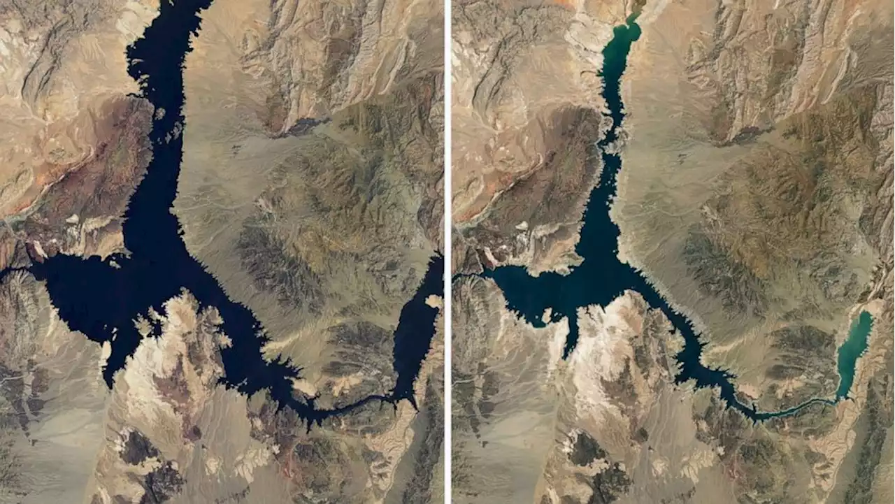
Dramatic before-and-after photos of Lake Mead are providing visual evidence to the alarming rate in which the water levels at the largest reservoir in the country are receding.
-- a mere 146 feet away from becoming a dead pool. As of July 18, Lake Mead was only at 27% capacity, according to NASA.
The highest surface elevation ever in Lake Mead was in June 1983, when levels were recorded at 1,225.85 feet, according to data from the Bureau of Reclamation. The reservoir also approached maximum capacity in the summer of 1999, according to NASA. Lake Mead has lost more than 25 feet this year alone, data shows. The water has receded so much that it has, some that may have been dumped there, as well as a World War II-era boat.
A buoy that reads 'No Boats' lays on cracked dry earth where water once was as people carry a boat further out to reach water at Lake Mead, Nevada, July 23, 2022.Water levels are expected to continue to dry up until November, when the wet season begins. Much of the megadrought and the concern over a potential water shortage is attributed to climate change, as global temperatures increase, causingand therefore less water flowing into the Colorado River once spring arrives year after year. About 10% of the water in Lake Mead comes from local precipitation and groundwater, and the rest comes from snowmelt in the Rocky Mountains that flows down the Colorado River and to Lake Powell, the second-largest reservoir in the U.S.
United States Latest News, United States Headlines
Similar News:You can also read news stories similar to this one that we have collected from other news sources.
 NASA Satellite Photos of Lake Mead 22 Years Apart Show Dramatic Water LossThe water levels are now at their lowest since 1937, when the lake was first being filled.
Read more »
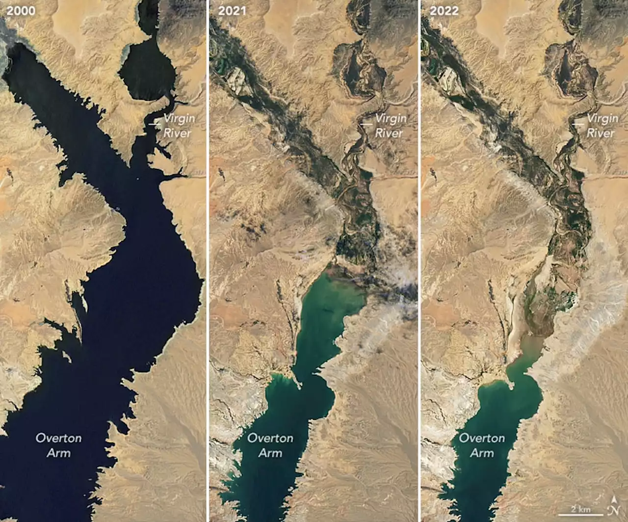 Satellite images from NASA show water loss at Lake Mead since 2000NASA has released new satellite images that show the rapid decline of water at Lake Mead since 2000.
Read more »
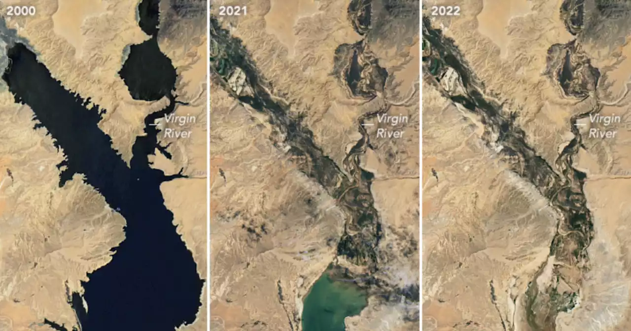 NASA Images of Shrinking Lake Mead Offer 'Stark Illustration' of Climate CrisisNew images of Lake Mead offer 'a stark illustration of climate change and a long-term drought that may be the worst in the U.S. west in 12 centuries.'
Read more »
 Lake Mead Is Shrinking, USPS Goes Electric And Software To Make Farmers GreenThis week’s Current Climate, which every Saturday brings you the latest news about the business of sustainability.
Read more »
 Lake Mead Is Shrinking, USPS Goes Electric And Software To Make Farmers GreenThis week’s Current Climate, which every Saturday brings you the latest news about the business of sustainability.
Read more »
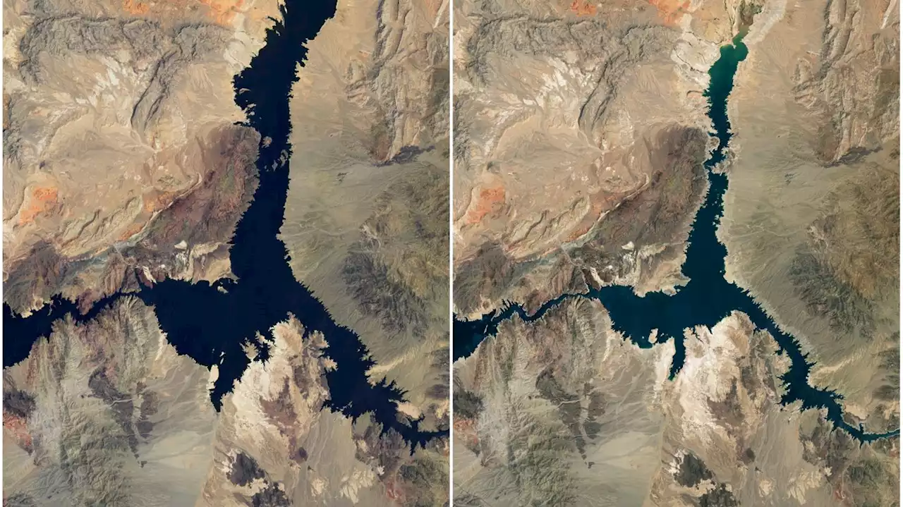 Lake Mead's water levels sink to lowest since 1937Lake Mead's water levels have sunk to the lowest since 1937, when the reservoir was being filled for the first time, according to newly released satellite pictures from NASA.
Read more »