
Dangerous heat and isolated storms are expected this afternoon, with a severe storm complex overnight.
Heat indices will be 100°-110° this evening. Isolated severe storms are in the east now, with a severe storm complex arriving late tonight.First, the heat this afternoon. Heat indices, away from thunderstorms, peak in the 100°-110° range, and the Heat Stress Index is"moderate," which is then recommended that you take half-hour breaks for each hour outside.
A more widespread storm and severe weather threat emerges late tonight and comes from an expected severe storm complex that initiates around Iowa later this evening. Individual thunderstorm cells there quickly merge into a"bowing" storm complex that likely produces swaths of significant wind gusts from Iowa, northern Illinois and possibly northwestern Indiana before it"weakens" on approach to the I-70 corridor around 3-4 a.m. early Tuesday morning.
Morning rain/thunderstorms diminish by midday, and there will be plenty of rain-free time on radar. There will also be plenty of highly humid air again tomorrow, with heat indices in the upper 90s to 100° before the next round of storms develop in the late afternoon/evening along an approaching front.Morning rain/thunderstorms diminish by midday, and there will be plenty of rain-free time on radar.
United States Latest News, United States Headlines
Similar News:You can also read news stories similar to this one that we have collected from other news sources.
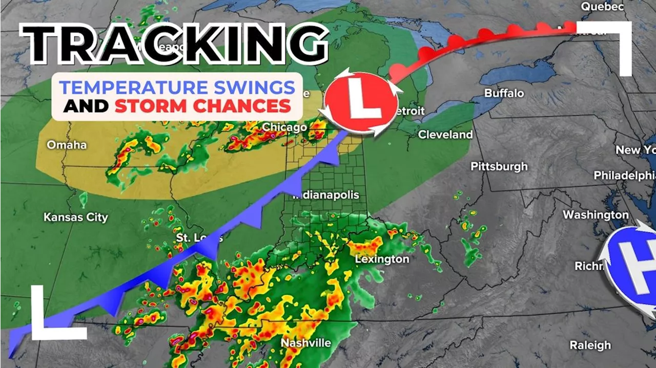 Storm chances and temperature swings | Live Doppler 13 Weather BlogMore storm chances are popping up around central Indiana this week.
Read more »
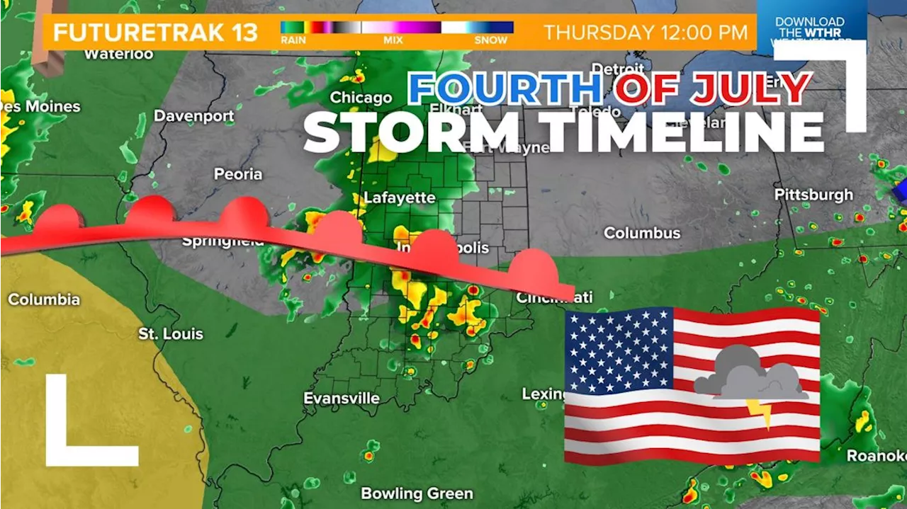 Storm timeline update Wednesday through Friday | Live Doppler 13 Weather BlogChuck's morning forecast for Tuesday, July 2, 2024.
Read more »
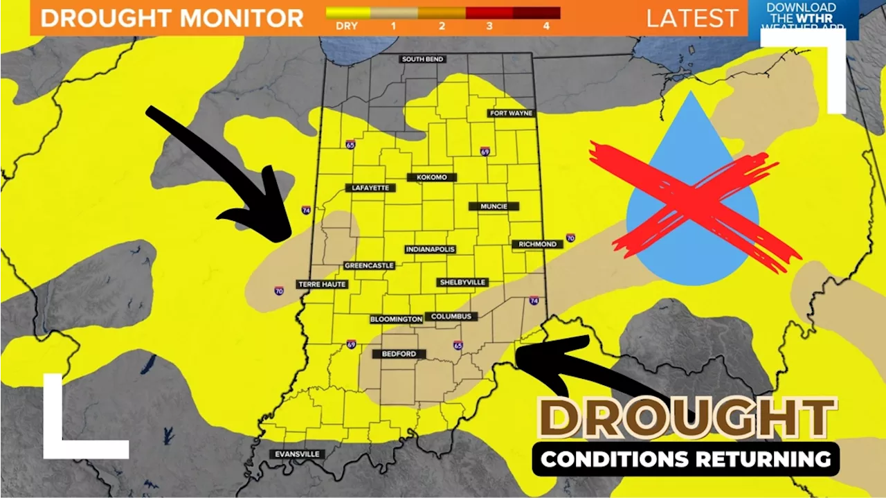 Drought conditions have officially returned to parts of Indiana | Live Doppler 13 Weather BlogNOAA has placed Indiana in a drought for the first time since early April 2024. We made some big progress with rain this spring, but now we have dried out again.
Read more »
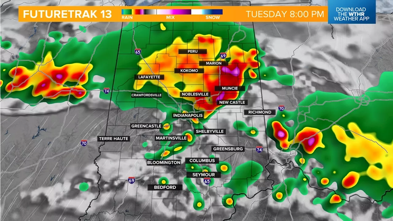 Severe Thunderstorm Watch issued, rain timeline | Live Doppler 13 Weather BlogScattered storms take over Indiana today with a small break from the heat on the way.
Read more »
 Multiple rounds of strong storms ahead | Live Doppler 13 Weather BlogLindsey's morning forecast for Monday, July 15, 2024.
Read more »
 More rounds of heavy storms ahead | Live Doppler 13 Weather BlogHigh pressure may steer the remnant rains of Hurricane Beryl from Texas to Indiana next week. While still far out, the highest rain chance is trending south of Indy.
Read more »