Recent wildfires in Los Angeles are delaying the release of updated fire hazard maps in California. The new maps, which are due every five years, will identify more areas as high-risk, leading to tougher wildfire prevention regulations. Cal Fire, the state's fire agency, is planning to release the maps in phases, starting with Northern California and then Southern California.
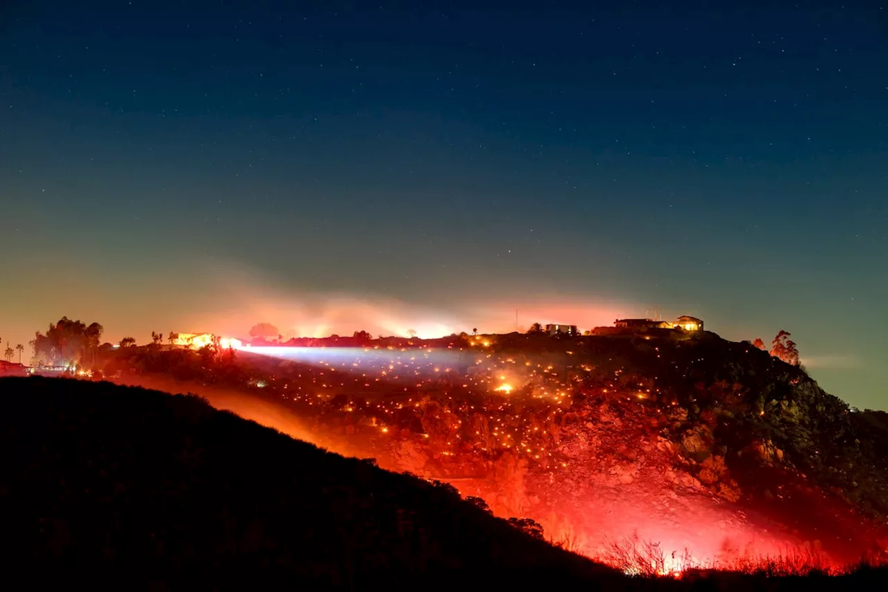
Climate disasters such as the recent Los Angeles–area fires are making it harder to prepare for more climate disastersIn this long exposure photo, fire smolders on a hillside during the Lilac fire in unincorporated San Diego County, California on January 21, 2025.SACRAMENTO, California — The Los Angeles fires are delaying California's rollout of new fire hazard maps that broadly detail more danger than previous versions, the state's fire marshal said Wednesday.
He said Cal Fire is now planning to release the new map recommendations for Northern California first, sometime in the next few weeks, and Southern California second, sometime in the months to follow, so as not to overwhelm local officials in LA, who are required by law to review and adopt the maps within three months.
“There's going to be some tough conversations,” Berlant said. “There's going to be a lot more cities and even some counties that would get a fire hazard level that they don't currently have.”Once Cal Fire publishes the new maps, cities and counties must review the recommendations, make any changes and formally adopt the zones.from environmental groups who feared the changes would put more people in the line of danger. State Sen.
WILDFIRE CALIFORNIA FIRE HAZARD CLIMATE CHANGE REGULATIONS
United States Latest News, United States Headlines
Similar News:You can also read news stories similar to this one that we have collected from other news sources.
 California Wildfires: Auto Fire Ignites as Hurst Fire Contained, Looting and Scams ReportedThe Auto Fire broke out in Ventura County, burning 56 acres and prompting evacuations. While the Hurst Fire north of Los Angeles has been fully contained, high winds pose a threat. Officials address grim discoveries of wildfire victims, rising costs, and reports of looting and price gouging.
Read more »
 Cal Fire's Fire Hazard Severity Zone Map Shows California Fire RiskCal Fire's new Fire Hazard Severity Zone map allows Californians to search for an address and see the location's probability of being affected by fire. The map assesses fire hazard, rather than risk, based on the physical conditions that create a likelihood of fire behavior over a 30 to 50-year period. The map considers terrain, local weather, and fire history over 50 years. Areas are ranked as moderate, high, or very high fire severity. The map is effective as of April 1, 2024 and focuses on areas under state responsibility, excluding federal land like the Sierra Nevada Mountains and some parts of the Bay Area.
Read more »
 Will California Wildfires Delay A$AP Rocky Trial?The rapper's upcoming felony assault trial is still set for later this month in Los Angeles amid the deadly Southern California wildfires.
Read more »
 California Wildfires Ravage Southern CaliforniaA series of wildfires fueled by strong Santa Ana winds are wreaking havoc across Southern California, forcing mass evacuations and resulting in tragic loss of life.
Read more »
 California Wildfires Ravage Southern CaliforniaThe California wildfires continue to rage, causing widespread devastation and forcing evacuations. The Eaton Fire has exploded to over 10,600 acres, while other fires burn across the region. The blazes have also impacted Hollywood's awards season, with events being delayed or canceled.
Read more »
 Northeast Ohio natives living in California give their account of the impact of the California wildfiresThe Cleveland native says it’s frightening for residents not to know if the city officials have everything under control.
Read more »