
Strong winds will affect parts of the state, with gusts up to 60 mph, making driving difficult.
National Weather Service meteorologists warned of high winds across parts of California that could make driving difficult on some Golden State highways on Monday and Tuesday.On Monday morning, the NWS offices in Las Vegas, Los Angeles, Hanford and San Diego issued wind advisories for their California forecast regions. Some of the advisories warned of difficult travel on highways and interstates.Most winds were forecast to be within 20 to 30 mph, with gusts up to 45 mph.
'Gusty winds will blow around unsecured objects,' the advisory said, 'Tree limbs could be blown down and a few power outages may result. Areas of blowing dust are likely and may impact travel on Highway 190 and Highway 127.'NWS lead forecaster Chris Outler told Newsweek that the strong winds are affecting nearly the entire Mojave Desert region ahead of a colder system making its way into the area.
United States Latest News, United States Headlines
Similar News:You can also read news stories similar to this one that we have collected from other news sources.
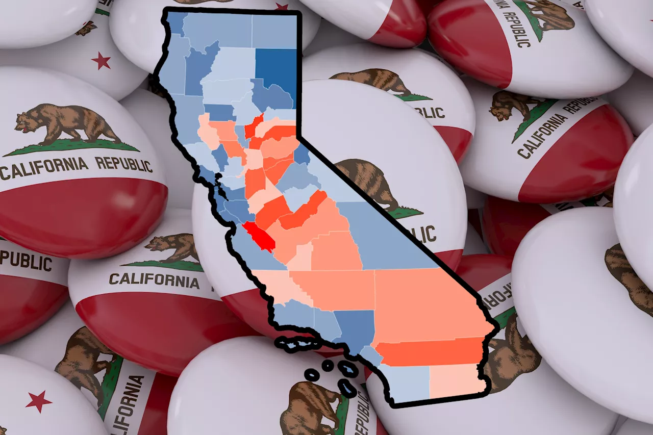 Most-Populated US State: Map Reveals Where California Numbers Are PlummetingCalifornia is one of the fastest shrinking states in the U.S., but this trend has not been equal across the state.
Read more »
 Map Shows Most Popular Condiments in Every StateA new map shows how the choice of condiments varies from state to state.
Read more »
 Map layout updates to be considered by California Coastal CommissionUpdates to the layouts of the California Coastal Commisson’s Local Coastal Program’s permit and appeal jurisdiction maps will be considered for approval at the governing body’s me…
Read more »
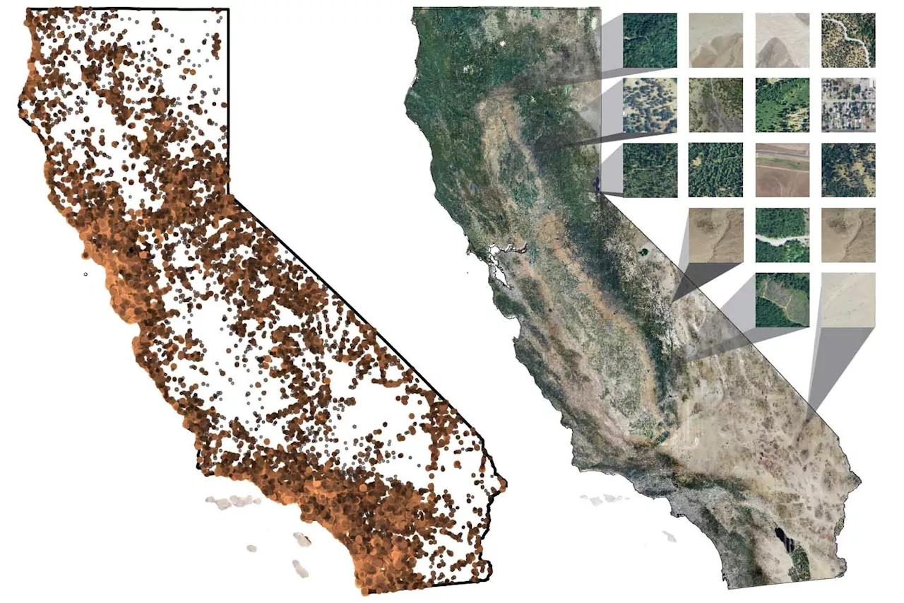 AI empowers iNaturalist to map California plants with unprecedented precisionUtilizing advanced artificial intelligence and citizen science data from the iNaturalist app, researchers at the University of California, Berkeley, have developed some of the most detailed maps yet showcasing the distribution of California plant species.
Read more »
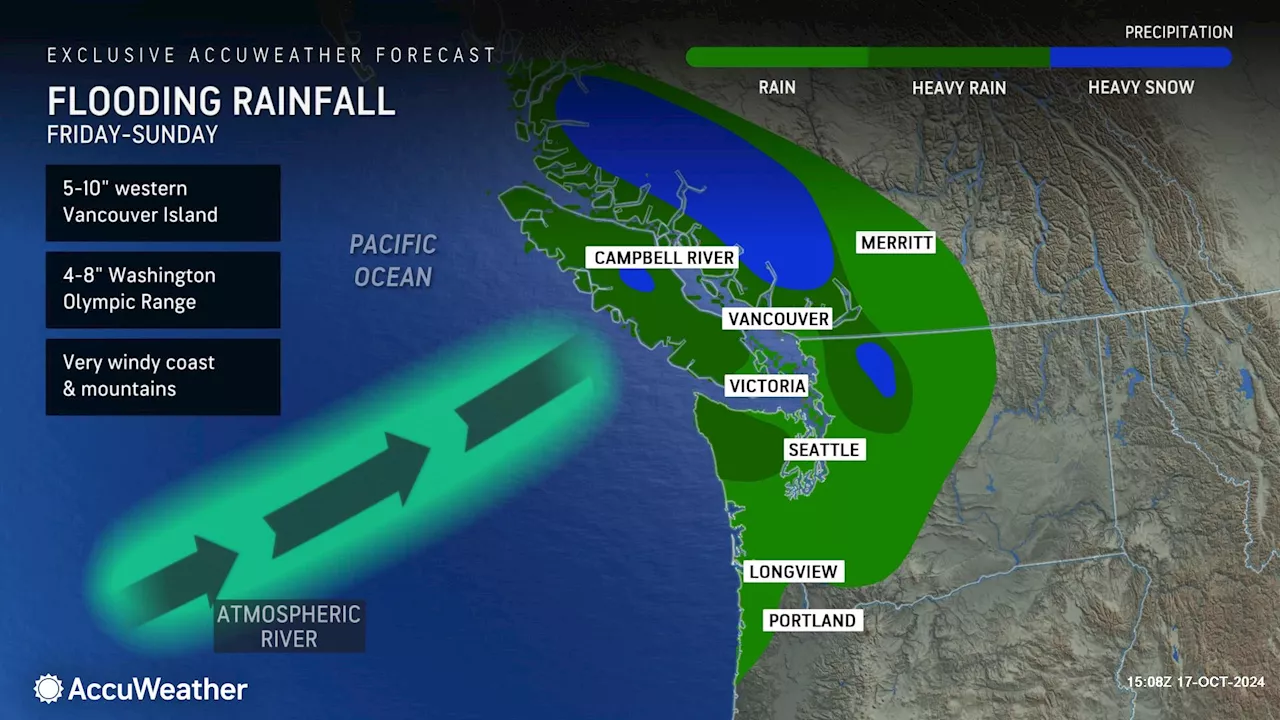 Atmospheric River Forecast Map Shows Heavy Snow, Rain for West Coast StateThe first atmospheric river of the season will bring widespread rain and snow to higher terrain in Washington.
Read more »
 Map Shows Puerto Rican Population in Every StatePuerto Rican voters in swing states could have an impact on the election after derogatory remarks were made about Puerto Rico at the MSG rally on October 27.
Read more »