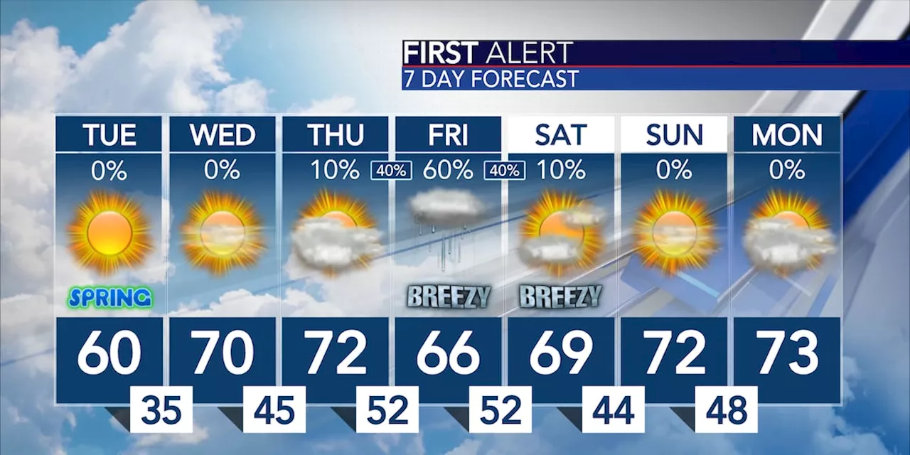
Warmer air arrives starting Wednesday; rain is looking more likely Thursday night through Friday night.
Warmer air arrives starting Wednesday; rain is looking more likely Thursday night through Friday nightPublished: Mar. 19, 2024 at 5:12 AM CDTMONTGOMERY, Ala. - A deep cold air mass is in place this morning across the eastern half of the U.S. That includes the Deep South with widespread frost and freeze conditions for most of the region.
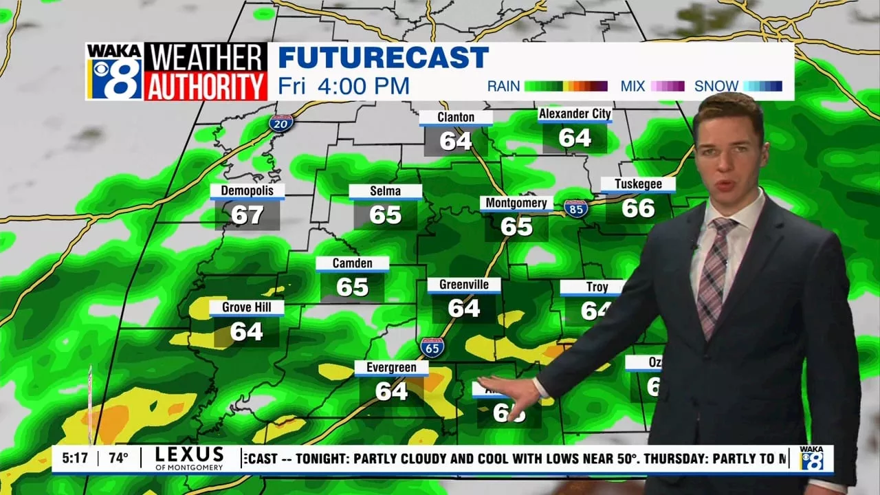
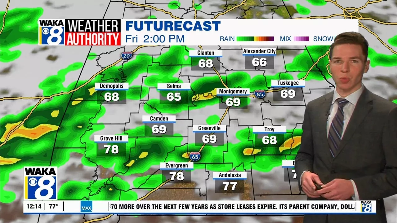
Temperatures will rebound nicely tomorrow and again Thursday. Highs tomorrow will be near 70 and highs Thursday will warm just above that mark. Both days will be entirely dry with more cloud cover arriving on Thursday. Some thunder and lightning may occur with this system as it looks a bit more organized than it previously did. However, severe weather and flooding will not occur based on current forecast expectations.
United States Latest News, United States Headlines
Similar News:You can also read news stories similar to this one that we have collected from other news sources.
 Warmer with sunshine Thursday, rain and storms likely FridayMontgomery, Alabama
Read more »
 Warmer with sunshine Thursday, rain and storms likely FridayMontgomery, Alabama
Read more »
 D.C.-area forecast: A brisk, breezy week continues, except warmer WednesdayTemperatures make a quick visit to the 50s tomorrow afternoon. We’re watching a chance of rain late Friday into Saturday.
Read more »
 Dallas weather: Cooler weather Wednesday, rain chances return ThursdayTemperatures dropped from 94 degrees Monday at 3 p.m. to 40 degrees at 8 a.m. on Wednesday.
Read more »
 First Alert Weather: Yellow Alert for rainy a.m. commute; Red Alert for Wednesday into ThursdayWe're tracking another system that could bring heavy rain and gusty winds late Wednesday into Thursday.
Read more »
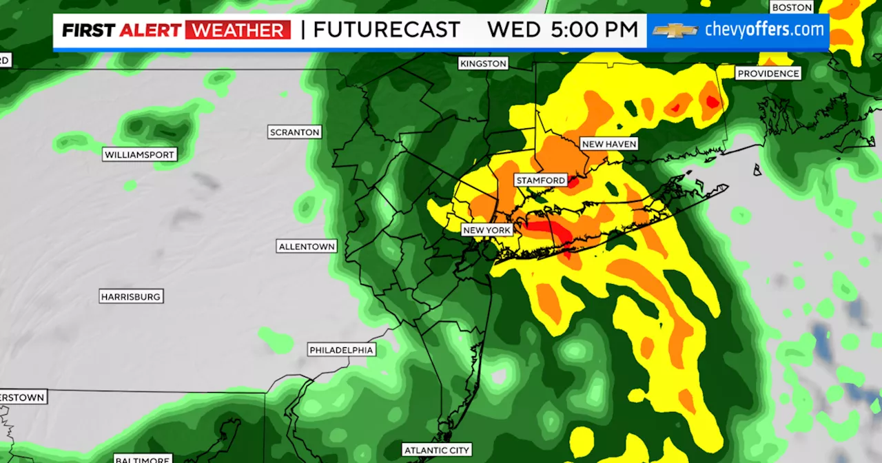 How much rain will New York and New Jersey get Wednesday and Thursday?The First Alert Weather Team has declared a Red Alert for heavy rain.
Read more »