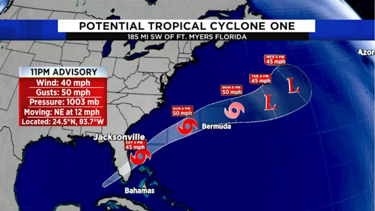
The National Hurricane Center is issuing advisories for Potential Tropical Cyclone 1. This system is an early season storm and will only slowly increase in strength.
At 5 AM EDT, the poorly defined center of the disturbance was located near latitude 25.6 North, longitude 83.1 West. The system is moving faster toward the northeast near 18 mph , and this general motion is expected to continue through tonight. A turn toward the east-northeast with an additional increase in forward speed is expected on Sunday, followed by a turn toward the east Monday night.
Maximum sustained winds remain near 40 mph with higher gusts, mainly in squalls. The disturbance is expected to become a tropical storm off the east coast of Florida by tonight, and some strengthening is forecast tonight through Monday as the system moves farther away from Florida over the western Atlantic.* Formation chance through 5 days...high...90 percent.