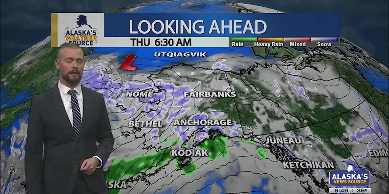
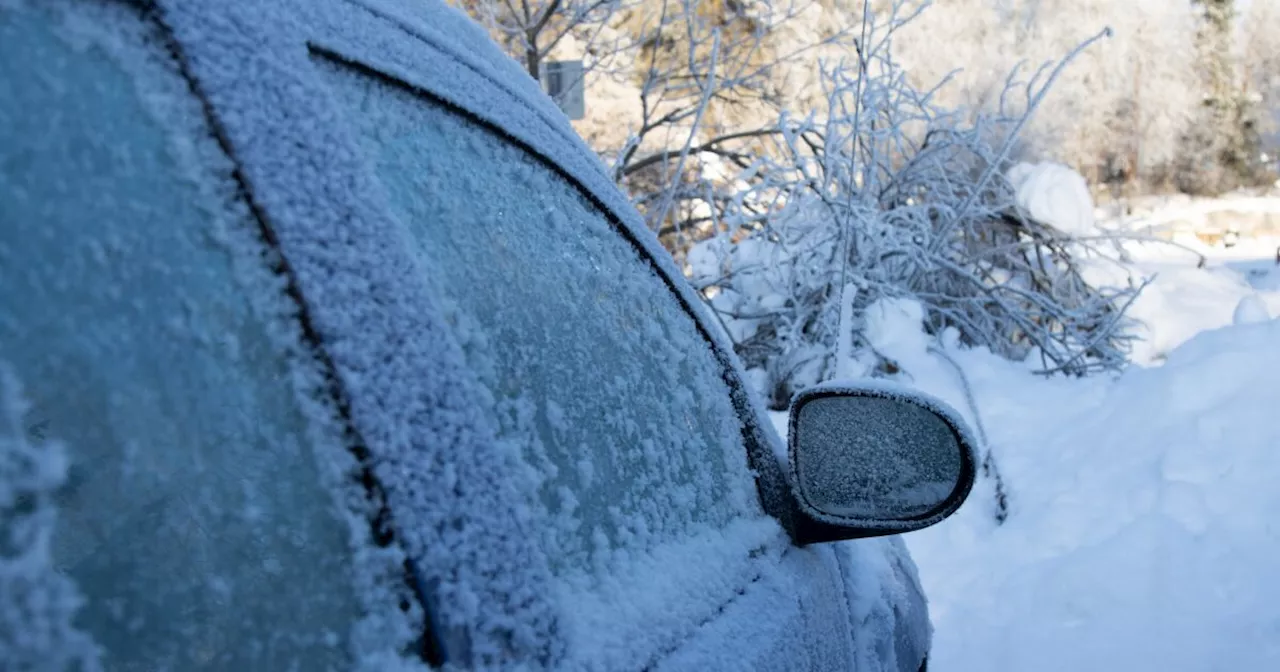
Alaska is experiencing a period of active and warm weather, with rain and snow showers affecting various regions. The Southcentral and Interior areas are particularly affected, with icy conditions, heavy snowfall, and strong winds anticipated. The weekend brings an atmospheric river with widespread rain and localized wintry mix. Colder temperatures are expected next week, potentially dropping to single digits and below zero in some areas.
ANCHORAGE, Alaska (KTUU) - Areas of light rain and some wintry mix are falling across Southcentral. This will lead to additional icy concerns across the region, with rain showers staying with us through the day. There will be some dry time; however, roads will continue to remain fairly slick. Light snow and a rain/snow mix will build into the Interior this evening, with heavy snow expected through Western Alaska. This active and warm weather pattern remains with us through the weekend.
Scattered to periodic rain showers will remain with us through the day, with some areas of snow possible through Keystone Canyon and Thompson Pass, as well as areas north of Talkeetna. A winter weather advisory remains in effect through tomorrow morning, where eight to 12 inches of snow is expected. Snowfall rates will be the heaviest through the morning hours, where one to two inches of snow per hour is possible. While snow will primarily stay north of Talkeetna, we’ll see snow showers as far south as Willow. In addition to the wet weather, breezy conditions are to be expected today. We’ll see winds gusting upwards of 35 mph throughout the day, with winds increasing into the evening hours. The overall pattern continues to favor wet, windy and warm conditions. We’re watching this weekend as an atmospheric river takes aim on the state. This will lead to widespread rain and localized areas of wintry mix this weekend. Additionally, we’ll see the return to some windy conditions for parts of Southcentral through Sunday. Be prepared for the return of colder weather, as Arctic Air looks to make a return next week. Any moisture still available will bring Southcentral the best shot of snow we’ve seen in weeks. It’s likely we could see highs next week dropping into the single digits and 10s. Rain showers continue for the Southeast, where less than half an inch is expected today. Most locations will see lingering showers into Friday before tapering off. While rain is to be expected, higher elevation of the Klondike and Haines Highway will see a rain/snow mix. Daily highs remain in the upper 30s and lower 40s, with drier weather expected for the first half of the weekend. While some spotty to isolated showers still look possible, we don’t see the return to widespread activity until early next week. With temperatures set to drop back near or below freezing by the middle of next week, areas of snow look to return to the Panhandle. Numerous winter weather alerts are in effect for the Interior, from winter storm warnings, to winter weather advisories and high wind warnings. The close of the week looks to be fairly active for the Interior, with warmer weather posing a problem. While today will see highs remaining below freezing for most, areas farther south near the Alaska Range will warm into the 30s. This is where areas of rain or a rain/snow mix will be problematic into the evening hours. As snow and rain spread north, be prepared for hazardous travel conditions. Roads will likely become icier into the weekend as temperatures are set to warm into the mid-30s. We’ll see heavy snow impact western parts of the Interior, where up to a foot of snow is possible for areas north and west of Fairbanks. Heavy snow will also occur for areas of the Alaska Range, where 12 to 20 inches is likely through the weekend. Through the heart of the Interior, a rain/snow mix will stay with us through the weekend. There will be several hours where snow will fall before a snow/rain mix builds into the region. Much of this will largely depend on the temperature profile of the atmosphere, but warmer air will move back into the region. Be prepared for winds gusting as high as 75 mph through the passes of the Alaska Range. Not only will this make for hazardous travel conditions, but any blowing snow will greatly reduce visibility. A strong frontal system will build into the Interior this weekend, driving very cold air back into the state. This has the potential to be the coldest air of the season, with afternoon highs dropping well below zero by the middle of next week. There are signs that overnight lows could drop below -40 in some of the coldest spots. Any standing water this weekend will rapidly refreeze as temperatures fall into next week. Continued warmth stays with the Slope through the end of this week, with highs set to warm back into the 20s through Friday. This will continue to lead to what will likely be one of the warmest January’s on record for the Slope. While today will bring some light snow and breezy conditions, even stronger winds and snow will move into the region Friday into Saturday. This comes as moisture moves in over the Brooks Range, with heavy snowfall expected on the south-facing slopes of the Brooks Range. Be prepared for the likelihood of winds gusting 50 to 60 mph through the Brooks Range through Saturday, with even stronger winds expected near Point Hope and Wainwrigh
Alaska Weather Winter Storm Snowfall Rain Wind Arctic Air
United States Latest News, United States Headlines
Similar News:You can also read news stories similar to this one that we have collected from other news sources.
 Alaska Weather Update: Winter Weather Moving Through StateVarious winter weather conditions, including high winds and snow, are expected to impact different parts of Alaska over Christmas and the start of Hanukkah.
Read more »
 National Weather Service updates criteria for cold weather advisories in AlaskaOfficials hope the changes will better illustrate to communities when they should worry about cold weather.
Read more »
 National Weather Service updates criteria for cold weather advisories in AlaskaOfficials hope the changes will better illustrate to communities when they should worry about cold weather.
Read more »
 ANILCA: Carter's Legacy in Alaska | Talk of AlaskaWe discuss President Carter's legacy of conservation, and the Alaska National Interest Lands Conservation Act on this Talk of Alaska.
Read more »
 Alaska Shoppers Willing to Pay More for 'Alaska Grown' ProduceA new study reveals that Alaska grocery shoppers are willing to pay a premium for locally grown produce, especially when informed about its benefits to health, the environment, and the state economy. The research, conducted by the University of Maine, found that consumers were willing to pay an average of $1.90 extra for a head of lettuce labeled as 'Alaska Grown'. This premium increased to $3.31 when given additional information about the benefits of locally grown food.
Read more »
 Alaska College Hockey Teams Head to Tournaments in Lower 48Alaska Anchorage and Alaska Fairbanks will compete in tournaments this weekend.
Read more »