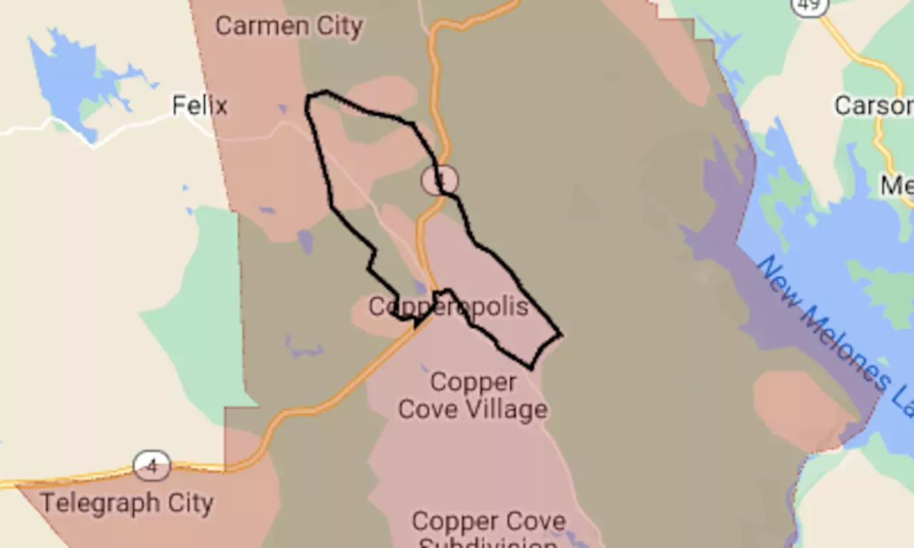
The map shows the evacuation area in red. The black line indicates the approximate perimeter of the fire.
The Aero Fire, reported around 3:30 p.m. Monday in the Sierra Nevada foothills, grew within hours to more than 5,000 acres, up to the edge of Copperopolis.Post Fire map: Evacuation expanded for biggest wildfire of California’s season
The map above shows the evacuation area in red. The black line indicates the approximate perimeter of the fire. As of Tuesday morning, it had burned 5,239 acres with 0% containment, the California Department of Forestry and Fire Protection said.
With rents on the decline, he decided to look for a new place. What could he find in the East Bay for $2,000?A mysterious figure is paying $600 to high school boys to be tied up, tickled and filmed She may have a full ride to Harvard, but as an undocumented immigrant without a job permit, her future is uncertain
United States Latest News, United States Headlines
Similar News:You can also read news stories similar to this one that we have collected from other news sources.
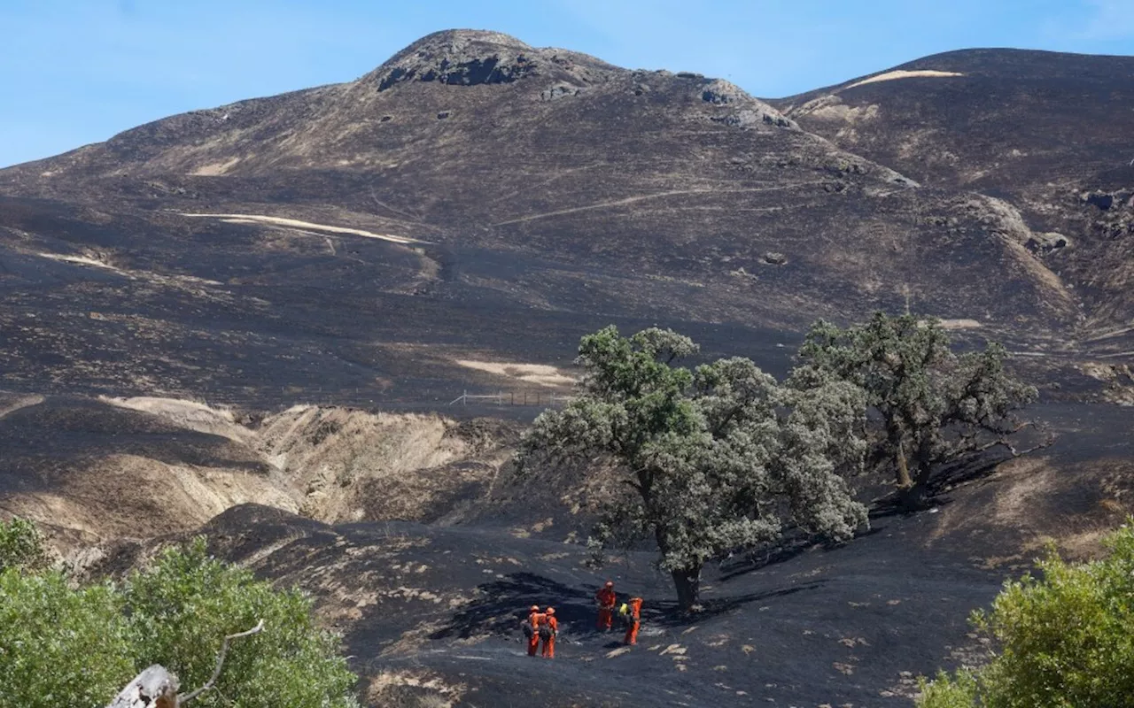 Patterson Fire and Corral Fire both nearly fully contained, Cal Fire reportsThe Patterson fire started burning Monday around the intersection of Patterson Pass and Midway Road, south of Mountain House. The Corral fire started burning Saturday near the Lawrence Livermore Na…
Read more »
 Patterson Fire and Corral Fire both 92% contained, Cal Fire reportsThe Patterson fire started burning Monday around the intersection of Patterson Pass and Midway Road, south of Mountain House. The Corral fire started burning Saturday near the Lawrence Livermore Na…
Read more »
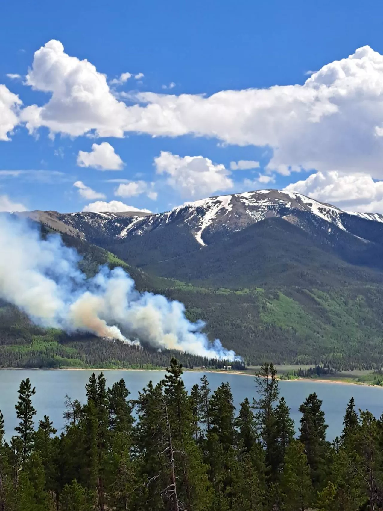
 Wildfire burning near Colorado's Lake County's Twin Lakes prompts evacuation, pre-evacuation ordersA wildfire burning on 164 acres of land in the Interlaken Historic District near Twin Lakes—a popular hiking and camping destination about 22 miles southwest of Leadville—prompted multiple evacuation and pre-evacuation orders Tuesday.
Read more »
 Wildfire burning near Lake County’s Twin Lakes prompts evacuation, pre-evacuation ordersA wildfire burning on 164 acres of land in the Interlaken Historic District near Twin Lakes — a popular hiking and camping destination — prompted multiple evacuation and pre-evacuation …
Read more »
 Evacuation order lifted for Spring Valley-area fireThe fire was reported just before 1:30 p.m. near the 9700 block of Arapaho Street, near Jamacha Boulevard.
Read more »
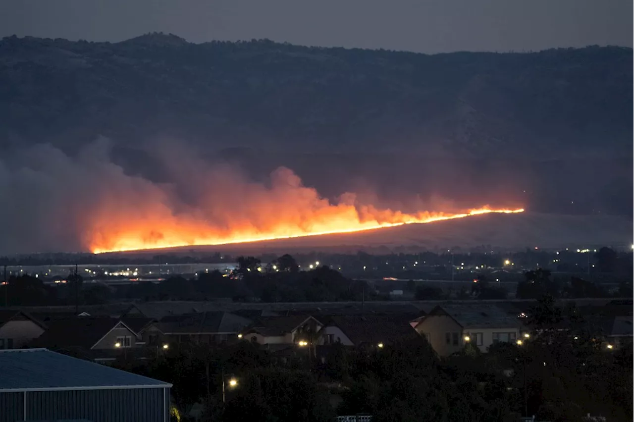 Corral Fire spreads to 14,000 acres, but evacuation order liftedTwo firefighters were injured battling the blaze that broke out near a Lawrence Livermore National Laboratory site south of Tracy on Saturday afternoon.
Read more »