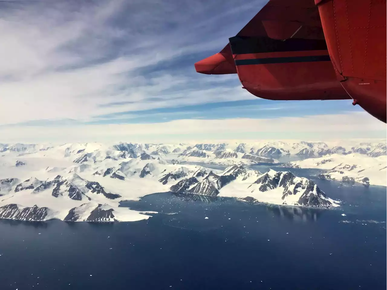
According to researchers, glaciers – massive blocks of moving ice – located along the coast of Antarctica are flowing faster during the summer due to a combination of melting snow and warmer ocean temperatures. On average, the glaciers travel at around one kilometer (0.6 miles) a year. But
Aerial photographs of the Antarctic Peninsula’s glaciers. Credit: Dr. Anna E. Hogg, University of Leeds
On average, the glaciers travel at around one kilometer a year. But a new study has found a seasonal variation in the speed of the ice flow, which speeded up by up to 22% in summer when temperatures are warmer. This gives an insight into the way climate change could affect the behavior of glaciers and the role they could play in raising sea levels.
Aerial photographs of the Antarctic Peninsula’s glaciers. Credit: Dr. Anna E. Hogg, University of LeedsThe Antarctic Peninsula is the largest reservoir of frozen water on Earth. It is estimated that between 1992 and 2017, meltwater from the glaciers increased global sea levels by around 7.6 mm. How that may change in the future is one of the big uncertainties in modeling climate change.
Along the west coast of the peninsula, the glaciers drain ice from the ice sheet directly into the Southern Ocean.
United States Latest News, United States Headlines
Similar News:You can also read news stories similar to this one that we have collected from other news sources.
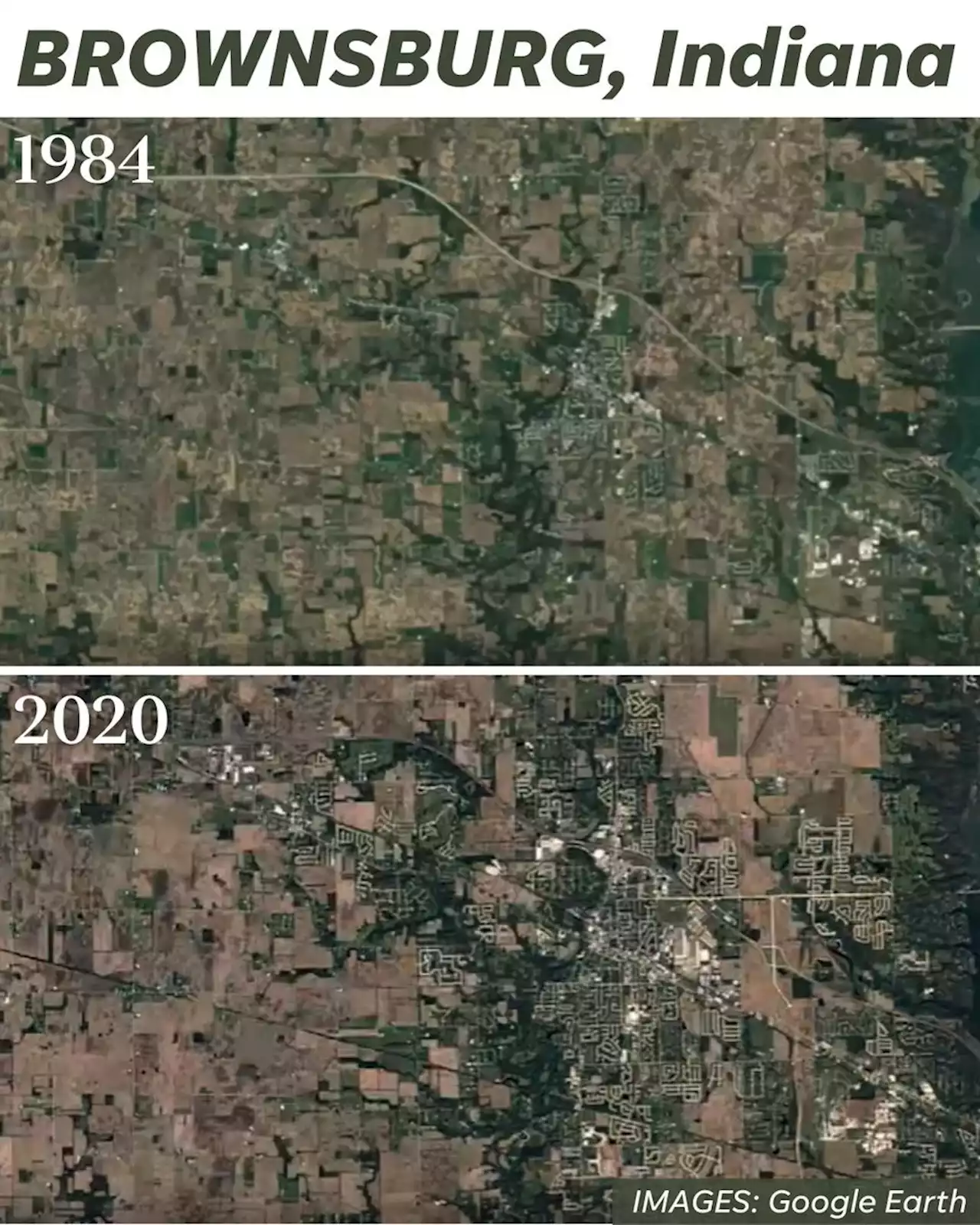 See how Indianapolis suburbs changed through these Google time-lapse satellite imagesSee Google time lapse videos from Avon, Brownsburg, Carmel, Fishers, Greenwood, McCordsville, Noblesville, Plainfield, Westfield, Zionsville.
Read more »
 These researchers use satellite photos, AI to map crosswalks and fill gapsQ&A: New technology could help cities to better understand walking routes and fill gaps in their pedestrian infrastructure.
Read more »
 Qualcomm, Android phone makers developing satellite messaging featureQualcomm Inc on Monday said it was working with a group of Android smartphone companies to add satellite-based messaging capabilities to their devices.
Read more »
 Qualcomm partners with Motorola, Nothing, Oppo, Vivo, and others to bring satellite messaging to phonesQualcomm announces Snapdragon Satellite. The company's partnership with leading phone makers means we're getting phones with satellite connectivity pretty soon.
Read more »
 Stunning video shows Mercury passing by the sunA satellite had a front-row seat as Mercury moved around the giant star.
Read more »
 NASA First Look at Japanese Asteroid Samples Reveal the Building Blocks for LifeNASA's analysis of Ryugu asteroid samples revealed chemical compounds that support the theory that space dust contains the building blocks for life.
Read more »